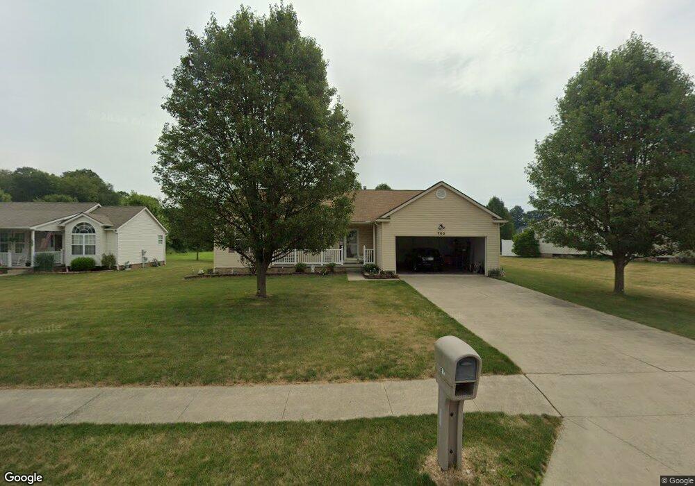
780 S Marion Ave Louisville, OH 44641
Estimated Value: $232,017 - $278,000
3
Beds
2
Baths
1,382
Sq Ft
$189/Sq Ft
Est. Value
About This Home
This home is located at 780 S Marion Ave, Louisville, OH 44641 and is currently estimated at $260,754, approximately $188 per square foot. 780 S Marion Ave is a home located in Stark County with nearby schools including Louisville High School and St. Thomas Aquinas High School & Middle School.
Ownership History
Date
Name
Owned For
Owner Type
Purchase Details
Closed on
Sep 12, 2006
Sold by
Schalmo Builders Inc
Bought by
Rezek Randall C and Rezek Donna J
Current Estimated Value
Home Financials for this Owner
Home Financials are based on the most recent Mortgage that was taken out on this home.
Original Mortgage
$67,000
Interest Rate
6.7%
Mortgage Type
Purchase Money Mortgage
Create a Home Valuation Report for This Property
The Home Valuation Report is an in-depth analysis detailing your home's value as well as a comparison with similar homes in the area
Home Values in the Area
Average Home Value in this Area
Purchase History
| Date | Buyer | Sale Price | Title Company |
|---|---|---|---|
| Rezek Randall C | $151,000 | None Available |
Source: Public Records
Mortgage History
| Date | Status | Borrower | Loan Amount |
|---|---|---|---|
| Previous Owner | Rezek Randall C | $67,000 |
Source: Public Records
Tax History Compared to Growth
Tax History
| Year | Tax Paid | Tax Assessment Tax Assessment Total Assessment is a certain percentage of the fair market value that is determined by local assessors to be the total taxable value of land and additions on the property. | Land | Improvement |
|---|---|---|---|---|
| 2025 | -- | $67,410 | $13,930 | $53,480 |
| 2024 | -- | $67,410 | $13,930 | $53,480 |
| 2023 | $2,190 | $60,130 | $13,160 | $46,970 |
| 2022 | $2,214 | $60,130 | $13,160 | $46,970 |
| 2021 | $2,220 | $60,130 | $13,160 | $46,970 |
| 2020 | $1,791 | $53,770 | $11,870 | $41,900 |
| 2019 | $1,859 | $55,270 | $11,870 | $43,400 |
| 2018 | $1,852 | $55,270 | $11,870 | $43,400 |
| 2017 | $1,698 | $49,910 | $10,430 | $39,480 |
| 2016 | $1,733 | $49,910 | $10,430 | $39,480 |
| 2015 | $1,738 | $49,910 | $10,430 | $39,480 |
| 2014 | $1,562 | $43,130 | $9,000 | $34,130 |
| 2013 | $784 | $43,130 | $9,000 | $34,130 |
Source: Public Records
Map
Nearby Homes
- 1715 High St
- 1812 E Broad St
- 641 S Nickelplate St
- 308 Superior St
- 2110 Edmar St
- 520 S Silver St
- 728 E Broad St
- 0 Michigan Blvd
- 2015 E Main St
- 908 Sand Lot Cir
- 510 S Bauman Ct
- 204 E Broad St
- 107 E Broad St
- 325 Lincoln Ave
- 3390 Meese Rd NE
- 1170 Winding Ridge Ave
- 910 Crosswyck Cir
- 1702 View Pointe Ave
- 1639 Horizon Dr
- 8225 Georgetown St
- 785 S Marion Ave
- 720 S Marion Ave
- 830 S Marion Ave
- 725 S Marion Ave
- 645 S Marion Ave
- 870 S Marion Ave
- 608 S Marion Ave
- 1714 High St
- 910 S Marion Ave
- 795 Thewes Cir
- 716 Hazel Ave
- 708 Hazel Ave
- 603 S Marion Ave
- 1724 High St
- 915 S Marion Ave
- 765 Thewes
- 618 Hazel Ave
- 815 Thewes Cir
- 940 S Marion Ave
- 614 Hazel Ave