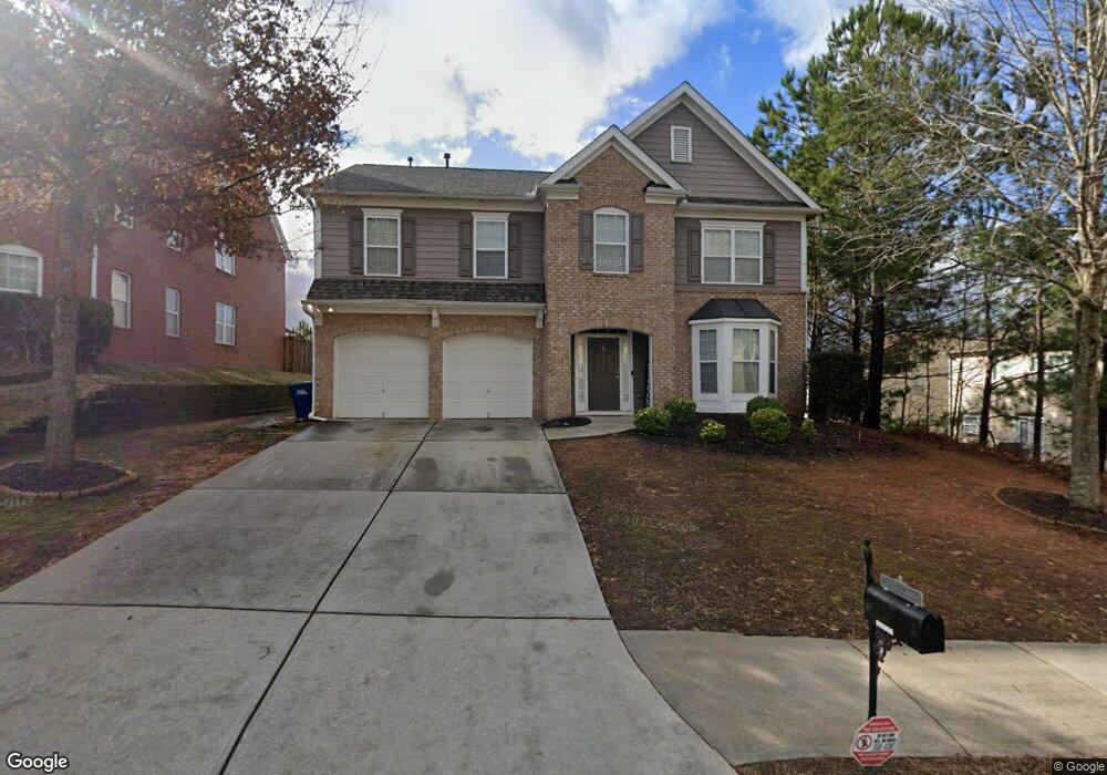
780 Stillrock Dr SW Unit 29 Atlanta, GA 30331
Estimated Value: $365,000 - $416,000
4
Beds
3
Baths
2,880
Sq Ft
$132/Sq Ft
Est. Value
About This Home
This home is located at 780 Stillrock Dr SW Unit 29, Atlanta, GA 30331 and is currently estimated at $380,987, approximately $132 per square foot. 780 Stillrock Dr SW Unit 29 is a home located in Fulton County with nearby schools including Stonewall Tell Elementary School, Sandtown Middle School, and Westlake High School.
Ownership History
Date
Name
Owned For
Owner Type
Purchase Details
Closed on
Sep 10, 2007
Sold by
D R Horton Inc
Bought by
Deguzman Albert S and Deguzman Perla C
Current Estimated Value
Home Financials for this Owner
Home Financials are based on the most recent Mortgage that was taken out on this home.
Original Mortgage
$192,500
Outstanding Balance
$122,190
Interest Rate
6.62%
Mortgage Type
New Conventional
Estimated Equity
$258,797
Create a Home Valuation Report for This Property
The Home Valuation Report is an in-depth analysis detailing your home's value as well as a comparison with similar homes in the area
Home Values in the Area
Average Home Value in this Area
Purchase History
| Date | Buyer | Sale Price | Title Company |
|---|---|---|---|
| Deguzman Albert S | $213,900 | -- |
Source: Public Records
Mortgage History
| Date | Status | Borrower | Loan Amount |
|---|---|---|---|
| Open | Deguzman Albert S | $192,500 |
Source: Public Records
Tax History Compared to Growth
Tax History
| Year | Tax Paid | Tax Assessment Tax Assessment Total Assessment is a certain percentage of the fair market value that is determined by local assessors to be the total taxable value of land and additions on the property. | Land | Improvement |
|---|---|---|---|---|
| 2025 | $5,641 | $132,600 | $33,360 | $99,240 |
| 2023 | $4,133 | $146,440 | $41,560 | $104,880 |
| 2022 | $4,878 | $124,400 | $37,800 | $86,600 |
| 2021 | $3,908 | $97,640 | $27,800 | $69,840 |
| 2020 | $3,737 | $91,840 | $19,520 | $72,320 |
| 2019 | $3,032 | $76,760 | $13,560 | $63,200 |
| 2018 | $2,984 | $74,960 | $13,240 | $61,720 |
| 2017 | $2,343 | $57,480 | $12,640 | $44,840 |
| 2016 | $2,343 | $57,480 | $12,640 | $44,840 |
| 2015 | $2,350 | $57,480 | $12,640 | $44,840 |
| 2014 | $2,479 | $57,480 | $12,640 | $44,840 |
Source: Public Records
Map
Nearby Homes
- 825 Stonehaven Rd SW
- 2539 Wrangler Dr SW
- 2844 Bluestone Dr SW
- 6498 Stonelake Place SW
- 6244 Selborn Dr SW
- 5907 Bunting Ln Unit 2
- 5907 Bunting Ln
- 6362 Sundowner Place Unit 108
- 6364 Sundowner Place Unit 109
- 6366 Sundowner Place Unit 110
- Edmund Plan at Sandtown Falls
- 6368 Sundowner Place Unit 111
- 6370 Sundowner Place Unit 112
- 2329 Red Hibiscus Ct
- 6372 Sundowner Place Unit 113
- 6373 Sundowner Place Unit 142
- 6375 Sundowner Place Unit 141
- 780 Stillrock Dr SW
- 770 Stillrock Dr SW
- 785 Stillrock Dr SW
- 775 Stillrock Dr SW
- 2633 Bluestone Dr SW
- 760 Stillrock Dr SW
- 795 Stillrock Dr SW
- 765 Stillrock Dr SW
- 765 Stillrock Dr SW Unit 326
- 765 Stillrock Dr SW
- 2629 Bluestone Dr SW
- 885 Stonehaven Rd SW
- 755 Stillrock Dr SW
- 875 Stonehaven Rd SW
- 0 Stillrock Dr SW Unit 8714969
- 0 Stillrock Dr SW Unit 7228476
- 0 Stillrock Dr SW Unit 7207142
- 0 Stillrock Dr SW Unit 7199367
- 0 Stillrock Dr SW Unit 8640022
- 0 Stillrock Dr SW Unit 7052250