Estimated Value: $175,738 - $197,000
1
Bed
1
Bath
735
Sq Ft
$249/Sq Ft
Est. Value
About This Home
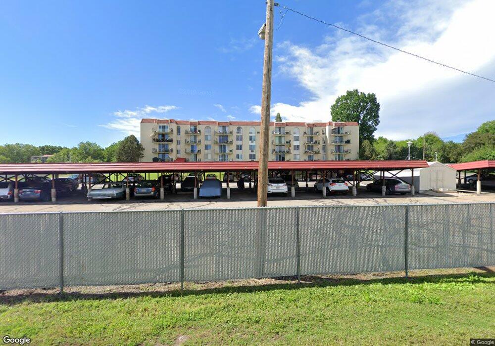
This home is located at 7801 W 35th Ave Unit 312, Wheat Ridge, CO 80033 and is currently estimated at $182,935, approximately $248 per square foot. 7801 W 35th Ave Unit 312 is a home located in Jefferson County with nearby schools including Stevens Elementary School, Everitt Middle School, and Wheat Ridge High School.
Ownership History
Date
Name
Owned For
Owner Type
Purchase Details
Closed on
Oct 20, 2016
Sold by
Montano Michael R
Bought by
Montano Michael R
Current Estimated Value
Purchase Details
Closed on
Nov 7, 2005
Sold by
Montano Mozelle and Montano Mike
Bought by
Montano Michael
Purchase Details
Closed on
Sep 9, 2002
Sold by
Canzona Lee A
Bought by
Montano Mozelle N
Home Financials for this Owner
Home Financials are based on the most recent Mortgage that was taken out on this home.
Original Mortgage
$73,800
Outstanding Balance
$31,211
Interest Rate
6.41%
Estimated Equity
$151,724
Purchase Details
Closed on
Feb 17, 1995
Sold by
Petralia Louis S
Bought by
Canzona Lee A
Home Financials for this Owner
Home Financials are based on the most recent Mortgage that was taken out on this home.
Original Mortgage
$43,000
Interest Rate
9%
Mortgage Type
Seller Take Back
Create a Home Valuation Report for This Property
The Home Valuation Report is an in-depth analysis detailing your home's value as well as a comparison with similar homes in the area
Home Values in the Area
Average Home Value in this Area
Purchase History
| Date | Buyer | Sale Price | Title Company |
|---|---|---|---|
| Montano Michael R | -- | None Available | |
| Montano Michael | $76,000 | -- | |
| Montano Mozelle N | $82,000 | -- | |
| Canzona Lee A | $53,000 | Title America |
Source: Public Records
Mortgage History
| Date | Status | Borrower | Loan Amount |
|---|---|---|---|
| Open | Montano Mozelle N | $73,800 | |
| Previous Owner | Canzona Lee A | $43,000 |
Source: Public Records
Tax History Compared to Growth
Tax History
| Year | Tax Paid | Tax Assessment Tax Assessment Total Assessment is a certain percentage of the fair market value that is determined by local assessors to be the total taxable value of land and additions on the property. | Land | Improvement |
|---|---|---|---|---|
| 2024 | $829 | $9,476 | -- | $9,476 |
| 2023 | $829 | $9,476 | $0 | $9,476 |
| 2022 | $965 | $10,843 | $0 | $10,843 |
| 2021 | $979 | $11,155 | $0 | $11,155 |
| 2020 | $860 | $9,854 | $0 | $9,854 |
| 2019 | $849 | $9,854 | $0 | $9,854 |
| 2018 | $761 | $8,537 | $0 | $8,537 |
| 2017 | $687 | $8,537 | $0 | $8,537 |
| 2016 | $509 | $5,923 | $1 | $5,922 |
| 2015 | $516 | $5,923 | $1 | $5,922 |
| 2014 | $400 | $4,363 | $1 | $4,362 |
Source: Public Records
About This Building
Map
Nearby Homes
- 7740 W 35th Ave Unit 207
- 7740 W 35th Ave Unit 214
- 7770 W 38th Ave Unit 108
- 3728 Vance St Unit 1-4
- 7801 W 39th Ave
- 3535 High Ct
- 4105 Yarrow Ct
- 4008 Upham St
- 4024 Upham St
- 4026 Upham St
- 4014 Upham St
- 3860 Dudley St
- 7808 W 43rd Place
- 8888 W 37th Place
- 4040 Reed St Unit A and B
- 3830 Pierce St
- 3820 Pierce St
- 4095 Quay St
- 6735 W 37th Place
- 6795 W 31st Ave
- 7801 W 35th Ave Unit 414
- 7801 W 35th Ave Unit 412
- 7801 W 35th Ave Unit 411
- 7801 W 35th Ave Unit 410
- 7801 W 35th Ave Unit 408
- 7801 W 35th Ave Unit 407
- 7801 W 35th Ave Unit 404
- 7801 W 35th Ave Unit 403
- 7801 W 35th Ave Unit 402
- 7801 W 35th Ave Unit 401
- 7801 W 35th Ave Unit 314
- 7801 W 35th Ave Unit 311
- 7801 W 35th Ave Unit 310
- 7801 W 35th Ave Unit 309
- 7801 W 35th Ave Unit 308
- 7801 W 35th Ave Unit 307
- 7801 W 35th Ave Unit 306
- 7801 W 35th Ave Unit 305
- 7801 W 35th Ave Unit 303
- 7801 W 35th Ave Unit 302