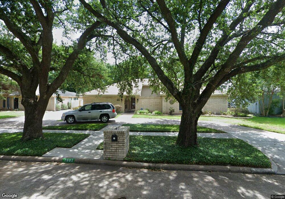
7802 Maple Tree Dr Houston, TX 77088
Greater Inwood NeighborhoodEstimated Value: $292,000 - $323,000
4
Beds
3
Baths
2,818
Sq Ft
$107/Sq Ft
Est. Value
About This Home
This home is located at 7802 Maple Tree Dr, Houston, TX 77088 and is currently estimated at $302,853, approximately $107 per square foot. 7802 Maple Tree Dr is a home located in Harris County with nearby schools including Stovall School, Caraway Intermediate School, and Caraway Elementary School.
Ownership History
Date
Name
Owned For
Owner Type
Purchase Details
Closed on
Jan 29, 2022
Sold by
Victoria Ovando Elizabeth
Bought by
Buckley Margaret M
Current Estimated Value
Purchase Details
Closed on
Dec 16, 1998
Sold by
Mccleary Daniel J and Mccleary Jill J
Bought by
Hanks Carl M and Buckley Margaret M
Home Financials for this Owner
Home Financials are based on the most recent Mortgage that was taken out on this home.
Original Mortgage
$128,150
Interest Rate
6.87%
Create a Home Valuation Report for This Property
The Home Valuation Report is an in-depth analysis detailing your home's value as well as a comparison with similar homes in the area
Home Values in the Area
Average Home Value in this Area
Purchase History
| Date | Buyer | Sale Price | Title Company |
|---|---|---|---|
| Buckley Margaret M | -- | Capital Title | |
| Hanks Carl M | -- | -- |
Source: Public Records
Mortgage History
| Date | Status | Borrower | Loan Amount |
|---|---|---|---|
| Previous Owner | Hanks Carl M | $128,150 |
Source: Public Records
Tax History Compared to Growth
Tax History
| Year | Tax Paid | Tax Assessment Tax Assessment Total Assessment is a certain percentage of the fair market value that is determined by local assessors to be the total taxable value of land and additions on the property. | Land | Improvement |
|---|---|---|---|---|
| 2025 | $1,081 | $282,248 | $45,963 | $236,285 |
| 2024 | $1,081 | $293,107 | $45,963 | $247,144 |
| 2023 | $1,081 | $283,355 | $45,963 | $237,392 |
| 2022 | $5,660 | $281,644 | $45,963 | $235,681 |
| 2021 | $5,388 | $214,504 | $34,472 | $180,032 |
| 2020 | $5,796 | $219,574 | $34,472 | $185,102 |
| 2019 | $5,529 | $199,815 | $17,619 | $182,196 |
| 2018 | $2,323 | $186,750 | $17,619 | $169,131 |
| 2017 | $4,549 | $186,750 | $17,619 | $169,131 |
| 2016 | $4,135 | $172,216 | $17,619 | $154,597 |
| 2015 | $2,903 | $157,693 | $17,619 | $140,074 |
| 2014 | $2,903 | $130,509 | $17,619 | $112,890 |
Source: Public Records
Map
Nearby Homes
- 5519 Council Grove Ln
- 5514 Long Creek Ln
- 5606 Water Leaf Ln
- 5639 Council Grove Ln
- 5710 Council Grove Ln
- 4306 Saratoga Dr
- 4206 Saratoga Dr
- 0 Antoine Dr
- 7611 Athlone Dr
- 8711 Wild Basin Dr
- 7526 Antoine Dr
- 3718 Storm Creek Dr
- 7808 Inwood Grove Ln
- 7728 Challie Ln
- 8803 Cold Lake Dr
- 7736 Challie Ln
- 7814 Inwood Grove Ln
- 7718 Inwood Grove Ln
- 7716 Inwood Grove Ln
- 7712 Inwood Grove Ln
- 7730 Maple Tree Dr
- 7806 Maple Tree Dr
- 7726 Maple Tree Dr
- 7727 Streamside Dr
- 7810 Maple Tree Dr
- 7803 Maple Tree Dr
- 7722 Maple Tree Dr
- 7807 Maple Tree Dr
- 5503 Council Grove Ln
- 7718 Maple Tree Dr
- 7814 Maple Tree Dr
- 5503 Blackjack Ln
- 7719 Streamside Dr
- 5506 Council Grove Ln
- 5507 Blackjack Ln
- 7714 Maple Tree Dr
- 7726 Streamside Dr
- 5511 Blackjack Ln
- 7803 Streamside Dr
- 7818 Maple Tree Dr