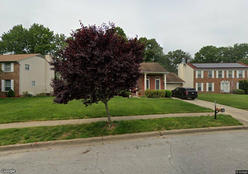
7805 Mike Shapiro Dr Clinton, MD 20735
Estimated Value: $408,000 - $510,000
4
Beds
3
Baths
1,296
Sq Ft
$344/Sq Ft
Est. Value
About This Home
This home is located at 7805 Mike Shapiro Dr, Clinton, MD 20735 and is currently estimated at $445,773, approximately $343 per square foot. 7805 Mike Shapiro Dr is a home located in Prince George's County with nearby schools including Francis T. Evans Elementary School, Stephen Decatur Middle School, and Dr. Henry A. Wise Jr. High School.
Ownership History
Date
Name
Owned For
Owner Type
Purchase Details
Closed on
Jun 16, 2005
Sold by
Lomax Lucius E
Bought by
Gonzales Asteria
Current Estimated Value
Home Financials for this Owner
Home Financials are based on the most recent Mortgage that was taken out on this home.
Original Mortgage
$280,000
Outstanding Balance
$146,083
Interest Rate
5.75%
Mortgage Type
Adjustable Rate Mortgage/ARM
Estimated Equity
$299,690
Purchase Details
Closed on
Feb 26, 1982
Sold by
Metro Development
Bought by
Lomax Lucius E and Lomax Betty M
Create a Home Valuation Report for This Property
The Home Valuation Report is an in-depth analysis detailing your home's value as well as a comparison with similar homes in the area
Home Values in the Area
Average Home Value in this Area
Purchase History
| Date | Buyer | Sale Price | Title Company |
|---|---|---|---|
| Gonzales Asteria | $350,000 | -- | |
| Lomax Lucius E | $116,700 | -- |
Source: Public Records
Mortgage History
| Date | Status | Borrower | Loan Amount |
|---|---|---|---|
| Open | Gonzales Asteria | $280,000 |
Source: Public Records
Tax History Compared to Growth
Tax History
| Year | Tax Paid | Tax Assessment Tax Assessment Total Assessment is a certain percentage of the fair market value that is determined by local assessors to be the total taxable value of land and additions on the property. | Land | Improvement |
|---|---|---|---|---|
| 2025 | $5,693 | $376,500 | $117,100 | $259,400 |
| 2024 | $5,693 | $356,233 | $0 | $0 |
| 2023 | $5,390 | $335,967 | $0 | $0 |
| 2022 | $5,089 | $315,700 | $102,100 | $213,600 |
| 2021 | $4,858 | $300,167 | $0 | $0 |
| 2020 | $4,627 | $284,633 | $0 | $0 |
| 2019 | $4,397 | $269,100 | $101,000 | $168,100 |
| 2018 | $4,285 | $261,600 | $0 | $0 |
| 2017 | $4,174 | $254,100 | $0 | $0 |
| 2016 | -- | $246,600 | $0 | $0 |
| 2015 | $4,332 | $246,600 | $0 | $0 |
| 2014 | $4,332 | $246,600 | $0 | $0 |
Source: Public Records
Map
Nearby Homes
- 7205 Mcmillen Dr
- 7904 Mike Shapiro Dr
- 7209 Mcmillen Dr
- 7729 Castle Rock Dr
- 7113 Branchwood Place
- 6610 Bullrush Ct
- 0 Dangerfield Rd
- 6410 Woodley Rd
- 0 Clinton Vista Ln
- 8817 Mimosa Ave
- 6109 Kirby Rd
- 7807 Colonial Ln
- 6009 Sellner Ln
- 9003 Woodyard Rd
- 6006 Runnymeade Ave
- 5900 Arbroath Dr
- 7804 New Ascot Ln
- 7300 Roselynn Ln
- 7308 Berkshire Dr
- 9302 Caldran Dr
- 7803 Mike Shapiro Dr
- 7903 Godfrey Ct
- 7901 Godfrey Ct
- 7801 Mike Shapiro Dr
- 7905 Godfrey Ct
- 7804 Mike Shapiro Dr
- 7808 Mike Shapiro Dr
- 7100 E Clinton St
- 7800 Mike Shapiro Dr
- 7900 Godfrey Ct
- 7719 Mike Shapiro Dr
- 7900 Mike Shapiro Dr
- 7906 Godfrey Ct
- 7902 Godfrey Ct
- 7904 Godfrey Ct
- 7203 Mcmillen Dr
- 7902 Mike Shapiro Dr
- 7715 Mike Shapiro Dr
- 7905 Mike Shapiro Dr
- 7207 Mcmillen Dr