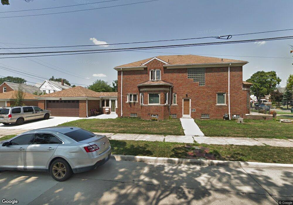
7807 E Morrow Cir Unit Bldg-Unit Dearborn, MI 48126
Aviation NeighborhoodEstimated Value: $380,000 - $487,000
3
Beds
3
Baths
2,735
Sq Ft
$151/Sq Ft
Est. Value
About This Home
This home is located at 7807 E Morrow Cir Unit Bldg-Unit, Dearborn, MI 48126 and is currently estimated at $413,553, approximately $151 per square foot. 7807 E Morrow Cir Unit Bldg-Unit is a home located in Wayne County with nearby schools including McDonald Elementary School, McCollough-Unis School, and Fordson High School.
Ownership History
Date
Name
Owned For
Owner Type
Purchase Details
Closed on
Jun 14, 2018
Sold by
Saad Naim and Saad Nada
Bought by
Majrad Ali
Current Estimated Value
Purchase Details
Closed on
Sep 30, 2016
Sold by
Brigh Thomas W and Brigh Lena M
Bought by
Saad Nalm
Purchase Details
Closed on
Oct 7, 2013
Sold by
Lubienski Walter H
Bought by
Lubienski Walter H
Purchase Details
Closed on
Jan 24, 2001
Sold by
Lubienski Mary E Flanagan Nee
Bought by
Lubienski Walter H
Purchase Details
Closed on
Sep 18, 2000
Sold by
Lubienski George R
Bought by
Lubienski Walter H
Create a Home Valuation Report for This Property
The Home Valuation Report is an in-depth analysis detailing your home's value as well as a comparison with similar homes in the area
Home Values in the Area
Average Home Value in this Area
Purchase History
| Date | Buyer | Sale Price | Title Company |
|---|---|---|---|
| Majrad Ali | $236,000 | Venture Title Agency | |
| Saad Nalm | $225,000 | None Available | |
| Lubienski Walter H | -- | None Available | |
| Lubienski Walter H | -- | None Available | |
| Lubienski Walter H | -- | None Available |
Source: Public Records
Tax History
| Year | Tax Paid | Tax Assessment Tax Assessment Total Assessment is a certain percentage of the fair market value that is determined by local assessors to be the total taxable value of land and additions on the property. | Land | Improvement |
|---|---|---|---|---|
| 2025 | $5,927 | $187,700 | $0 | $0 |
| 2024 | $5,798 | $132,400 | $0 | $0 |
| 2023 | $5,734 | $135,800 | $0 | $0 |
| 2022 | $6,453 | $140,800 | $0 | $0 |
| 2021 | $7,498 | $131,900 | $0 | $0 |
| 2019 | $8,668 | $117,600 | $0 | $0 |
| 2018 | $5,197 | $105,100 | $0 | $0 |
| 2017 | $1,482 | $91,200 | $0 | $0 |
| 2011 | -- | $81,150 | $0 | $0 |
Source: Public Records
Map
Nearby Homes
- 7900 Middlepointe St
- 10339 Tireman Ave
- 7815 Normile St
- 7929 Normile St
- 8100 Middlepoint St
- 7634 Pinehurst St
- 7830 Miller Rd
- 8116 Wyoming Ave
- 7658 Appoline St
- 8315 Freda St
- 8265 Kentucky St
- 8088 Wisconsin St
- 8258 Meyers Rd
- 30 Morross Cir Unit 44
- 8511 Lonyo St
- 7857 Esper Blvd
- 7524 Hartwell St
- 8604 Birwood St
- 7758 Reuter St
- 5491 Oakman Blvd
- 7807 E Morrow Cir
- 7815 E Morrow Cir
- 7823 E Morrow Cir
- 7757 E Morrow Cir
- 7800 Middlepointe St
- 7831 E Morrow Cir
- 7814 Middlepointe St
- 7747 E Morrow Cir
- 7820 Middlepointe St
- 7754 Middlepointe St
- 7841 E Morrow Cir
- 7830 Middlepointe St
- 7741 E Morrow Cir
- 7748 Middlepointe St
- 7800 E Morrow Cir
- 7838 Middlepointe St
- 7814 E Morrow Cir Unit Bldg-Unit
- 7814 E Morrow Cir
- 7847 E Morrow Cir
- 7822 E Morrow Cir
Your Personal Tour Guide
Ask me questions while you tour the home.