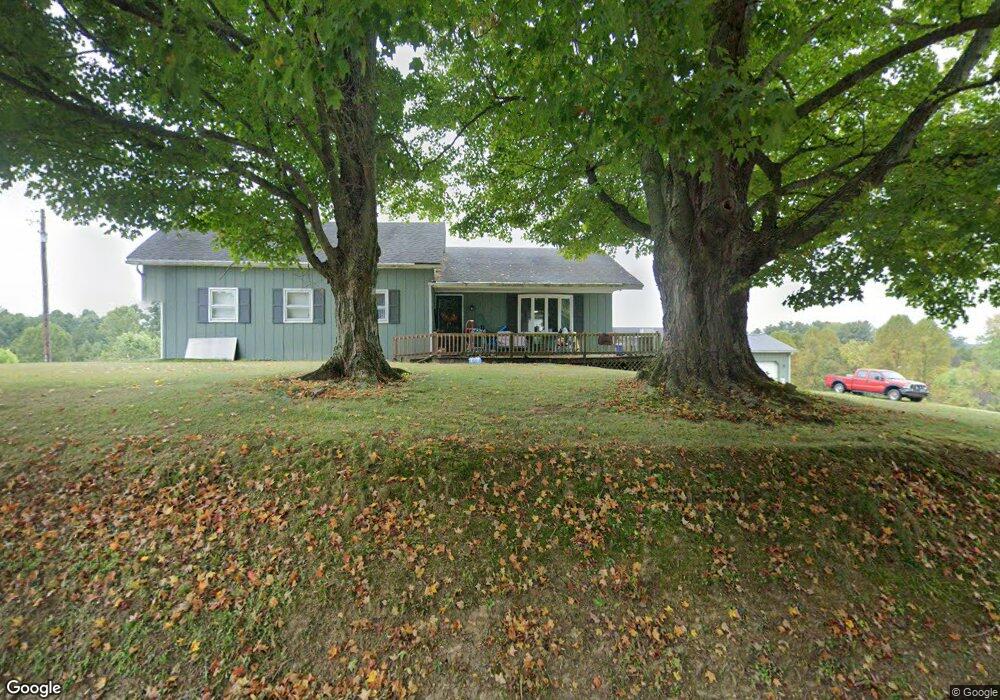
7809 S State Route 555 Chesterhill, OH 43728
Estimated Value: $124,000 - $409,000
3
Beds
2
Baths
1,796
Sq Ft
$127/Sq Ft
Est. Value
About This Home
This home is located at 7809 S State Route 555, Chesterhill, OH 43728 and is currently estimated at $227,580, approximately $126 per square foot. 7809 S State Route 555 is a home with nearby schools including Morgan High School.
Ownership History
Date
Name
Owned For
Owner Type
Purchase Details
Closed on
Oct 8, 2021
Sold by
Brown Teresa Kim and Ellis Dale Alan
Bought by
Ellis Dale Alan and Ellis Kristen
Current Estimated Value
Home Financials for this Owner
Home Financials are based on the most recent Mortgage that was taken out on this home.
Original Mortgage
$155,800
Outstanding Balance
$142,240
Interest Rate
2.88%
Mortgage Type
New Conventional
Estimated Equity
$85,340
Create a Home Valuation Report for This Property
The Home Valuation Report is an in-depth analysis detailing your home's value as well as a comparison with similar homes in the area
Home Values in the Area
Average Home Value in this Area
Purchase History
| Date | Buyer | Sale Price | Title Company |
|---|---|---|---|
| Ellis Dale Alan | -- | None Listed On Document | |
| Ellis Dale Alan | -- | None Listed On Document |
Source: Public Records
Mortgage History
| Date | Status | Borrower | Loan Amount |
|---|---|---|---|
| Open | Ellis Dale Alan | $155,800 | |
| Closed | Ellis Dale Alan | $155,800 |
Source: Public Records
Tax History Compared to Growth
Tax History
| Year | Tax Paid | Tax Assessment Tax Assessment Total Assessment is a certain percentage of the fair market value that is determined by local assessors to be the total taxable value of land and additions on the property. | Land | Improvement |
|---|---|---|---|---|
| 2024 | $1,690 | $50,980 | $7,090 | $43,890 |
| 2023 | $1,690 | $37,900 | $5,780 | $32,120 |
| 2022 | $1,260 | $37,900 | $5,780 | $32,120 |
| 2021 | $976 | $37,900 | $5,780 | $32,120 |
| 2019 | $921 | $35,020 | $5,250 | $29,770 |
| 2018 | $886 | $35,020 | $5,250 | $29,770 |
| 2017 | $832 | $32,715 | $4,550 | $28,165 |
| 2016 | $836 | $32,715 | $4,550 | $28,165 |
| 2015 | $835 | $32,715 | $4,550 | $28,165 |
| 2014 | $870 | $32,715 | $4,550 | $28,165 |
| 2013 | $855 | $32,715 | $4,550 | $28,165 |
Source: Public Records
Map
Nearby Homes
- 7600 Marion St
- 0 Ohio 555 Unit 5146049
- 3205 Goshen Run Rd
- 5174 Lightner Ridge Rd
- 681 Downing Rd
- 781 Downing Rd
- 0 Downing Rd
- 4000 C206
- 15901 Lathrop Rd
- 2187 State Route 550
- 1022 Tullis Rd
- 0 Meadow St Unit Lot 9 5158299
- 0 Meadow St Unit Lot 9 225008020
- 1715 South St
- 3265 Tieber Rd
- 1770 Broadway St
- 3111 Big Bottom Ln
- 1960 Broadway St
- 1920 North St
- 0 Kosky Dr
- 1277 Fischer Howard Rd
- 1211 Fischer Howard Rd
- 7817 S State Route 555
- 1390 Coal St
- 1415 Coal St
- 7940 S State Route 555
- 7815 Crews Ln
- 7895 Crews Ln
- 7952 S State Route 555
- 1455 S R 555 St
- 8070 Daniels Ln
- 1480 Coal St
- 1505 Coal St
- 7845 Crews Ln
- 1545 Coal St
- 8089 S State Route 555
- 1524 East St
- 1535 East St
- 1585 Coal St
- 1530 Marietta St