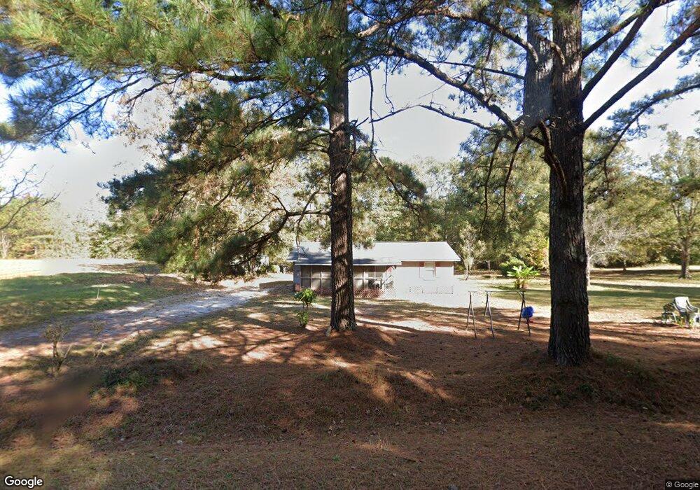
781 Cedar Rock Rd Greenville, GA 30222
Estimated Value: $69,000 - $125,000
3
Beds
1
Bath
1,008
Sq Ft
$90/Sq Ft
Est. Value
About This Home
This home is located at 781 Cedar Rock Rd, Greenville, GA 30222 and is currently estimated at $91,025, approximately $90 per square foot. 781 Cedar Rock Rd is a home located in Meriwether County with nearby schools including George E. Washington Elementary School.
Ownership History
Date
Name
Owned For
Owner Type
Purchase Details
Closed on
Sep 12, 2022
Sold by
Caldwell Connie
Bought by
Caldwell Patrick
Current Estimated Value
Purchase Details
Closed on
Jul 26, 2008
Sold by
Caldwell Vernita T
Bought by
Caldwell Jewell
Purchase Details
Closed on
Aug 7, 2007
Sold by
Caldwell Gilbert
Bought by
Caldwell Vernita
Purchase Details
Closed on
Jan 1, 1975
Bought by
Caldwell Gilbert and Caldwell J
Create a Home Valuation Report for This Property
The Home Valuation Report is an in-depth analysis detailing your home's value as well as a comparison with similar homes in the area
Home Values in the Area
Average Home Value in this Area
Purchase History
| Date | Buyer | Sale Price | Title Company |
|---|---|---|---|
| Caldwell Patrick | -- | -- | |
| Caldwell Gilbert | -- | -- | |
| Caldwell Jewell | -- | -- | |
| Caldwell Vernita | $35,621 | -- | |
| Caldwell Gilbert | -- | -- |
Source: Public Records
Tax History Compared to Growth
Tax History
| Year | Tax Paid | Tax Assessment Tax Assessment Total Assessment is a certain percentage of the fair market value that is determined by local assessors to be the total taxable value of land and additions on the property. | Land | Improvement |
|---|---|---|---|---|
| 2024 | $578 | $17,404 | $5,040 | $12,364 |
| 2023 | $601 | $17,404 | $5,040 | $12,364 |
| 2022 | $353 | $17,404 | $5,040 | $12,364 |
| 2021 | $358 | $17,404 | $5,040 | $12,364 |
| 2020 | $361 | $17,404 | $5,040 | $12,364 |
| 2019 | $362 | $17,404 | $5,040 | $12,364 |
| 2018 | $365 | $17,404 | $5,040 | $12,364 |
| 2017 | $565 | $17,404 | $5,040 | $12,364 |
| 2016 | $509 | $17,404 | $5,040 | $12,364 |
| 2015 | $509 | $17,404 | $5,040 | $12,364 |
| 2014 | $509 | $17,404 | $5,040 | $12,364 |
| 2013 | -- | $17,404 | $5,040 | $12,364 |
Source: Public Records
Map
Nearby Homes
- 2001 Threadgill Rd
- 2067 Threadgill Rd
- 909 Threadgill Rd
- 3860 Cedar Rock Rd
- 1152 Old Durand Rd
- 0 Owens Rd Unit 219685
- 188 Hidden Lakes Rd
- 1621 Dukes Waddell Rd
- 7333 White House Pkwy
- 0 Winter Rd Unit 10499103
- 7333 Roosevelt Hwy
- 934 R D Hill St
- 330 Stovall Rd
- 568 S Talbotton St
- 353 Parham Rd
- 421 Lagrange St
- 0 Winter Rd Unit 10498954
- 1100 Reville
- 0 Whitehouse Pkwy Unit 10593573
- 0 Durand Hwy Unit 10622092
- 835 Cedar Rock Rd
- 717 Cedar Rock Rd
- 681 Cedar Rock Rd
- 591 Cedar Rock Rd
- 1864 Threadgill Rd
- 1817 Threadgill Rd
- 467 Cedar Rock Rd
- 2028 Threadgill Rd Unit 3.05 ACRES
- 1815 Threadgill Rd
- 1193 Cedar Rock Rd
- 1933 Threadgill Rd
- 1993 Threadgill Rd
- 1246 Cedar Rock Rd
- 355 Cedar Rock Rd
- 2255 Harmony Church Rd Unit TR 3 PARCEL3
- 2255 Harmony Church Rd
- 2067 Threadgill Rd Unit 2.09 ACRES
- 2101 Threadgill Rd
- 56 Windy Ln
- 1339 Cedar Rock Rd