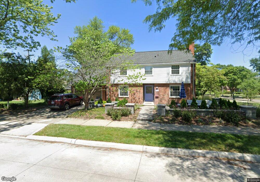
781 Lincoln Rd Grosse Pointe, MI 48230
Estimated Value: $408,410 - $450,000
3
Beds
2
Baths
1,724
Sq Ft
$248/Sq Ft
Est. Value
About This Home
This home is located at 781 Lincoln Rd, Grosse Pointe, MI 48230 and is currently estimated at $426,853, approximately $247 per square foot. 781 Lincoln Rd is a home located in Wayne County with nearby schools including Richard Elementary School, Brownell Middle School, and Grosse Pointe South High School.
Ownership History
Date
Name
Owned For
Owner Type
Purchase Details
Closed on
Sep 26, 2023
Sold by
Uhl Joseph and Doddamani Sunita
Bought by
Doddamani Sunita
Current Estimated Value
Home Financials for this Owner
Home Financials are based on the most recent Mortgage that was taken out on this home.
Original Mortgage
$269,000
Outstanding Balance
$262,188
Interest Rate
5.75%
Mortgage Type
New Conventional
Estimated Equity
$164,665
Purchase Details
Closed on
Jun 24, 2011
Sold by
Kirk Robert D and Kirk Shirley S
Bought by
Uhl Joseph and Doddamani Sunita
Home Financials for this Owner
Home Financials are based on the most recent Mortgage that was taken out on this home.
Original Mortgage
$151,738
Interest Rate
4.67%
Mortgage Type
New Conventional
Create a Home Valuation Report for This Property
The Home Valuation Report is an in-depth analysis detailing your home's value as well as a comparison with similar homes in the area
Home Values in the Area
Average Home Value in this Area
Purchase History
| Date | Buyer | Sale Price | Title Company |
|---|---|---|---|
| Doddamani Sunita | -- | None Listed On Document | |
| Doddamani Sunita | -- | None Listed On Document | |
| Uhl Joseph | $157,000 | Greco |
Source: Public Records
Mortgage History
| Date | Status | Borrower | Loan Amount |
|---|---|---|---|
| Open | Doddamani Sunita | $269,000 | |
| Closed | Doddamani Sunita | $269,000 | |
| Previous Owner | Uhl Joseph | $151,738 |
Source: Public Records
Tax History
| Year | Tax Paid | Tax Assessment Tax Assessment Total Assessment is a certain percentage of the fair market value that is determined by local assessors to be the total taxable value of land and additions on the property. | Land | Improvement |
|---|---|---|---|---|
| 2025 | $4,339 | $199,500 | $0 | $0 |
| 2024 | $4,193 | $199,300 | $0 | $0 |
| 2023 | $3,998 | $179,900 | $0 | $0 |
| 2022 | $5,787 | $161,500 | $0 | $0 |
| 2021 | $5,487 | $163,800 | $0 | $0 |
| 2019 | $5,699 | $142,500 | $0 | $0 |
| 2018 | $3,470 | $119,100 | $0 | $0 |
| 2017 | $3,664 | $117,700 | $0 | $0 |
| 2016 | $5,223 | $122,600 | $0 | $0 |
| 2015 | $9,904 | $108,500 | $0 | $0 |
| 2013 | $9,595 | $102,700 | $0 | $0 |
| 2012 | -- | $93,700 | $0 | $0 |
Source: Public Records
Map
Nearby Homes
- 256 Fisher Rd
- 346 Mckinley Ave
- 341 Mcmillan Rd
- 17590 Mack Ave Unit 8
- 17540 Mack Ave Unit 10
- 213 Muir Rd
- 407 Moran Rd
- 201 Mcmillan Rd
- 194 Charlevoix Ave
- 614 Rivard Blvd
- 314 Mount Vernon Ave
- 302 Mount Vernon Ave
- 4082 Hereford St
- 259 Mount Vernon Ave
- 4104 Woodhall St
- 464 Mckinley Ave
- 4496 Radnor St
- 4528 Farmbrook St
- 775 Notre Dame St
- 3808 Cadieux Rd
- 791 Lincoln Rd
- 771 Lincoln Rd
- 790 Washington Rd
- 796 Washington Rd
- 765 Lincoln Rd
- 800 Washington Rd Unit Bldg-Unit
- 800 Washington Rd
- 780 Washington Rd
- 801 Lincoln Rd
- 806 Washington Rd
- 780 Lincoln Rd
- 786 Lincoln Rd
- 774 Washington Rd
- 761 Lincoln Rd
- 790 Lincoln Rd
- 807 Lincoln Rd
- 810 Washington Rd
- 796 Lincoln Rd
- 768 Washington Rd
- 755 Lincoln Rd
Your Personal Tour Guide
Ask me questions while you tour the home.