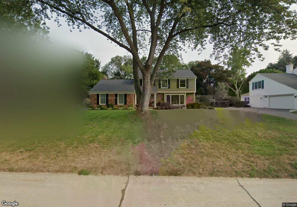
781 N Shady Hollow Cir Bloomfield Hills, MI 48304
Estimated Value: $547,000 - $636,000
4
Beds
3
Baths
2,089
Sq Ft
$289/Sq Ft
Est. Value
About This Home
This home is located at 781 N Shady Hollow Cir, Bloomfield Hills, MI 48304 and is currently estimated at $603,809, approximately $289 per square foot. 781 N Shady Hollow Cir is a home located in Oakland County with nearby schools including Harlan Elementary School, Ernest W. Seaholm High School, and Roeper City and Country Upper.
Ownership History
Date
Name
Owned For
Owner Type
Purchase Details
Closed on
Aug 20, 2025
Sold by
Whitman David H and Whitman Annette M
Bought by
Whitman David H and Whitman Annette M
Current Estimated Value
Purchase Details
Closed on
Nov 14, 1997
Sold by
Wroubel Leo J
Bought by
Whitman David H
Home Financials for this Owner
Home Financials are based on the most recent Mortgage that was taken out on this home.
Original Mortgage
$262,400
Interest Rate
7.46%
Create a Home Valuation Report for This Property
The Home Valuation Report is an in-depth analysis detailing your home's value as well as a comparison with similar homes in the area
Home Values in the Area
Average Home Value in this Area
Purchase History
| Date | Buyer | Sale Price | Title Company |
|---|---|---|---|
| Whitman David H | -- | None Listed On Document | |
| Whitman David H | -- | None Listed On Document | |
| Whitman David H | $308,800 | -- |
Source: Public Records
Mortgage History
| Date | Status | Borrower | Loan Amount |
|---|---|---|---|
| Previous Owner | Whitman David H | $262,400 |
Source: Public Records
Tax History Compared to Growth
Tax History
| Year | Tax Paid | Tax Assessment Tax Assessment Total Assessment is a certain percentage of the fair market value that is determined by local assessors to be the total taxable value of land and additions on the property. | Land | Improvement |
|---|---|---|---|---|
| 2024 | $3,078 | $253,000 | $0 | $0 |
| 2023 | $2,954 | $223,090 | $0 | $0 |
| 2022 | $4,893 | $207,250 | $0 | $0 |
| 2021 | $4,934 | $204,870 | $0 | $0 |
| 2020 | $2,777 | $204,600 | $0 | $0 |
| 2019 | $4,927 | $199,070 | $0 | $0 |
| 2018 | $4,890 | $195,580 | $0 | $0 |
| 2017 | $4,887 | $191,800 | $0 | $0 |
| 2016 | $4,914 | $186,110 | $0 | $0 |
| 2015 | -- | $167,350 | $0 | $0 |
| 2014 | -- | $167,710 | $0 | $0 |
| 2011 | -- | $127,540 | $0 | $0 |
Source: Public Records
Map
Nearby Homes
- 2991 Lanergan Dr
- 2840 Bolingbroke Dr
- 4731 Haddington Dr
- 2650 Binbrooke Dr
- 0000 Brookdale Rd
- 1333 N Adams Rd
- 3014 Caswell Dr
- 1330 Oxford Rd
- 4144 Rouge Circle Dr
- 680 Shepardbush St
- 654 Shepardbush St
- 3036 Newport Ct
- 000 N Adams Rd
- 2154 Babcock Dr
- 5554 Pine Brooke Ct
- 3665 Estates Dr
- 4890 Charing Cross Rd
- 3729 Boulder Dr
- 2873 Summers Place
- 878 Brooklawn Dr
- 769 N Shady Hollow Cir Unit Bldg-Unit
- 769 N Shady Hollow Cir
- 789 N Shady Hollow Cir
- 782 Emerson Way Ct
- 774 Emerson Way Ct
- 761 N Shady Hollow Cir
- 797 N Shady Hollow Cir
- 778 N Shady Hollow Cir
- 742 Tennyson Downs Ct
- 764 N Shady Hollow Cir
- 786 N Shady Hollow Cir
- 790 Emerson Way Ct
- 750 Tennyson Downs Ct
- 798 N Shady Hollow Cir
- 749 N Shady Hollow Cir
- 766 Tennyson Downs Ct
- 750 N Shady Hollow Cir
- 841 Thorntree Ct
- 855 Thorntree Ct
- 829 Thorntree Ct