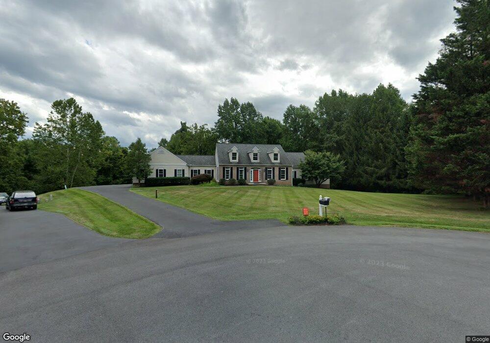
7811 Lois Ct Adamstown, MD 21710
Estimated Value: $793,670 - $853,000
--
Bed
4
Baths
2,684
Sq Ft
$309/Sq Ft
Est. Value
About This Home
This home is located at 7811 Lois Ct, Adamstown, MD 21710 and is currently estimated at $829,890, approximately $309 per square foot. 7811 Lois Ct is a home located in Frederick County with nearby schools including Urbana Elementary School, Urbana Middle School, and Urbana High School.
Ownership History
Date
Name
Owned For
Owner Type
Purchase Details
Closed on
May 24, 1993
Sold by
Seneca Valley Builders, Inc.
Bought by
Maucione Robert H and Maucione Judith C
Current Estimated Value
Purchase Details
Closed on
Jan 16, 1987
Sold by
Beaulah Inc & Jpk Prop Inc
Bought by
Seneca Valley Builders, Inc.
Home Financials for this Owner
Home Financials are based on the most recent Mortgage that was taken out on this home.
Original Mortgage
$30,800
Interest Rate
9.21%
Create a Home Valuation Report for This Property
The Home Valuation Report is an in-depth analysis detailing your home's value as well as a comparison with similar homes in the area
Home Values in the Area
Average Home Value in this Area
Purchase History
| Date | Buyer | Sale Price | Title Company |
|---|---|---|---|
| Maucione Robert H | $61,000 | -- | |
| Seneca Valley Builders, Inc. | $38,500 | -- |
Source: Public Records
Mortgage History
| Date | Status | Borrower | Loan Amount |
|---|---|---|---|
| Previous Owner | Seneca Valley Builders, Inc. | $30,800 |
Source: Public Records
Tax History Compared to Growth
Tax History
| Year | Tax Paid | Tax Assessment Tax Assessment Total Assessment is a certain percentage of the fair market value that is determined by local assessors to be the total taxable value of land and additions on the property. | Land | Improvement |
|---|---|---|---|---|
| 2025 | $296 | $697,033 | -- | -- |
| 2024 | $296 | $642,000 | $172,700 | $469,300 |
| 2023 | $148 | $607,967 | $0 | $0 |
| 2022 | $148 | $573,933 | $0 | $0 |
| 2021 | $148 | $539,900 | $146,800 | $393,100 |
| 2020 | $148 | $521,000 | $0 | $0 |
| 2019 | $5,979 | $502,100 | $0 | $0 |
| 2018 | $5,811 | $483,200 | $136,800 | $346,400 |
| 2017 | $5,632 | $483,200 | $0 | $0 |
| 2016 | $4,975 | $461,200 | $0 | $0 |
| 2015 | $4,975 | $450,200 | $0 | $0 |
| 2014 | $4,975 | $439,067 | $0 | $0 |
Source: Public Records
Map
Nearby Homes
- 2305 Mount Ephraim Rd
- 3012 Wasatch View Dr
- 7119 Michaels Mill Rd
- 8715 Shady Pines Dr
- 3658 Stone Barn Dr
- 3509 Flatwoods Dr
- 7106 Downing St
- 3913 Baker Valley Rd
- 7144 Ira Sears Rd
- 3603 Worthington Blvd
- 3557 Worthington Blvd Unit A
- 3460 Sugarloaf Pkwy
- 0 Michaels Mill Rd
- 9119 Landon House Ln
- 9047 Clendenin Way
- 9152 Landon House Ln
- 9084 Clendenin Way
- 3248 Starlight St
- 9103 John Simmons St
- 3528 Tabard Ln
- 7816 Lois Ct
- 7809 Lois Ct
- 7812 Lois Ct
- 7810 Lois Ct
- 7805 Lois Ct
- 7806 Lois Ct
- 2987 Hope Mill Ln
- 2989 Hope Mill Ln
- 2983 Hope Mill Ln
- 2985 Hope Mills Ln
- 7801 Lois Ct
- 2981 Hope Mill Ln
- 7804 Lois Ct
- 7802 Lois Ct
- 7925 Hope Valley Ct
- 7923 Hope Valley Ct
- 7922 Hope Valley Ct
- 2986 Hope Mills Ln
- 7921 Hope Valley Ct
- 2982 Hope Mills Ln