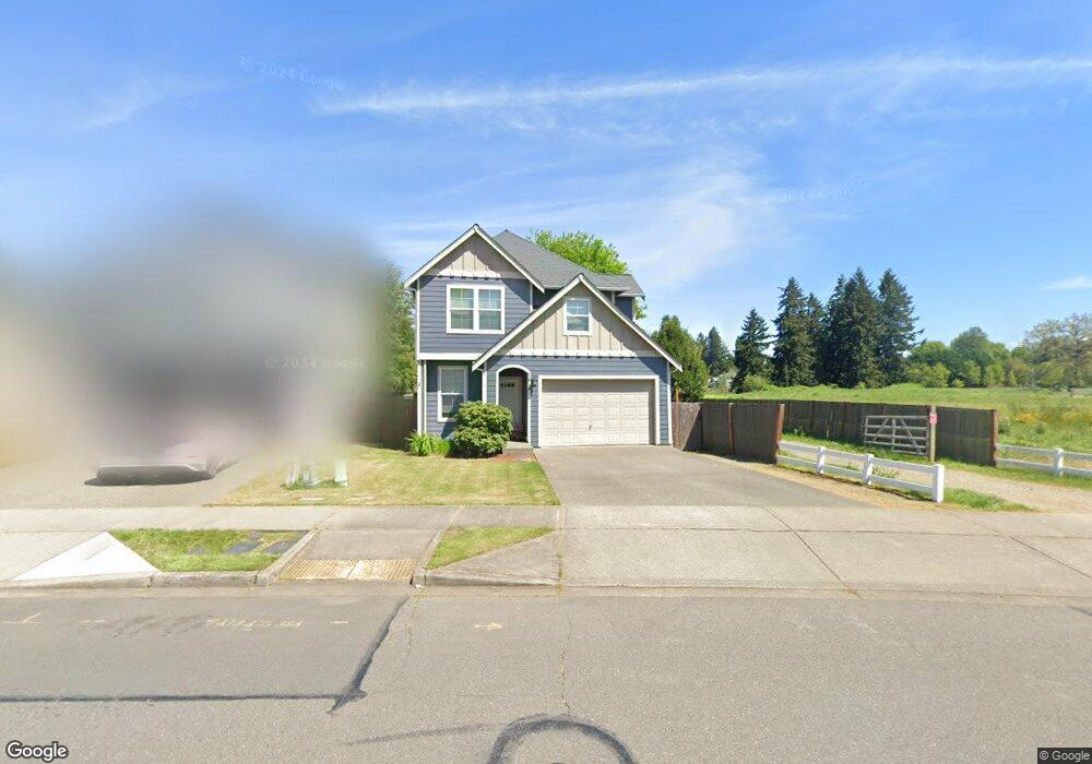
7814 Trails End Dr SE Olympia, WA 98501
Estimated Value: $462,974 - $497,000
3
Beds
3
Baths
1,584
Sq Ft
$301/Sq Ft
Est. Value
About This Home
This home is located at 7814 Trails End Dr SE, Olympia, WA 98501 and is currently estimated at $475,994, approximately $300 per square foot. 7814 Trails End Dr SE is a home located in Thurston County with nearby schools including Peter G. Schmidt Elementary School, George Washington Bush Middle School, and Tumwater High School.
Ownership History
Date
Name
Owned For
Owner Type
Purchase Details
Closed on
Aug 23, 2017
Sold by
Emmons Mark K
Bought by
Jelvik Robert M
Current Estimated Value
Home Financials for this Owner
Home Financials are based on the most recent Mortgage that was taken out on this home.
Original Mortgage
$242,250
Outstanding Balance
$200,983
Interest Rate
3.75%
Mortgage Type
Adjustable Rate Mortgage/ARM
Estimated Equity
$275,011
Purchase Details
Closed on
Jun 17, 2009
Sold by
Sterling Ventures Nw Llc
Bought by
Emmons Mark K
Home Financials for this Owner
Home Financials are based on the most recent Mortgage that was taken out on this home.
Original Mortgage
$225,784
Interest Rate
4.82%
Mortgage Type
FHA
Create a Home Valuation Report for This Property
The Home Valuation Report is an in-depth analysis detailing your home's value as well as a comparison with similar homes in the area
Home Values in the Area
Average Home Value in this Area
Purchase History
| Date | Buyer | Sale Price | Title Company |
|---|---|---|---|
| Jelvik Robert M | $254,719 | Thurston County Title | |
| Emmons Mark K | $229,950 | Stewart Title |
Source: Public Records
Mortgage History
| Date | Status | Borrower | Loan Amount |
|---|---|---|---|
| Open | Jelvik Robert M | $242,250 | |
| Previous Owner | Emmons Mark K | $225,784 |
Source: Public Records
Tax History Compared to Growth
Tax History
| Year | Tax Paid | Tax Assessment Tax Assessment Total Assessment is a certain percentage of the fair market value that is determined by local assessors to be the total taxable value of land and additions on the property. | Land | Improvement |
|---|---|---|---|---|
| 2024 | $3,955 | $409,900 | $118,900 | $291,000 |
| 2023 | $3,955 | $394,900 | $105,900 | $289,000 |
| 2022 | $3,669 | $381,000 | $75,100 | $305,900 |
| 2021 | $3,383 | $311,600 | $62,200 | $249,400 |
| 2020 | $3,292 | $263,500 | $67,100 | $196,400 |
| 2019 | $2,928 | $248,600 | $67,200 | $181,400 |
| 2018 | $3,137 | $243,000 | $55,800 | $187,200 |
| 2017 | $3,005 | $228,900 | $50,900 | $178,000 |
| 2016 | $2,919 | $213,100 | $51,800 | $161,300 |
| 2014 | -- | $209,600 | $53,000 | $156,600 |
Source: Public Records
Map
Nearby Homes
- 1320 Derby Ln SE
- 1602 Sundrop Ln SE
- 7844 Riverview Ct SE
- 8400 Old Highway 99 SE
- 7236 Twin Cedar Ln SE
- 7315 Munn Lake Dr SE
- 2349 79th Ave SE Unit 42-45
- 2409 79th Ave SE Unit 109
- 7413 Munn Lake Dr SE
- 7045 Henderson Blvd SE
- 1945 71st Ave SE
- 7026 Munn Lake Dr SE
- 8813 Old Highway 99 SE
- 1133 68th Ave SE Unit 25
- 1192 68th Ave SE Unit 35
- 1184 68th Ave SE Unit 36
- 6823 Kyodi Ct SE
- 1145 68th Ave SE Unit 27
- 6808 Kyodi Ct SE
- 8890 Yarrow Ct SE
- 7812 Trails End Dr SE
- 7816 Trails End Dr SE
- 7806 Trails End Dr SE
- 7807 Trails End Dr SE
- 7802 Trails End Dr SE
- 1537 77th Trail SE
- 7801 Trails End Dr SE
- 1541 77th Trail SE
- 7748 Trails End Dr SE
- 7747 Trails End Dr SE
- 1531 77th Trail SE
- 7744 Trails End Dr SE
- 7743 Trails End Dr SE
- 7740 Trails End Dr SE
- 7736 Trails End Dr SE
- 1429 77th Trail SE
- 7735 Trails End Dr SE
- 7814 Karenna Ln SE