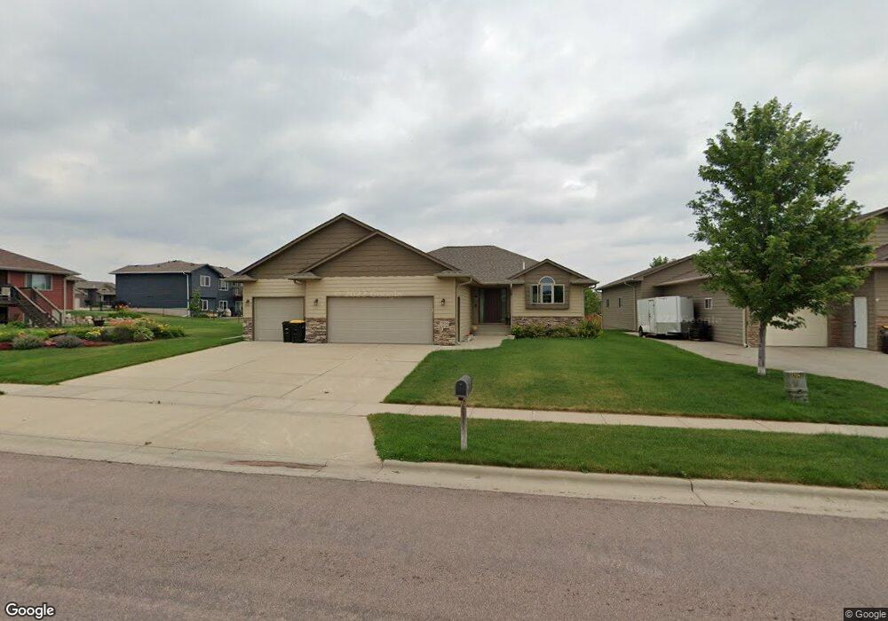
7816 W Kelsey Cir Sioux Falls, SD 57106
Northwest Sioux Falls NeighborhoodEstimated Value: $399,000 - $499,000
4
Beds
3
Baths
2,574
Sq Ft
$177/Sq Ft
Est. Value
About This Home
This home is located at 7816 W Kelsey Cir, Sioux Falls, SD 57106 and is currently estimated at $456,657, approximately $177 per square foot. 7816 W Kelsey Cir is a home located in Minnehaha County with nearby schools including Discovery Elementary School, Memorial Middle School, and Jefferson High School - 67.
Ownership History
Date
Name
Owned For
Owner Type
Purchase Details
Closed on
Jan 11, 2013
Sold by
Paul Fick Homes Inc
Bought by
Austin Laura L
Current Estimated Value
Home Financials for this Owner
Home Financials are based on the most recent Mortgage that was taken out on this home.
Original Mortgage
$214,200
Outstanding Balance
$148,515
Interest Rate
3.31%
Mortgage Type
Stand Alone First
Estimated Equity
$308,142
Purchase Details
Closed on
Jun 12, 2012
Sold by
Wfc Llc
Bought by
Paul Fick Homes Inc
Create a Home Valuation Report for This Property
The Home Valuation Report is an in-depth analysis detailing your home's value as well as a comparison with similar homes in the area
Home Values in the Area
Average Home Value in this Area
Purchase History
| Date | Buyer | Sale Price | Title Company |
|---|---|---|---|
| Austin Laura L | -- | -- | |
| Paul Fick Homes Inc | -- | -- |
Source: Public Records
Mortgage History
| Date | Status | Borrower | Loan Amount |
|---|---|---|---|
| Open | Austin Laura L | $214,200 |
Source: Public Records
Tax History Compared to Growth
Tax History
| Year | Tax Paid | Tax Assessment Tax Assessment Total Assessment is a certain percentage of the fair market value that is determined by local assessors to be the total taxable value of land and additions on the property. | Land | Improvement |
|---|---|---|---|---|
| 2024 | $4,706 | $347,100 | $48,900 | $298,200 |
| 2023 | $4,985 | $354,900 | $44,600 | $310,300 |
| 2022 | $4,616 | $309,500 | $44,600 | $264,900 |
| 2021 | $4,800 | $312,500 | $0 | $0 |
| 2020 | $4,800 | $310,100 | $0 | $0 |
| 2019 | $4,360 | $276,002 | $0 | $0 |
| 2018 | $4,180 | $270,003 | $0 | $0 |
| 2017 | $3,992 | $266,004 | $36,050 | $229,954 |
| 2016 | $3,992 | $254,006 | $36,050 | $217,956 |
| 2015 | $3,961 | $242,286 | $34,247 | $208,039 |
| 2014 | -- | $234,207 | $34,247 | $199,960 |
Source: Public Records
Map
Nearby Homes
- 7805 W Noah Cir
- 8008 W Browning St
- 7809 W Stoney Creek St
- 7517 W 15th St
- 7524 W Boysenberry St
- 604 S Mary Gene Ave
- 501 S Mary Gene Ave
- 7512 W Stoney Creek St
- 1200 S Monticello Ave
- 521 S Big Stone Ave
- 8709 W Rathburn St
- 1301 Hyannis Port Ln
- 8605 W Bryggen Ct
- 1209 S Discovery Ave
- 100 N Bryggen Place
- 102 N Bryggen Place
- 104 N Bryggen Place
- 106 N Bryggen Place
- 8607 W Shoreline Place
- 8609 W Shoreline Place
- 7812 W Kelsey Cir
- 7812 W Kelsey Cir Cir
- 608 S Clearbrook Ave
- 604 S Clearbrook Ave
- 7808 W Kelsey Cir
- 628 Berretta Ln
- 7817 W Kelsey Cir
- 700 S Clearbrook Ave
- 624 S Berretta Ln
- 624 Berretta Ln
- 600 S Clearbrook Ave
- 7804 W Kelsey Cir
- 7809 W Kelsey Cir
- 620 Berretta Ln
- 704 S Clearbrook Ave
- 609 S Clearbrook Ave
- 7812 W Noah Cir
- 605 S Clearbrook Ave
- 7800 W Kelsey Cir
- 7816 W Noah Cir