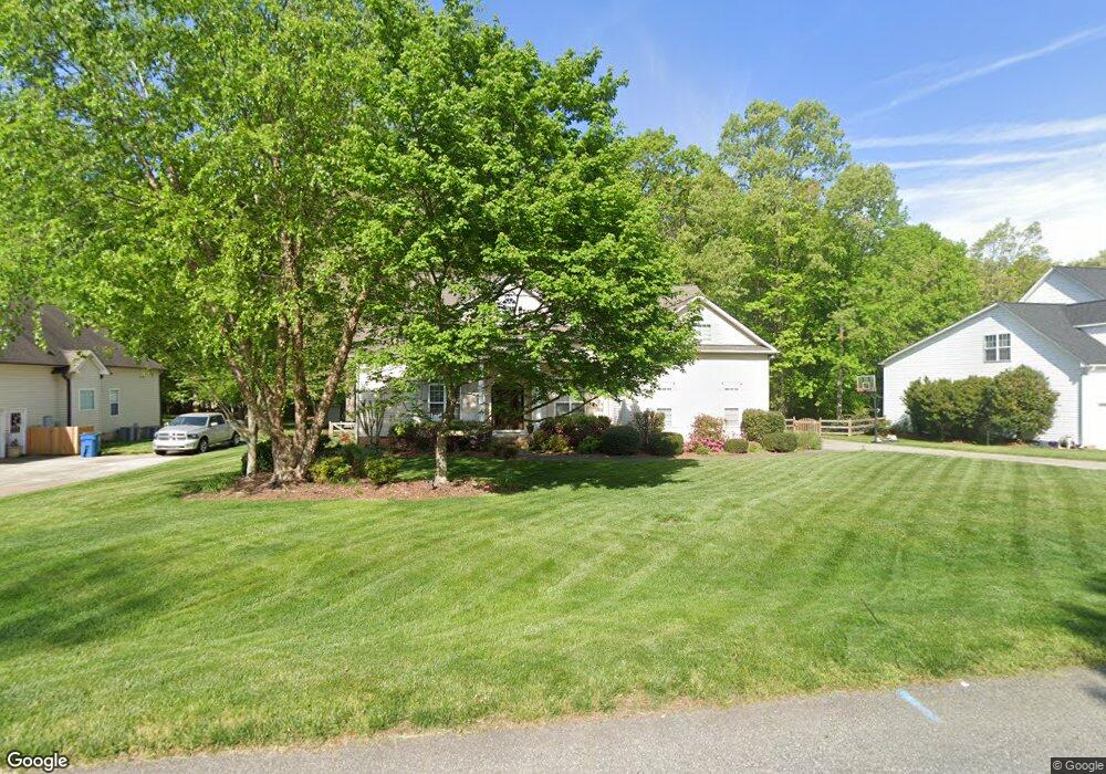
7817 Spencer Brook Dr Summerfield, NC 27358
Estimated Value: $561,000 - $648,000
4
Beds
3
Baths
3,082
Sq Ft
$194/Sq Ft
Est. Value
About This Home
This home is located at 7817 Spencer Brook Dr, Summerfield, NC 27358 and is currently estimated at $596,481, approximately $193 per square foot. 7817 Spencer Brook Dr is a home located in Guilford County with nearby schools including Stokesdale Elementary School, Northwest Guilford Middle School, and Northwest Guilford High School.
Ownership History
Date
Name
Owned For
Owner Type
Purchase Details
Closed on
Mar 28, 2002
Sold by
R&K Investment Properties Inc
Bought by
Zeyfang David William and Zeyfang Linda Lusk
Current Estimated Value
Home Financials for this Owner
Home Financials are based on the most recent Mortgage that was taken out on this home.
Original Mortgage
$223,200
Outstanding Balance
$92,791
Interest Rate
6.85%
Estimated Equity
$503,690
Create a Home Valuation Report for This Property
The Home Valuation Report is an in-depth analysis detailing your home's value as well as a comparison with similar homes in the area
Home Values in the Area
Average Home Value in this Area
Purchase History
| Date | Buyer | Sale Price | Title Company |
|---|---|---|---|
| Zeyfang David William | $282,000 | -- |
Source: Public Records
Mortgage History
| Date | Status | Borrower | Loan Amount |
|---|---|---|---|
| Open | Zeyfang David William | $223,200 |
Source: Public Records
Tax History Compared to Growth
Tax History
| Year | Tax Paid | Tax Assessment Tax Assessment Total Assessment is a certain percentage of the fair market value that is determined by local assessors to be the total taxable value of land and additions on the property. | Land | Improvement |
|---|---|---|---|---|
| 2025 | $3,510 | $394,800 | $75,000 | $319,800 |
| 2024 | $3,510 | $394,800 | $75,000 | $319,800 |
| 2023 | $3,510 | $394,800 | $75,000 | $319,800 |
| 2022 | $3,510 | $394,800 | $75,000 | $319,800 |
| 2021 | $2,869 | $322,700 | $65,000 | $257,700 |
| 2020 | $2,869 | $322,700 | $65,000 | $257,700 |
| 2019 | $2,869 | $322,700 | $0 | $0 |
| 2018 | $2,854 | $322,700 | $0 | $0 |
| 2017 | $2,869 | $322,700 | $0 | $0 |
| 2016 | $2,769 | $303,100 | $0 | $0 |
| 2015 | $2,784 | $303,100 | $0 | $0 |
| 2014 | $2,814 | $303,100 | $0 | $0 |
Source: Public Records
Map
Nearby Homes
- 7825 Spencer Brook Dr
- 7819 Wilson Farm Rd
- 7003 Pearson Run Ct
- 6981 Brandi Wood Cir
- 7004 Westfield Village Cir
- 7107 Lanier Rd
- 7400 & 7400 ZZ Haw Ridge Rd
- 7619 Whitaker Dr
- 7418 Moores Mill Rd
- 7524 Whitaker Dr
- 7399 Henson Forest Dr
- 7376 Henson Forest Dr
- 7106 Lambert Lake Rd
- 6998 Colleen Ct
- 7111 Lambert Lake Rd
- 7722 NW Meadows Dr
- 7107 Lake Henson Dr
- 5603 Monk Ct
- 5408 Briardenn Ct
- 6925 US Highway 158
- 7815 Spencer Brook Dr
- 7819 Spencer Brook Dr
- 7814 Spencer Brook Dr
- 7821 Spencer Brook Dr
- 7813 Spencer Brook Dr
- 6998 Saratoga Ct
- 7811 Spencer Brook Dr
- 7812 Spencer Brook Dr
- 7823 Spencer Brook Dr
- 6997 Saratoga Ct
- 7810 Wilson Farm Rd
- 6996 Saratoga Ct
- 7816 Wilson Farm Rd
- 7809 Spencer Brook Dr
- 7808 Wilson Farm Rd
- 6995 Saratoga Ct
- 7806 Wilson Farm Rd
- 7807 Spencer Brook Dr
- 7827 Spencer Brook Dr
- 7818 Wilson Farm Rd