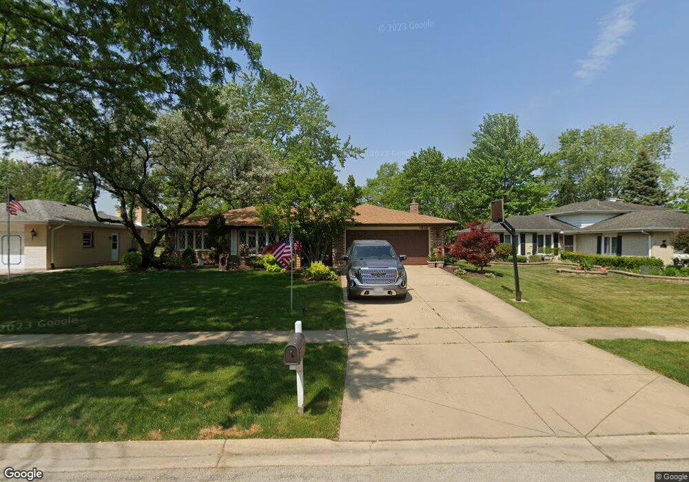
7818 Nantucket Dr Darien, IL 60561
Estimated Value: $451,533 - $515,000
--
Bed
--
Bath
1,872
Sq Ft
$261/Sq Ft
Est. Value
About This Home
This home is located at 7818 Nantucket Dr, Darien, IL 60561 and is currently estimated at $488,883, approximately $261 per square foot. 7818 Nantucket Dr is a home located in DuPage County with nearby schools including Mark Delay School, Lace Elementary School, and Eisenhower Jr High School.
Ownership History
Date
Name
Owned For
Owner Type
Purchase Details
Closed on
Apr 13, 1998
Sold by
Parise Joseph T and Parise Georgine M
Bought by
Barry William G and Barry Victoria E
Current Estimated Value
Home Financials for this Owner
Home Financials are based on the most recent Mortgage that was taken out on this home.
Original Mortgage
$150,000
Outstanding Balance
$28,674
Interest Rate
7.18%
Estimated Equity
$460,209
Purchase Details
Closed on
Sep 29, 1995
Sold by
Tomz Steven C
Bought by
Parise Joseph T and Parise Georgine M
Home Financials for this Owner
Home Financials are based on the most recent Mortgage that was taken out on this home.
Original Mortgage
$100,000
Interest Rate
7.91%
Create a Home Valuation Report for This Property
The Home Valuation Report is an in-depth analysis detailing your home's value as well as a comparison with similar homes in the area
Home Values in the Area
Average Home Value in this Area
Purchase History
| Date | Buyer | Sale Price | Title Company |
|---|---|---|---|
| Barry William G | $227,500 | -- | |
| Parise Joseph T | $183,000 | -- |
Source: Public Records
Mortgage History
| Date | Status | Borrower | Loan Amount |
|---|---|---|---|
| Open | Barry William G | $150,000 | |
| Previous Owner | Parise Joseph T | $100,000 |
Source: Public Records
Tax History Compared to Growth
Tax History
| Year | Tax Paid | Tax Assessment Tax Assessment Total Assessment is a certain percentage of the fair market value that is determined by local assessors to be the total taxable value of land and additions on the property. | Land | Improvement |
|---|---|---|---|---|
| 2024 | $8,813 | $144,775 | $53,650 | $91,125 |
| 2023 | $8,490 | $133,090 | $49,320 | $83,770 |
| 2022 | $8,200 | $128,490 | $48,310 | $80,180 |
| 2021 | $7,889 | $127,030 | $47,760 | $79,270 |
| 2020 | $7,783 | $124,510 | $46,810 | $77,700 |
| 2019 | $7,524 | $119,460 | $44,910 | $74,550 |
| 2018 | $7,022 | $112,740 | $44,670 | $68,070 |
| 2017 | $6,799 | $106,210 | $42,960 | $63,250 |
| 2016 | $6,622 | $101,360 | $41,000 | $60,360 |
| 2015 | $6,528 | $95,360 | $38,570 | $56,790 |
| 2014 | $6,688 | $96,240 | $37,500 | $58,740 |
| 2013 | $6,464 | $95,780 | $37,320 | $58,460 |
Source: Public Records
Map
Nearby Homes
- 7817 Mayfair Ln
- 716 Somerset Ln
- 709 79th St Unit 103
- 709 79th St Unit 307
- 709 79th St Unit 403
- Lot 1, 2, 3, 4 & 5 Nantucket Dr
- 7715 Sussex Creek Dr Unit 1D
- 9S080 Stratford Place
- 7713 Brookhaven Ave
- 7515 Nantucket Dr Unit 404
- 7525 Nantucket Dr Unit 210
- 7510 Farmingdale Dr Unit 208
- 8081 Tennessee Ave
- 1018 Bob-O-link Ln
- 320 Sheridan Dr Unit 2C
- 7976 Clarendon Hills Rd
- 7831 Clarendon Hills Rd
- 8301 Highpoint Cir Unit C
- 7930 Grant St
- 1310 Iroquois Ln
- 7814 Nantucket Dr
- 7822 Nantucket Dr
- 7826 Nantucket Dr
- 7817 Nantucket Dr
- 7813 Nantucket Dr
- 7821 Nantucket Dr
- 814 79th St
- 818 79th St
- 7809 Nantucket Dr
- 813 Andermann Ln
- 817 Andermann Ln
- 822 79th St
- 821 Andermann Ln
- 7825 Nantucket Dr
- 7805 Nantucket Dr
- 826 79th St
- 825 Andermann Ln
- 7829 Nantucket Dr
- 7820 Mayfair Ln
- 7816 Mayfair Ln