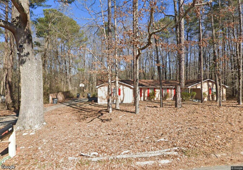
782 Britt Rd SW Mableton, GA 30126
Estimated Value: $329,000 - $370,722
5
Beds
3
Baths
2,516
Sq Ft
$137/Sq Ft
Est. Value
About This Home
This home is located at 782 Britt Rd SW, Mableton, GA 30126 and is currently estimated at $345,181, approximately $137 per square foot. 782 Britt Rd SW is a home located in Cobb County with nearby schools including Bryant Elementary School, Lindley Middle School, and Pebblebrook High School.
Ownership History
Date
Name
Owned For
Owner Type
Purchase Details
Closed on
Jul 29, 1999
Sold by
Worldwide Church Of God
Bought by
Barr Allan and Barr Edna
Current Estimated Value
Home Financials for this Owner
Home Financials are based on the most recent Mortgage that was taken out on this home.
Original Mortgage
$112,250
Interest Rate
7.66%
Mortgage Type
New Conventional
Create a Home Valuation Report for This Property
The Home Valuation Report is an in-depth analysis detailing your home's value as well as a comparison with similar homes in the area
Home Values in the Area
Average Home Value in this Area
Purchase History
| Date | Buyer | Sale Price | Title Company |
|---|---|---|---|
| Barr Allan | $118,200 | -- |
Source: Public Records
Mortgage History
| Date | Status | Borrower | Loan Amount |
|---|---|---|---|
| Previous Owner | Barr Allan | $112,250 |
Source: Public Records
Tax History Compared to Growth
Tax History
| Year | Tax Paid | Tax Assessment Tax Assessment Total Assessment is a certain percentage of the fair market value that is determined by local assessors to be the total taxable value of land and additions on the property. | Land | Improvement |
|---|---|---|---|---|
| 2025 | $576 | $116,776 | $37,544 | $79,232 |
| 2024 | $579 | $116,776 | $37,544 | $79,232 |
| 2023 | $328 | $101,988 | $37,544 | $64,444 |
| 2022 | $458 | $76,536 | $23,712 | $52,824 |
| 2021 | $426 | $65,660 | $20,552 | $45,108 |
| 2020 | $412 | $60,916 | $15,808 | $45,108 |
| 2019 | $412 | $60,916 | $15,808 | $45,108 |
| 2018 | $381 | $50,684 | $9,088 | $41,596 |
| 2017 | $298 | $37,124 | $5,928 | $31,196 |
| 2016 | $299 | $37,124 | $5,928 | $31,196 |
| 2015 | $320 | $37,228 | $3,952 | $33,276 |
| 2014 | $284 | $33,392 | $0 | $0 |
Source: Public Records
Map
Nearby Homes
- 767 Kenneth Ln SW
- 846 Orris Ln SW
- 6281 Denny Ln SW
- 760 W Starling Dr SW
- 6266 Britt Rd SW
- 377 Waterbluff Dr SW
- 373 Waterbluff Dr SW
- 369 Waterbluff Dr SW
- 368 Waterbluff Dr SW
- 365 Waterbluff Dr SW
- 364 Waterbluff Dr SW
- 537 Elizabeth Ln SW
- 6302 Mount Pisgah Ln
- 496 Elizabeth Ln SW
- 6365 Susan Dr SW
- 1086 S Gordon Rd
- Harbor Plan at Mableton Station
- Robie Plan at Mableton Station
- Aisle Plan at Mableton Station
- Elston Plan at Mableton Station
- 754 Britt Rd SW
- 0 Britt Rd Unit 3154077
- 0 Britt Rd Unit 20011772
- 0 Britt Rd Unit 7583015
- 761 Britt Rd SW
- 890 Britt Rd SW
- 791 Britt Rd SW
- 757 Britt Rd SW
- 795 Britt Rd SW
- 715 Factory Shoals Dr SW
- 0 Gardner Ct Unit Lot 6 8979157
- 616 Charity Ln SW
- 745 Factory Shoals Dr SW
- 6520 Gardner Ct Unit 5
- 6520 Gardner Ct
- 797 Britt Rd
- 616 Charity Ln SW
- 763 Factory Shoals Dr SW
- 6531 Gardner Ct
- 615 Charity Ln SW