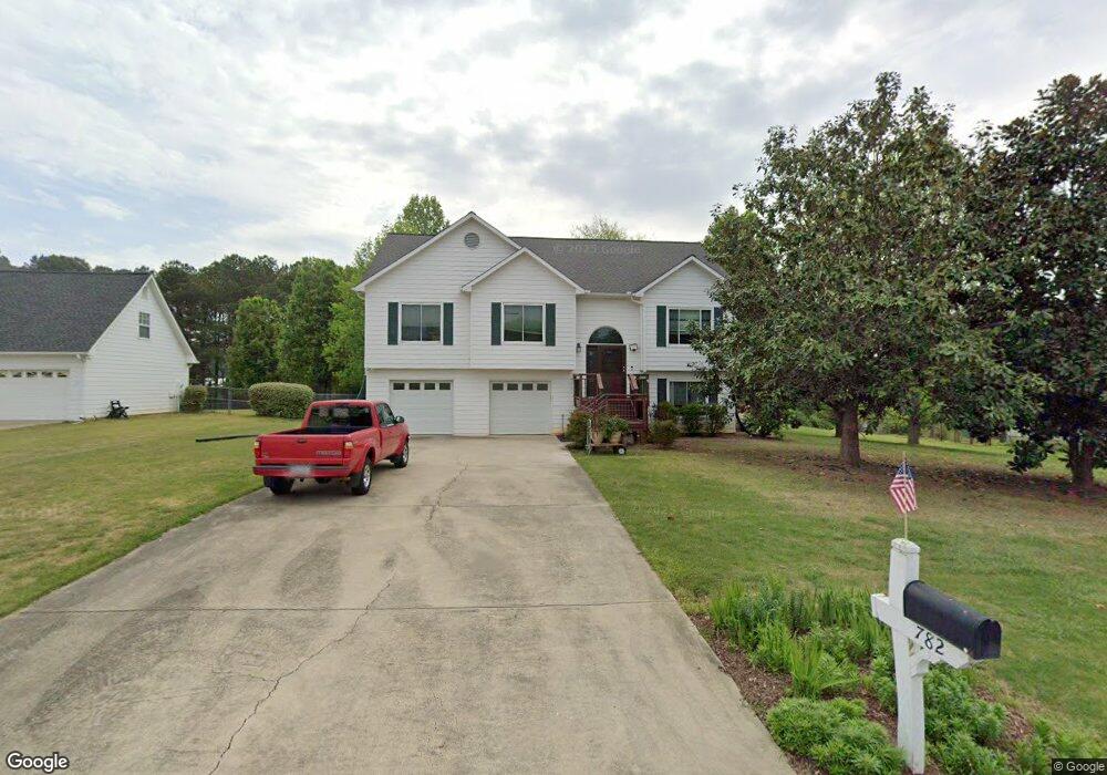
782 Brookelynn Trace Bethlehem, GA 30620
Estimated Value: $340,195 - $370,000
3
Beds
3
Baths
2,415
Sq Ft
$148/Sq Ft
Est. Value
About This Home
This home is located at 782 Brookelynn Trace, Bethlehem, GA 30620 and is currently estimated at $356,799, approximately $147 per square foot. 782 Brookelynn Trace is a home located in Barrow County with nearby schools including Yargo Elementary School, Haymon-Morris Middle School, and Apalachee High School.
Ownership History
Date
Name
Owned For
Owner Type
Purchase Details
Closed on
Oct 27, 1998
Sold by
Dcm Bldrs Inc
Bought by
Mahiney Greg A
Current Estimated Value
Home Financials for this Owner
Home Financials are based on the most recent Mortgage that was taken out on this home.
Original Mortgage
$124,630
Outstanding Balance
$25,233
Interest Rate
6.58%
Mortgage Type
VA
Estimated Equity
$331,566
Purchase Details
Closed on
Mar 19, 1998
Sold by
C G S Development In
Bought by
D C M Builders Inc
Purchase Details
Closed on
Jul 9, 1996
Bought by
C G S Development In
Create a Home Valuation Report for This Property
The Home Valuation Report is an in-depth analysis detailing your home's value as well as a comparison with similar homes in the area
Home Values in the Area
Average Home Value in this Area
Purchase History
| Date | Buyer | Sale Price | Title Company |
|---|---|---|---|
| Mahiney Greg A | $121,000 | -- | |
| D C M Builders Inc | $38,000 | -- | |
| C G S Development In | -- | -- |
Source: Public Records
Mortgage History
| Date | Status | Borrower | Loan Amount |
|---|---|---|---|
| Open | Mahiney Greg A | $124,630 |
Source: Public Records
Tax History
| Year | Tax Paid | Tax Assessment Tax Assessment Total Assessment is a certain percentage of the fair market value that is determined by local assessors to be the total taxable value of land and additions on the property. | Land | Improvement |
|---|---|---|---|---|
| 2025 | $2,231 | $105,133 | $26,800 | $78,333 |
| 2024 | $2,285 | $102,960 | $26,800 | $76,160 |
| 2023 | $1,802 | $103,360 | $26,800 | $76,560 |
| 2022 | $2,548 | $100,362 | $22,400 | $77,962 |
| 2021 | $2,511 | $93,962 | $16,000 | $77,962 |
| 2020 | $2,067 | $75,240 | $16,000 | $59,240 |
| 2019 | $2,097 | $75,240 | $16,000 | $59,240 |
| 2018 | $2,000 | $72,440 | $13,200 | $59,240 |
| 2017 | $1,854 | $63,681 | $13,200 | $50,481 |
| 2016 | $1,527 | $53,555 | $13,200 | $40,355 |
| 2015 | $1,544 | $54,025 | $13,200 | $40,825 |
| 2014 | $1,398 | $47,763 | $6,468 | $41,295 |
| 2013 | -- | $43,218 | $6,468 | $36,750 |
Source: Public Records
Map
Nearby Homes
- 209 Angie Way
- 1256 Loganville Hwy
- 1129 Loganville Hwy
- 627 Bridle Creek Dr
- 907 Downing Dr
- 923 Downing Dr
- 1188 Carl-Bethlehem Rd
- 449 Carl Bethlehem Rd SW
- 732 Ridgeland Rd
- 611 Mcdowell Ln
- 1202 Benton Ct
- 1309 Tom Miller Rd
- 738 Worth Ct
- 724 Westbury Dr
- 253 Meadows Dr
- 286 Meadows Dr
- 308 Meadows Dr
- 631 Saddle Ridge Dr
- 713 Carl Bethlehem Rd
- 236 Vision St
- 780 Brookelynn Trace
- 784 Brookelynn Trace
- 200 Angie Way
- 778 Brookelyn Trace
- 778 Brookelynn Trace
- 786 Brookelynn Trace Unit 2
- 786 Brookelyn Trace
- 301 Ron Dr
- 202 Angie Way Unit 2
- 776 Brookelynn Trace
- 201 Angie Way Unit 2
- 788 Brookelynn Trace Unit 2
- 204 Angie Way Unit 2
- 774 Brookelynn Trace
- 203 Angie Way
- 790 Brookelyn Trace
- 305 Ron Dr
- 790 Brookelynn Trace
- 302 Ron Dr
- 547 Harvey Lokey Rd
Your Personal Tour Guide
Ask me questions while you tour the home.