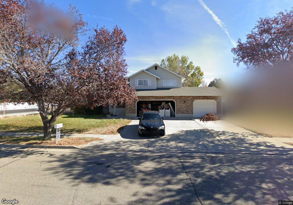
782 N 2700 W Clearfield, UT 84015
Estimated Value: $539,956 - $576,000
4
Beds
3
Baths
2,770
Sq Ft
$202/Sq Ft
Est. Value
About This Home
This home is located at 782 N 2700 W, Clearfield, UT 84015 and is currently estimated at $558,239, approximately $201 per square foot. 782 N 2700 W is a home located in Davis County with nearby schools including Lakeside School, West Point Junior High School, and Syracuse High School.
Ownership History
Date
Name
Owned For
Owner Type
Purchase Details
Closed on
Sep 8, 2016
Sold by
Lemieux Jerimiah Christopher and Lemieux Lori Dawn
Bought by
Calton Robert Reed
Current Estimated Value
Purchase Details
Closed on
Sep 9, 2008
Sold by
Calton Pamela Gail
Bought by
Calton Robert Reed
Create a Home Valuation Report for This Property
The Home Valuation Report is an in-depth analysis detailing your home's value as well as a comparison with similar homes in the area
Home Values in the Area
Average Home Value in this Area
Purchase History
| Date | Buyer | Sale Price | Title Company |
|---|---|---|---|
| Calton Robert Reed | -- | First American Title | |
| Calton Robert Reed | -- | None Available |
Source: Public Records
Tax History Compared to Growth
Tax History
| Year | Tax Paid | Tax Assessment Tax Assessment Total Assessment is a certain percentage of the fair market value that is determined by local assessors to be the total taxable value of land and additions on the property. | Land | Improvement |
|---|---|---|---|---|
| 2025 | $3,099 | $290,400 | $106,735 | $183,665 |
| 2024 | $2,986 | $281,051 | $96,124 | $184,927 |
| 2023 | $2,755 | $477,000 | $117,965 | $359,035 |
| 2022 | $2,925 | $277,200 | $60,851 | $216,349 |
| 2021 | $2,624 | $372,000 | $97,067 | $274,933 |
| 2020 | $2,301 | $322,000 | $81,179 | $240,821 |
| 2019 | $2,218 | $306,000 | $74,925 | $231,075 |
| 2018 | $2,103 | $286,000 | $75,694 | $210,306 |
| 2016 | $1,551 | $110,990 | $29,254 | $81,736 |
| 2015 | $1,564 | $103,455 | $29,254 | $74,201 |
| 2014 | $1,492 | $102,631 | $29,254 | $73,377 |
| 2013 | -- | $101,102 | $29,156 | $71,946 |
Source: Public Records
Map
Nearby Homes