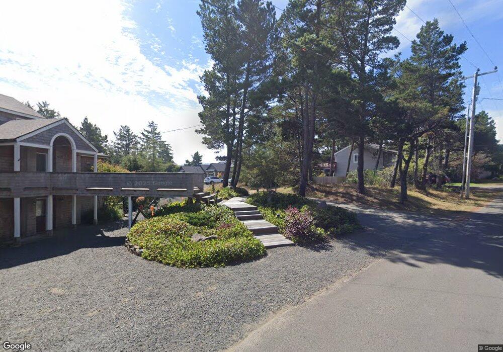
782 Nita Ave Seaside, OR 97138
Estimated Value: $1,188,030 - $1,246,000
--
Bed
--
Bath
--
Sq Ft
10,019
Sq Ft Lot
About This Home
This home is located at 782 Nita Ave, Seaside, OR 97138 and is currently estimated at $1,220,677. 782 Nita Ave is a home with nearby schools including Seaside High School.
Ownership History
Date
Name
Owned For
Owner Type
Purchase Details
Closed on
Jun 27, 2017
Sold by
Fewell John B and Fewell Kerrie S
Bought by
Hays Vivian and Vivian Hays Living Trust
Current Estimated Value
Purchase Details
Closed on
Sep 12, 2012
Sold by
Gearhart Llc
Bought by
Fewel John B and Fewel Kerrie S
Purchase Details
Closed on
Dec 23, 2004
Sold by
Fewel Elizabeth B
Bought by
Gearhart Llc
Home Financials for this Owner
Home Financials are based on the most recent Mortgage that was taken out on this home.
Original Mortgage
$87,500
Interest Rate
5.74%
Mortgage Type
Seller Take Back
Create a Home Valuation Report for This Property
The Home Valuation Report is an in-depth analysis detailing your home's value as well as a comparison with similar homes in the area
Home Values in the Area
Average Home Value in this Area
Purchase History
| Date | Buyer | Sale Price | Title Company |
|---|---|---|---|
| Hays Vivian | $245,000 | Ticor Title Company Of Or | |
| Fewel John B | $180,000 | None Available | |
| Gearhart Llc | $175,000 | Pacific Title Company |
Source: Public Records
Mortgage History
| Date | Status | Borrower | Loan Amount |
|---|---|---|---|
| Previous Owner | Gearhart Llc | $87,500 |
Source: Public Records
Tax History Compared to Growth
Tax History
| Year | Tax Paid | Tax Assessment Tax Assessment Total Assessment is a certain percentage of the fair market value that is determined by local assessors to be the total taxable value of land and additions on the property. | Land | Improvement |
|---|---|---|---|---|
| 2024 | $6,217 | $543,593 | -- | -- |
| 2023 | $6,043 | $527,761 | $0 | $0 |
| 2022 | $5,862 | $512,391 | $0 | $0 |
| 2021 | $5,984 | $497,468 | $0 | $0 |
| 2020 | $5,772 | $482,979 | $0 | $0 |
| 2019 | $3,294 | $274,634 | $0 | $0 |
| 2018 | $1,696 | $142,464 | $0 | $0 |
| 2017 | $1,651 | $138,315 | $0 | $0 |
| 2016 | $1,426 | $134,287 | $134,287 | $0 |
| 2015 | $1,379 | $130,376 | $130,376 | $0 |
| 2014 | $1,311 | $126,579 | $0 | $0 |
| 2013 | -- | $122,893 | $0 | $0 |
Source: Public Records
Map
Nearby Homes
- 0 Wellington Ave Unit 25-48
- 0 Wellington Ave Unit 1202
- 924 Little Beach Dr
- 782 Woodland Ct
- 1265 D St
- 196 Dylan Ct
- 2624 Neawanna St
- 415 Spruce Ave
- 2549 Neawanna St
- 1396 N Ocean Ave
- 000 Neawanna St
- 802 25th Ave
- Lots 25-26 5th St
- 2469 Pine St
- 3387-3389 U S 101
- 3389 U S 101
- 623 Indian Way
- 0 5th St
- 261 Railroad Ave
- 2657 Highway 101 N Unit 42
