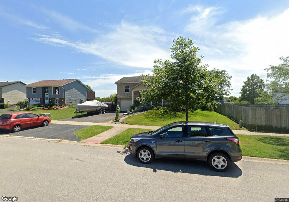
7823 W Frankfort Square Rd Frankfort, IL 60423
Frankfort Square NeighborhoodEstimated Value: $287,000 - $319,650
3
Beds
2
Baths
736
Sq Ft
$418/Sq Ft
Est. Value
About This Home
This home is located at 7823 W Frankfort Square Rd, Frankfort, IL 60423 and is currently estimated at $307,663, approximately $418 per square foot. 7823 W Frankfort Square Rd is a home located in Will County with nearby schools including Frankfort Square Elementary School, Summit Hill Junior High School, and Lincoln-Way East High School.
Ownership History
Date
Name
Owned For
Owner Type
Purchase Details
Closed on
Apr 12, 2022
Sold by
Standish Roger J and Standish Gina L
Bought by
Standish Roger J and Standish Gina L
Current Estimated Value
Purchase Details
Closed on
Apr 19, 1994
Sold by
Morris Mark C and Morris Kim M
Bought by
Standish Roger J and Standish Gina L
Home Financials for this Owner
Home Financials are based on the most recent Mortgage that was taken out on this home.
Original Mortgage
$103,250
Interest Rate
7.84%
Mortgage Type
FHA
Create a Home Valuation Report for This Property
The Home Valuation Report is an in-depth analysis detailing your home's value as well as a comparison with similar homes in the area
Home Values in the Area
Average Home Value in this Area
Purchase History
| Date | Buyer | Sale Price | Title Company |
|---|---|---|---|
| Standish Roger J | -- | None Listed On Document | |
| Standish Roger J | $118,000 | Greater Illinois Title Compa |
Source: Public Records
Mortgage History
| Date | Status | Borrower | Loan Amount |
|---|---|---|---|
| Previous Owner | Standish Roger J | $103,250 |
Source: Public Records
Tax History Compared to Growth
Tax History
| Year | Tax Paid | Tax Assessment Tax Assessment Total Assessment is a certain percentage of the fair market value that is determined by local assessors to be the total taxable value of land and additions on the property. | Land | Improvement |
|---|---|---|---|---|
| 2024 | $5,975 | $86,842 | $24,739 | $62,103 |
| 2023 | $5,975 | $77,558 | $22,094 | $55,464 |
| 2022 | $5,902 | $70,642 | $20,124 | $50,518 |
| 2021 | $5,520 | $66,089 | $18,827 | $47,262 |
| 2020 | $5,429 | $64,226 | $18,296 | $45,930 |
| 2019 | $5,242 | $62,507 | $17,806 | $44,701 |
| 2018 | $5,044 | $60,710 | $17,294 | $43,416 |
| 2017 | $4,933 | $59,293 | $16,890 | $42,403 |
| 2016 | $4,773 | $57,260 | $16,311 | $40,949 |
| 2015 | $4,592 | $55,244 | $15,737 | $39,507 |
| 2014 | $4,592 | $54,860 | $15,628 | $39,232 |
| 2013 | $4,592 | $55,572 | $15,831 | $39,741 |
Source: Public Records
Map
Nearby Homes
- 20027 S Jessica Ln
- 8025 Stonegate Dr
- 7758 W Kingston Dr
- 7800 W Kingston Dr
- 8131 W Evergreen Dr
- 7959 Brookside Glen Dr Unit VI
- 19708 S Skye Dr
- 20137 S Hampton Ct Unit A
- 20130 S Frankfort Square Rd
- 7752 W Almond Ct Unit 135
- 7905 Richardson Ln
- 20206 S Frankfort Square Rd Unit A
- 8124 Glenbrook Place Unit 1
- 7407 Ridgefield Ln
- 19642 S Edinburgh Ln
- 7928 Trinity Cir Unit 2SW
- 7928 Trinity Cir Unit 3NW
- 20158 S Rosewood Dr
- 8026 Bradley Dr
- 19558 S Harlem Ave
- 7815 W Frankfort Square Rd
- 7839 W Carrie Ct
- 7809 W Frankfort Square Rd
- 7843 W Carrie Ct
- 7830 W Frankfort Square Rd
- 7801 W Frankfort Square Rd
- 19749 S Patricia Ln
- 7838 W Frankfort Square Rd
- 7847 W Carrie Ct
- 19741 S Patricia Ln
- 7848 W Frankfort Square Rd
- 19746 S Woodruff Ct
- 7851 W Frankfort Square Rd
- 19754 S Woodruff Ct
- 7831 W Evan Terrace
- 19760 S Woodruff Ct
- 19732 S Skidmore Ct
- 7851 W Carrie Ct
- 7839 W Evan Terrace
- 19802 S Woodruff Ct