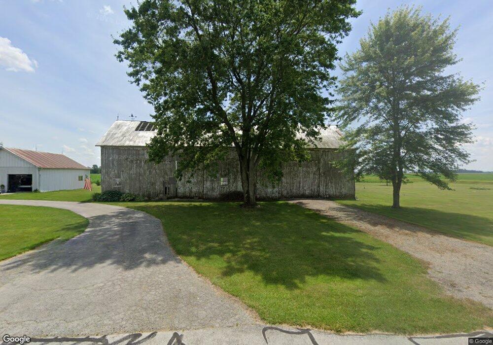
7827 Dull Rd Arcanum, OH 45304
Estimated Value: $164,000 - $238,000
4
Beds
1
Bath
1,736
Sq Ft
$114/Sq Ft
Est. Value
About This Home
This home is located at 7827 Dull Rd, Arcanum, OH 45304 and is currently estimated at $197,308, approximately $113 per square foot. 7827 Dull Rd is a home with nearby schools including Franklin Monroe Elementary School and Franklin Monroe High School.
Ownership History
Date
Name
Owned For
Owner Type
Purchase Details
Closed on
Mar 17, 2003
Sold by
Foster Dennis D and Foster Linda S
Bought by
Baker Jeffrey A and Baker Sara Jane
Current Estimated Value
Home Financials for this Owner
Home Financials are based on the most recent Mortgage that was taken out on this home.
Original Mortgage
$114,000
Interest Rate
6%
Mortgage Type
Purchase Money Mortgage
Purchase Details
Closed on
Apr 1, 1988
Bought by
Baker Jeffrey A and Sara Jane
Create a Home Valuation Report for This Property
The Home Valuation Report is an in-depth analysis detailing your home's value as well as a comparison with similar homes in the area
Home Values in the Area
Average Home Value in this Area
Purchase History
| Date | Buyer | Sale Price | Title Company |
|---|---|---|---|
| Baker Jeffrey A | $60,000 | -- | |
| Baker Jeffrey A | $72,500 | -- |
Source: Public Records
Mortgage History
| Date | Status | Borrower | Loan Amount |
|---|---|---|---|
| Previous Owner | Baker Jeffrey A | $114,000 |
Source: Public Records
Tax History Compared to Growth
Tax History
| Year | Tax Paid | Tax Assessment Tax Assessment Total Assessment is a certain percentage of the fair market value that is determined by local assessors to be the total taxable value of land and additions on the property. | Land | Improvement |
|---|---|---|---|---|
| 2024 | $1,619 | $48,610 | $8,550 | $40,060 |
| 2023 | $1,621 | $48,610 | $8,550 | $40,060 |
| 2022 | $1,463 | $38,390 | $7,250 | $31,140 |
| 2021 | $1,476 | $38,390 | $7,250 | $31,140 |
| 2020 | $1,413 | $38,390 | $7,250 | $31,140 |
| 2019 | $1,183 | $33,200 | $7,250 | $25,950 |
| 2018 | $1,179 | $33,200 | $7,250 | $25,950 |
| 2017 | $1,023 | $33,200 | $7,250 | $25,950 |
| 2016 | $1,031 | $30,790 | $6,810 | $23,980 |
| 2015 | $1,031 | $30,790 | $6,810 | $23,980 |
| 2014 | $1,038 | $30,790 | $6,810 | $23,980 |
| 2013 | $1,103 | $30,510 | $6,530 | $23,980 |
Source: Public Records
Map
Nearby Homes
- 2012 Ohio 49
- 107 Merrie Ln
- 6977 Alternate State Route 49
- 200 N Jefferson St
- 9 Seminole Ln
- Oh-722
- 8784 Grubbs Rex Rd
- 406 W South St
- 1486 Ohio 49
- 604 W North St
- 3 Harvest Dr
- 9 Harvest Dr
- 8 Harvest Dr
- Alt St Rt 49 Alt State Route 49
- 8 Parkdale Dr
- 21 Wheatland Dr
- 20 Wheatland Dr
- 22 Greenmoor Dr
- 2 Edgewood Dr
- 620 Pearl St
- 1893 Gordon Landis Rd
- 1923 Gordon-Landis Rd
- 1976 Gordon Landis Rd
- 7500 Dull Rd
- 7476 Dull Rd
- 7458 Dull Rd
- 7446 Dull Rd
- 7438 Dull Rd
- 7405 Dull Rd
- 7416 Dull Rd
- 1676 Gordon Landis Rd
- 2070 Gordon Landis Rd
- 2055 Gordon Landis Rd
- 7382 Dull Rd
- 7370 Dull Rd Unit Arcanum
- 7370 Dull Rd
- 2177 Gordon Landis Rd
- 2192 Gordon Landis Rd
- 7572 Grubbs Rex Rd
- 7757 Grubbs Rex Rd