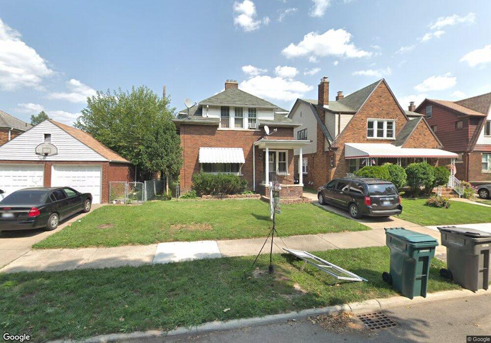
7828 Appoline St Unit Bldg-Unit Dearborn, MI 48126
Aviation NeighborhoodEstimated Value: $219,199 - $270,000
3
Beds
2
Baths
1,232
Sq Ft
$195/Sq Ft
Est. Value
About This Home
This home is located at 7828 Appoline St Unit Bldg-Unit, Dearborn, MI 48126 and is currently estimated at $239,800, approximately $194 per square foot. 7828 Appoline St Unit Bldg-Unit is a home located in Wayne County with nearby schools including McCollough-Unis School, Fordson High School, and Riverside Academy East.
Ownership History
Date
Name
Owned For
Owner Type
Purchase Details
Closed on
Jul 8, 2019
Sold by
Haimour Kolthum and Haimour Muhannad
Bought by
Kharroubi Hanan
Current Estimated Value
Purchase Details
Closed on
Jan 30, 1998
Sold by
Turk Ghada
Bought by
Haimour Majaa
Purchase Details
Closed on
Jul 18, 1997
Sold by
Mallah Oussama and Mallah Wafaa
Bought by
Ghada Turk
Purchase Details
Closed on
May 23, 1996
Sold by
Oussama Mallah
Bought by
Summers Harold C and Summers Amy I
Create a Home Valuation Report for This Property
The Home Valuation Report is an in-depth analysis detailing your home's value as well as a comparison with similar homes in the area
Home Values in the Area
Average Home Value in this Area
Purchase History
| Date | Buyer | Sale Price | Title Company |
|---|---|---|---|
| Kharroubi Hanan | $122,500 | Title One Inc | |
| Haimour Majaa | $132,000 | -- | |
| Ghada Turk | $127,000 | -- | |
| Summers Harold C | $60,000 | -- |
Source: Public Records
Tax History
| Year | Tax Paid | Tax Assessment Tax Assessment Total Assessment is a certain percentage of the fair market value that is determined by local assessors to be the total taxable value of land and additions on the property. | Land | Improvement |
|---|---|---|---|---|
| 2025 | $2,766 | $92,200 | $0 | $0 |
| 2024 | $2,705 | $91,900 | $0 | $0 |
| 2023 | $2,560 | $76,700 | $0 | $0 |
| 2022 | $2,881 | $61,200 | $0 | $0 |
| 2021 | $3,348 | $57,800 | $0 | $0 |
| 2019 | $2,721 | $52,000 | $0 | $0 |
| 2018 | $2,364 | $49,800 | $0 | $0 |
| 2017 | $556 | $44,300 | $0 | $0 |
| 2016 | $2,235 | $40,700 | $0 | $0 |
| 2015 | $3,427 | $37,600 | $0 | $0 |
| 2013 | $3,320 | $33,200 | $0 | $0 |
| 2011 | -- | $37,750 | $0 | $0 |
Source: Public Records
Map
Nearby Homes
- 7658 Appoline St
- 7634 Pinehurst St
- 12953 Tireman Ave
- 7857 Esper Blvd
- 7758 Reuter St
- 8205 Appoline St
- 7900 Middlepointe St
- 10339 Tireman Ave
- 8130 Ward St
- 8258 Meyers Rd
- 7750 Morross Ct
- 8100 Middlepoint St
- 7927 Bingham St
- 7815 Normile St
- 7929 Normile St
- 8029 Hartwell St
- 12950 Mackenzie St
- 13145 Mackenzie St
- 8315 Freda St
- 7813 Neckel St
- 7828 Appoline St
- 7820 Appoline St
- 7812 Appoline St
- 12733 Patton St
- 12741 Patton St
- 12725 Patton St
- 7829 Miller Rd
- 7825 Miller Rd
- 7804 Appoline St
- 12717 Patton St
- 7815 Miller Rd
- 7844 Esper Blvd
- 12709 Patton St
- 7803 Miller Rd
- 7801 Appoline St
- 7754 Appoline St
- 7757 Miller Rd
- 7744 Appoline St
- 10841 Patton St
- 7877 Esper Blvd
Your Personal Tour Guide
Ask me questions while you tour the home.