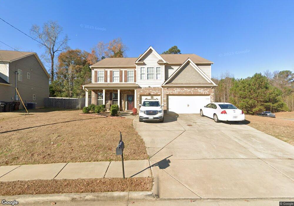
783 Honey Do Ct Columbus, GA 31907
Eastern Columbus NeighborhoodEstimated Value: $352,506 - $438,000
4
Beds
4
Baths
4,032
Sq Ft
$96/Sq Ft
Est. Value
About This Home
This home is located at 783 Honey Do Ct, Columbus, GA 31907 and is currently estimated at $388,877, approximately $96 per square foot. 783 Honey Do Ct is a home located in Muscogee County with nearby schools including Dawson Elementary School, East Columbus Magnet Academy, and Spencer High School.
Ownership History
Date
Name
Owned For
Owner Type
Purchase Details
Closed on
Jun 6, 2019
Sold by
Chiles William R
Bought by
Gordon-Potts Lillye Denise
Current Estimated Value
Home Financials for this Owner
Home Financials are based on the most recent Mortgage that was taken out on this home.
Original Mortgage
$260,000
Outstanding Balance
$227,294
Interest Rate
3.82%
Estimated Equity
$161,583
Create a Home Valuation Report for This Property
The Home Valuation Report is an in-depth analysis detailing your home's value as well as a comparison with similar homes in the area
Home Values in the Area
Average Home Value in this Area
Purchase History
| Date | Buyer | Sale Price | Title Company |
|---|---|---|---|
| Gordon-Potts Lillye Denise | $260,000 | -- |
Source: Public Records
Mortgage History
| Date | Status | Borrower | Loan Amount |
|---|---|---|---|
| Open | Gordon-Potts Lillye Denise | $260,000 |
Source: Public Records
Tax History Compared to Growth
Tax History
| Year | Tax Paid | Tax Assessment Tax Assessment Total Assessment is a certain percentage of the fair market value that is determined by local assessors to be the total taxable value of land and additions on the property. | Land | Improvement |
|---|---|---|---|---|
| 2025 | -- | $138,972 | $14,832 | $124,140 |
| 2024 | -- | $138,972 | $14,832 | $124,140 |
| 2023 | $82 | $138,972 | $14,832 | $124,140 |
| 2022 | $82 | $102,452 | $14,832 | $87,620 |
| 2021 | $117 | $103,768 | $14,832 | $88,936 |
| 2020 | $3,991 | $97,720 | $29,316 | $68,404 |
| 2019 | $3,695 | $97,720 | $29,316 | $68,404 |
| 2018 | $3,695 | $97,720 | $29,316 | $68,404 |
| 2017 | $3,708 | $97,720 | $29,316 | $68,404 |
| 2016 | $3,219 | $91,308 | $18,400 | $72,908 |
| 2015 | $3,224 | $91,308 | $18,400 | $72,908 |
| 2014 | $3,228 | $91,308 | $18,400 | $72,908 |
| 2013 | -- | $91,308 | $18,400 | $72,908 |
Source: Public Records
Map
Nearby Homes
- 780 Honey Do Ct
- 5234 Saint Marys Rd
- 849 Bunker Hill Rd
- 4965 Brightstar Ln
- 906 Bunker Hill Rd
- 4939 Aaron Dr
- 4408 Walking Stick Way
- 4201 Valley Crest Dr
- 4462 Walking Stick Way
- 5336 Gettysburg Way
- 1513 Alamo Dr
- 5219 Argonne Dr
- 4917 Brightstar Ln
- 811 Pheasant Loop
- 31 R C Allen Dr
- 59 Apollo Dr
- 1210 Bunker Hill Rd
- 300 Jefferson Dr
- 4930 Capricorn Ct
- 1238 Brandywine Dr
- 789 Honey Do Ct
- 779 Honey Do Ct
- 795 Honey Do Ct
- 0 Honey Do Ct Unit 8866157
- 792 Honey Do Ct
- 786 Honey Do Ct
- 35 Middleton Place
- 773 Honey Do Ct
- 5237 Village Way
- 5223 Village Way
- 39 Middleton Place
- 31 Middleton Place
- 774 Honey Do Ct
- 5219 Village Way
- 5243 Village Way
- 767 Honey Do Ct
- 29 Middleton Place
- 785 Compass Trail Unit 4
- 785 Compass Trail
- 768 Honey Do Ct