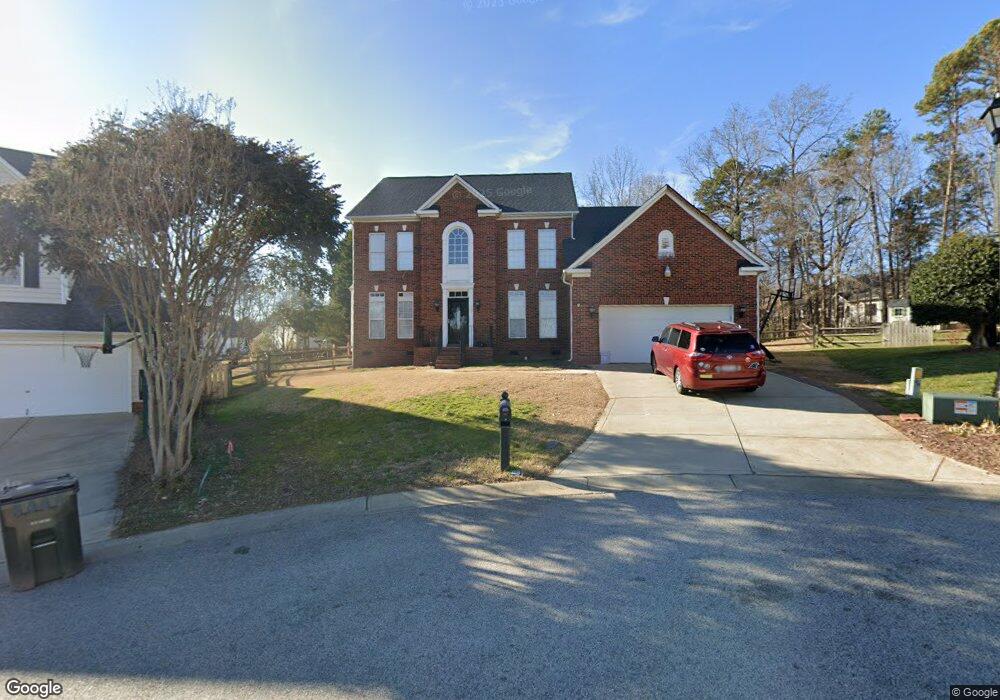
783 Knightswood Rd Fort Mill, SC 29708
Gold Hill NeighborhoodEstimated Value: $625,000 - $687,000
5
Beds
3
Baths
3,206
Sq Ft
$202/Sq Ft
Est. Value
About This Home
This home is located at 783 Knightswood Rd, Fort Mill, SC 29708 and is currently estimated at $647,858, approximately $202 per square foot. 783 Knightswood Rd is a home located in York County with nearby schools including Pleasant Knoll Elementary School, Pleasant Knoll Middle School, and Nation Ford High School.
Ownership History
Date
Name
Owned For
Owner Type
Purchase Details
Closed on
May 15, 2015
Sold by
Lattig David A and Lattig April L
Bought by
Mineck Raymond J and Mineck Lindsay P
Current Estimated Value
Home Financials for this Owner
Home Financials are based on the most recent Mortgage that was taken out on this home.
Original Mortgage
$268,000
Outstanding Balance
$207,278
Interest Rate
3.79%
Mortgage Type
New Conventional
Estimated Equity
$440,580
Purchase Details
Closed on
Jul 10, 2009
Sold by
Dana Hadi M and Dana Donna S
Bought by
Lattig David A and Lattig April L
Home Financials for this Owner
Home Financials are based on the most recent Mortgage that was taken out on this home.
Original Mortgage
$270,019
Interest Rate
5.53%
Mortgage Type
FHA
Purchase Details
Closed on
Dec 21, 1999
Sold by
The Howey Co Inc
Bought by
Nvr Inc
Create a Home Valuation Report for This Property
The Home Valuation Report is an in-depth analysis detailing your home's value as well as a comparison with similar homes in the area
Home Values in the Area
Average Home Value in this Area
Purchase History
| Date | Buyer | Sale Price | Title Company |
|---|---|---|---|
| Mineck Raymond J | $298,000 | -- | |
| Lattig David A | $275,000 | -- | |
| Nvr Inc | $25,600 | -- |
Source: Public Records
Mortgage History
| Date | Status | Borrower | Loan Amount |
|---|---|---|---|
| Open | Mineck Raymond J | $268,000 | |
| Previous Owner | Lattig David A | $270,019 |
Source: Public Records
Tax History Compared to Growth
Tax History
| Year | Tax Paid | Tax Assessment Tax Assessment Total Assessment is a certain percentage of the fair market value that is determined by local assessors to be the total taxable value of land and additions on the property. | Land | Improvement |
|---|---|---|---|---|
| 2024 | $2,302 | $13,041 | $2,503 | $10,538 |
| 2023 | $2,231 | $13,041 | $2,503 | $10,538 |
| 2022 | $2,212 | $13,041 | $2,503 | $10,538 |
| 2021 | -- | $13,041 | $2,503 | $10,538 |
| 2020 | $2,375 | $13,041 | $0 | $0 |
| 2019 | $2,371 | $11,340 | $0 | $0 |
| 2018 | $2,504 | $11,340 | $0 | $0 |
| 2017 | $2,363 | $11,340 | $0 | $0 |
| 2016 | $2,333 | $11,340 | $0 | $0 |
| 2014 | $1,646 | $11,340 | $2,000 | $9,340 |
| 2013 | $1,646 | $11,540 | $2,000 | $9,540 |
Source: Public Records
Map
Nearby Homes
- 878 Treasure Ct
- 736 Knightswood Rd
- 1674 Caille Ct
- 903 Furman Ct
- 646 Quicksilver Trail
- 3559 Nestling Ln
- 657 Chase Ct
- 916 Knightsbridge Rd
- 504 Saint George Rd
- 567 Quicksilver Trail
- 3400 Pleasant Rd
- 505 Whitehead Ct
- 1326 Clifflure Ln
- 618 Chase Ct
- 543 Saint George Rd
- 374 Windell Dr
- 01 Lurecliff Place
- 142 Canterbury Crossing
- 1281 Lurecliff Place
- 4 Lurecliff Place
- 779 Knightswood Rd
- 786 Knightswood Rd Unit 401
- 782 Knightswood Rd
- 782 Knightswood Rd Unit 402
- 775 Knightswood Rd
- 776 Knightswood Rd
- 1026 Kilpatrick Ln
- 1022 Kilpatrick Ln
- 1018 Kilpatrick Ln
- 1661 Spandril Ln
- 771 Knightswood Rd
- 1010 Kilpatrick Ln
- 1010 Kilpatrick Ln Unit 396
- 1657 Spandril Ln
- 1038 Kilpatrick Ln
- 1034 Kilpatrick Ln
- 1664 Spandril Ln
- 1042 Kilpatrick Ln
- 1206 Keara Ct
- 1206 Keara Ct Unit 453