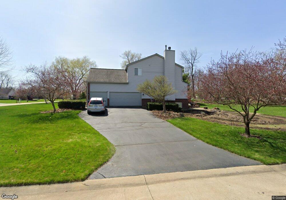
783 Scott Dr Highland, MI 48356
Estimated Value: $493,941 - $555,000
4
Beds
3
Baths
2,716
Sq Ft
$193/Sq Ft
Est. Value
About This Home
This home is located at 783 Scott Dr, Highland, MI 48356 and is currently estimated at $525,485, approximately $193 per square foot. 783 Scott Dr is a home located in Oakland County with nearby schools including Spring Mills Elementary School, Oak Valley Middle School, and West Highland Christian Academy.
Ownership History
Date
Name
Owned For
Owner Type
Purchase Details
Closed on
Feb 16, 2006
Sold by
Merriam Forrest D and Merriam Susan L
Bought by
The Merriam Family Living Trust
Current Estimated Value
Purchase Details
Closed on
Mar 25, 2002
Sold by
J C Development Co
Bought by
Merriam Forrest D
Home Financials for this Owner
Home Financials are based on the most recent Mortgage that was taken out on this home.
Original Mortgage
$200,000
Interest Rate
6.63%
Create a Home Valuation Report for This Property
The Home Valuation Report is an in-depth analysis detailing your home's value as well as a comparison with similar homes in the area
Home Values in the Area
Average Home Value in this Area
Purchase History
| Date | Buyer | Sale Price | Title Company |
|---|---|---|---|
| The Merriam Family Living Trust | -- | None Available | |
| Merriam Forrest D | $65,000 | -- |
Source: Public Records
Mortgage History
| Date | Status | Borrower | Loan Amount |
|---|---|---|---|
| Previous Owner | Merriam Forrest D | $200,000 |
Source: Public Records
Tax History Compared to Growth
Tax History
| Year | Tax Paid | Tax Assessment Tax Assessment Total Assessment is a certain percentage of the fair market value that is determined by local assessors to be the total taxable value of land and additions on the property. | Land | Improvement |
|---|---|---|---|---|
| 2024 | $3,292 | $223,570 | $0 | $0 |
| 2023 | $3,140 | $213,170 | $0 | $0 |
| 2022 | $4,428 | $173,870 | $0 | $0 |
| 2021 | $4,191 | $173,620 | $0 | $0 |
| 2020 | $2,876 | $168,130 | $0 | $0 |
| 2019 | $4,077 | $164,540 | $0 | $0 |
| 2018 | $3,995 | $154,110 | $0 | $0 |
| 2017 | $3,829 | $154,110 | $0 | $0 |
| 2016 | $3,798 | $149,400 | $0 | $0 |
| 2015 | -- | $144,160 | $0 | $0 |
| 2014 | -- | $131,690 | $0 | $0 |
| 2011 | -- | $108,700 | $0 | $0 |
Source: Public Records
Map
Nearby Homes
- 1023 N Park St
- 265 E Livingston Rd
- 1716 E Wardlow Rd
- 171 Countryside Ln
- 1000 Waterbury Rd
- 222 Countryside Ln
- 246 Spruce Unit 246
- 248 Spruce Unit 248
- 105 Beech Unit 105
- 398 Delmar Ct
- 446 Delmar Ct
- 83 Elm
- 33 Pine Unit 33
- 2525 Sherlock Trail
- 230 Macgregor Ct E
- 173 Birch Unit 173
- 1625 Highland Park Dr
- 3015 Lakeview Blvd
- 53 Ash Ave Unit 53
- 1949 Percy
- Vac 3.8 Acres Paved Milford Rd Fenton Rd
- 763 Scott Dr
- 743 Scott Dr
- 780 Donald Dr
- 941 Scott Dr
- 760 Donald Dr
- 760 Scott Dr
- 800 Scott Dr
- 723 Scott Dr
- 808 Donald Dr
- 740 Donald Dr
- 740 Scott Dr
- 720 Donald Dr
- 832 Donald Dr
- 720 Scott Dr
- 720 Scott
- 703 Scott Dr
- 868 Adam Ct Unit Bldg-Unit
- 868 Adam Ct
- 700 Donald Dr