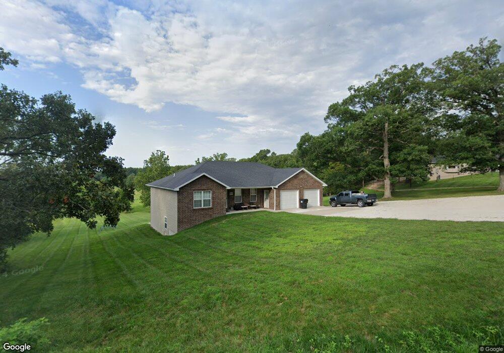
7830 Route D Jefferson City, MO 65109
Estimated Value: $347,000 - $484,000
3
Beds
2
Baths
1,782
Sq Ft
$234/Sq Ft
Est. Value
About This Home
This home is located at 7830 Route D, Jefferson City, MO 65109 and is currently estimated at $417,194, approximately $234 per square foot. 7830 Route D is a home with nearby schools including Cole R-1 Elementary School, Cole R-1 Middle School, and Russellville High School.
Ownership History
Date
Name
Owned For
Owner Type
Purchase Details
Closed on
Oct 6, 2017
Sold by
Groose Patrick T and Groose Pamela L
Bought by
Wilson Gregory J and Wilson Amanda M
Current Estimated Value
Home Financials for this Owner
Home Financials are based on the most recent Mortgage that was taken out on this home.
Original Mortgage
$169,000
Outstanding Balance
$137,948
Interest Rate
3.78%
Mortgage Type
New Conventional
Estimated Equity
$279,246
Create a Home Valuation Report for This Property
The Home Valuation Report is an in-depth analysis detailing your home's value as well as a comparison with similar homes in the area
Home Values in the Area
Average Home Value in this Area
Purchase History
| Date | Buyer | Sale Price | Title Company |
|---|---|---|---|
| Wilson Gregory J | -- | -- |
Source: Public Records
Mortgage History
| Date | Status | Borrower | Loan Amount |
|---|---|---|---|
| Open | Wilson Gregory J | $169,000 |
Source: Public Records
Tax History Compared to Growth
Tax History
| Year | Tax Paid | Tax Assessment Tax Assessment Total Assessment is a certain percentage of the fair market value that is determined by local assessors to be the total taxable value of land and additions on the property. | Land | Improvement |
|---|---|---|---|---|
| 2025 | $2,508 | $42,310 | $4,750 | $37,560 |
| 2024 | $2,508 | $42,310 | $4,750 | $37,560 |
| 2023 | $2,403 | $42,310 | $4,750 | $37,560 |
| 2022 | $2,290 | $40,190 | $0 | $40,190 |
| 2021 | $2,288 | $40,190 | $0 | $40,190 |
| 2020 | $2,292 | $40,185 | $4,750 | $35,435 |
| 2019 | $2,255 | $40,185 | $4,750 | $35,435 |
| 2018 | $2,160 | $40,185 | $4,750 | $35,435 |
| 2017 | $129 | $2,375 | $2,375 | $0 |
| 2016 | $123 | $2,375 | $2,375 | $0 |
| 2015 | $122 | $0 | $0 | $0 |
| 2014 | $122 | $2,375 | $2,375 | $0 |
Source: Public Records
Map
Nearby Homes
- 4200 Windy Hill Dr
- 9412 Pleasant Hill Rd
- 4112 Pin Oak Dr
- 0 Heritage Hwy
- 9635 Tanner Bridge Rd
- LOT 13 Henley Estates
- LOT 12 Henley Estates
- LOT 11 Henley Estates
- LOT 10 Henley Estates
- LOT 1 Henley Estates
- LOT 9 Henley Estates
- 5623 Heritage Hwy
- 6262 Stringtown Rd
- 5611 Hemstreet Rd
- 3936 Dewberry Dr
- 3022 Rumsey Ln
- 2829 Foxdale Dr
- 2704 Covey Ln
- 3402 Rocky Rd
- 620 Whispering Cedars Ln