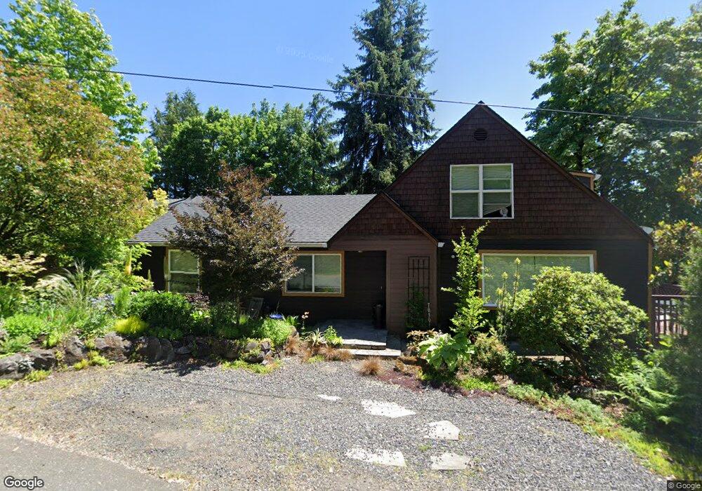
7830 SW 17th Dr Portland, OR 97219
Hillsdale NeighborhoodEstimated Value: $546,000 - $765,000
3
Beds
2
Baths
2,700
Sq Ft
$255/Sq Ft
Est. Value
About This Home
This home is located at 7830 SW 17th Dr, Portland, OR 97219 and is currently estimated at $688,084, approximately $254 per square foot. 7830 SW 17th Dr is a home located in Multnomah County with nearby schools including Rieke Elementary School, Robert Gray Middle School, and Ida B. Wells-Barnett High School.
Ownership History
Date
Name
Owned For
Owner Type
Purchase Details
Closed on
Apr 25, 2013
Sold by
Simpson Lisa
Bought by
Bertin Alan D
Current Estimated Value
Home Financials for this Owner
Home Financials are based on the most recent Mortgage that was taken out on this home.
Original Mortgage
$293,584
Interest Rate
3.6%
Mortgage Type
FHA
Purchase Details
Closed on
Jul 17, 2006
Sold by
Olson John D
Bought by
Heady Donald R
Home Financials for this Owner
Home Financials are based on the most recent Mortgage that was taken out on this home.
Original Mortgage
$310,360
Interest Rate
6.25%
Mortgage Type
New Conventional
Purchase Details
Closed on
Mar 1, 2002
Sold by
Nelson Todd Allen
Bought by
Olson John D
Create a Home Valuation Report for This Property
The Home Valuation Report is an in-depth analysis detailing your home's value as well as a comparison with similar homes in the area
Home Values in the Area
Average Home Value in this Area
Purchase History
| Date | Buyer | Sale Price | Title Company |
|---|---|---|---|
| Bertin Alan D | $299,000 | Wfg Title | |
| Heady Donald R | $387,950 | Ticor Title Insurance Compan | |
| Olson John D | $115,000 | Oregon Title Insurance Co |
Source: Public Records
Mortgage History
| Date | Status | Borrower | Loan Amount |
|---|---|---|---|
| Previous Owner | Bertin Alan D | $293,584 | |
| Previous Owner | Heady Donald R | $310,360 |
Source: Public Records
Tax History Compared to Growth
Tax History
| Year | Tax Paid | Tax Assessment Tax Assessment Total Assessment is a certain percentage of the fair market value that is determined by local assessors to be the total taxable value of land and additions on the property. | Land | Improvement |
|---|---|---|---|---|
| 2025 | $8,501 | $315,790 | -- | -- |
| 2024 | $8,196 | $306,600 | -- | -- |
| 2023 | $7,880 | $297,670 | $0 | $0 |
| 2022 | $7,710 | $289,000 | $0 | $0 |
| 2021 | $7,579 | $280,590 | $0 | $0 |
| 2020 | $6,953 | $272,420 | $0 | $0 |
| 2019 | $6,697 | $264,494 | $0 | $0 |
| 2018 | $5,367 | $212,030 | $0 | $0 |
| 2017 | $5,144 | $205,860 | $0 | $0 |
| 2016 | $4,707 | $199,870 | $0 | $0 |
| 2015 | $4,584 | $194,050 | $0 | $0 |
| 2014 | $4,515 | $188,400 | $0 | $0 |
Source: Public Records
Map
Nearby Homes
- 8046 SW Capitol Hill Rd
- 8040 SW Capitol Hill Rd
- 1515 SW Carson St
- 1834 SW Miles St
- 1323 SW Carson St
- 2320 SW Canby Ct
- 7290 SW 13th Ave
- 7308 SW 13th Dr
- 7131 SW 12th Ave
- 2119 SW Nevada Ct
- 2612 SW Moss St
- 8329 SW 24th Ave Unit 3
- 2616 SW Hume Ct Unit 28
- 660 SW Evans St
- 7776 SW 5th Ave
- 2644 SW Hume Ct
- 2531 SW Spring Garden St
- 6835 SW Capitol Hill Rd Unit 30
- 1345 SW Taylors Ferry Ct
- 8325 SW Terwilliger Blvd
- 7943 SW Barbur Blvd
- 7820 SW 17th Dr Unit 7840
- 7910 SW 17th Ave
- 7809 SW 17th Dr
- 1706 SW Troy St
- 1705 SW Moss St
- 1704 SW Moss St
- 7802 SW 17th Dr
- 1707 SW Moss St
- 1716 SW Troy St
- 1709 SW Moss St
- 7934 SW Barbur Blvd
- 1627 SW Troy St
- 1609 SW Troy St
- 1641 SW Troy St
- 1718 SW Moss St
- 1724 SW Troy St
- 1701 SW Troy St
- 1430 SW Moss St
- 7943 SW 17th Ave