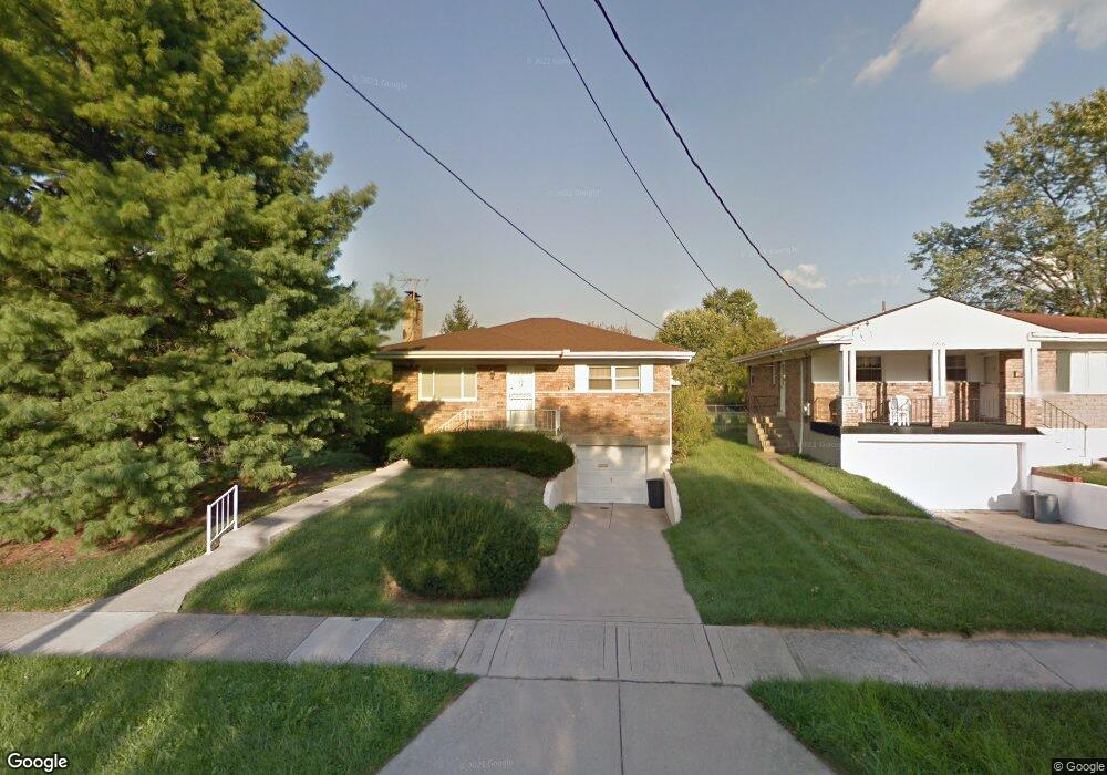
7834 Spirea Dr Cincinnati, OH 45236
Estimated Value: $235,000 - $302,000
2
Beds
1
Bath
932
Sq Ft
$290/Sq Ft
Est. Value
About This Home
This home is located at 7834 Spirea Dr, Cincinnati, OH 45236 and is currently estimated at $269,858, approximately $289 per square foot. 7834 Spirea Dr is a home located in Hamilton County with nearby schools including Indian Hill Primary School, Indian Hill Elementary School, and Indian Hill Middle School.
Ownership History
Date
Name
Owned For
Owner Type
Purchase Details
Closed on
Apr 30, 2007
Sold by
Grever James J and Grever Anna Marie
Bought by
Laidler Henri
Current Estimated Value
Home Financials for this Owner
Home Financials are based on the most recent Mortgage that was taken out on this home.
Original Mortgage
$140,600
Interest Rate
6.77%
Mortgage Type
Unknown
Purchase Details
Closed on
Jul 13, 2001
Sold by
Grever James J and Grever Marie Anna
Bought by
Grever James J and Grever Anna Marie
Create a Home Valuation Report for This Property
The Home Valuation Report is an in-depth analysis detailing your home's value as well as a comparison with similar homes in the area
Home Values in the Area
Average Home Value in this Area
Purchase History
We collect this data history from publicly available records. To have your information removed, we recommend requesting removal directly through your county’s website.
| Date | Buyer | Sale Price | Title Company |
|---|---|---|---|
| Laidler Henri | $148,000 | Federated Land Title Agency | |
| Grever James J | -- | -- |
Source: Public Records
Mortgage History
We collect this data history from publicly available records. To have your information removed, we recommend requesting removal directly through your county’s website.
| Date | Status | Borrower | Loan Amount |
|---|---|---|---|
| Previous Owner | Laidler Henri | $140,600 |
Source: Public Records
Tax History
| Year | Tax Paid | Tax Assessment Tax Assessment Total Assessment is a certain percentage of the fair market value that is determined by local assessors to be the total taxable value of land and additions on the property. | Land | Improvement |
|---|---|---|---|---|
| 2025 | $2,893 | $81,789 | $29,509 | $52,280 |
| 2024 | $2,819 | $81,789 | $29,509 | $52,280 |
| 2023 | $2,868 | $81,789 | $29,509 | $52,280 |
| 2022 | $2,336 | $57,075 | $16,622 | $40,453 |
| 2021 | $2,268 | $57,075 | $16,622 | $40,453 |
| 2020 | $2,034 | $57,075 | $16,622 | $40,453 |
| 2019 | $1,865 | $50,068 | $14,581 | $35,487 |
| 2018 | $1,911 | $50,068 | $14,581 | $35,487 |
| 2017 | $1,820 | $50,068 | $14,581 | $35,487 |
| 2016 | $1,698 | $46,992 | $14,165 | $32,827 |
| 2015 | $1,691 | $46,992 | $14,165 | $32,827 |
| 2014 | $1,681 | $46,992 | $14,165 | $32,827 |
| 2013 | $1,700 | $46,071 | $13,888 | $32,183 |
Source: Public Records
Map
Nearby Homes
- 4615 Largo Dr
- 4436 Clifford Rd
- 7304 Richmond Ave
- 8075 Queens Ave
- 8014 Dalton Ave
- 7137 Silvercrest Dr
- 7123 Silver Crest Dr
- 4325 Glenway Ave
- 26 Wentworth Ln
- 25 Wentworth Ln
- 34 Wentworth Ln
- 8313 Monroe Ave
- 9 Wentworth Ln
- 7534 Blue Ash Rd
- 4357 Yakima Ct
- 6149 Saint Regis Dr
- 8517 Wilton Ave
- 8527 Wilton Ave
- 4215 Matson Ave
- 7027 Glenellyn Dr
- 7816 Spirea Dr
- 4611 Duneden Ave
- 4619 Duneden Ave
- 4606 Duneden Ave
- 4598 Duneden Ave
- 7840 Styrax Ln
- 7833 Spirea Dr
- 7817 Spirea Dr
- 4614 Duneden Ave
- 7782 Spirea Dr
- 4592 Duneden Ave
- 4627 Duneden Ave
- 7803 Spirea Dr
- 4620 Duneden Ave
- 4584 Duneden Ave
- 7849 Styrax Ln
- 7832 Styrax Ln
- 7789 Spirea Dr
- 7766 Spirea Dr
- 4635 Duneden Ave
Your Personal Tour Guide
Ask me questions while you tour the home.