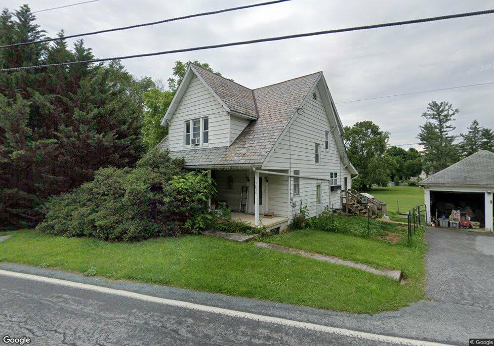
7836 Tomstown Rd Waynesboro, PA 17268
Estimated Value: $140,751 - $288,000
--
Bed
--
Bath
1,456
Sq Ft
$156/Sq Ft
Est. Value
About This Home
This home is located at 7836 Tomstown Rd, Waynesboro, PA 17268 and is currently estimated at $226,688, approximately $155 per square foot. 7836 Tomstown Rd is a home located in Franklin County with nearby schools including Waynesboro Area Senior High School, St. Andrew Catholic School, and Providence School - Pigeon Hill Building.
Ownership History
Date
Name
Owned For
Owner Type
Purchase Details
Closed on
Jun 5, 2006
Sold by
Royer Jeffrey L and Royer Barbara J
Bought by
Williams John Peter and Williams Jennifer Lynn
Current Estimated Value
Home Financials for this Owner
Home Financials are based on the most recent Mortgage that was taken out on this home.
Original Mortgage
$179,910
Outstanding Balance
$106,068
Interest Rate
6.62%
Mortgage Type
New Conventional
Estimated Equity
$120,620
Create a Home Valuation Report for This Property
The Home Valuation Report is an in-depth analysis detailing your home's value as well as a comparison with similar homes in the area
Home Values in the Area
Average Home Value in this Area
Purchase History
| Date | Buyer | Sale Price | Title Company |
|---|---|---|---|
| Williams John Peter | $199,900 | None Available |
Source: Public Records
Mortgage History
| Date | Status | Borrower | Loan Amount |
|---|---|---|---|
| Open | Williams John Peter | $179,910 |
Source: Public Records
Tax History Compared to Growth
Tax History
| Year | Tax Paid | Tax Assessment Tax Assessment Total Assessment is a certain percentage of the fair market value that is determined by local assessors to be the total taxable value of land and additions on the property. | Land | Improvement |
|---|---|---|---|---|
| 2025 | $2,084 | $14,280 | $980 | $13,300 |
| 2024 | $2,019 | $14,280 | $980 | $13,300 |
| 2023 | $1,964 | $14,280 | $980 | $13,300 |
| 2022 | $1,907 | $14,280 | $980 | $13,300 |
| 2021 | $1,850 | $14,280 | $980 | $13,300 |
| 2020 | $1,850 | $14,280 | $980 | $13,300 |
| 2019 | $1,807 | $14,280 | $980 | $13,300 |
| 2018 | $1,746 | $14,280 | $980 | $13,300 |
| 2017 | $1,707 | $14,280 | $980 | $13,300 |
| 2016 | $409 | $14,280 | $980 | $13,300 |
| 2015 | $381 | $14,280 | $980 | $13,300 |
| 2014 | $381 | $14,280 | $980 | $13,300 |
Source: Public Records
Map
Nearby Homes
- 7468 Anthony Hwy
- 5434 Manheim Rd
- 6159 Orphanage Rd
- 8620 Monns Gap Rd
- 8652 Mormon Church Rd
- 286 Verdier St
- 207 University Dr
- 111 Poplar St
- 6 S Main St
- 8655 Wayne Hwy
- 6456 Wayne Hwy
- 7205 Fairway Dr S
- 6158 Merion Dr
- 0 Unit PAFL2024598
- 0 Unit PAFL2024594
- 0 Unit PAFL2024596
- 0 Unit PAFL2024618
- 7130 St Annes Dr
- 0 Unit PAFL2024592
- 0 Unit PAFL2024616
- 7835 Tomstown Rd
- 7720 Anthony Hwy
- 7803 Tomstown Rd
- 7710 Anthony Hwy
- 7851 Tomstown Rd
- 7756 Anthony Hwy
- 7772 Anthony Hwy
- 7700 Anthony Hwy
- 7747 Anthony Hwy
- 7721 Anthony Hwy
- 7866 Tomstown Rd
- 7705 Anthony Hwy
- 7835 Oak Dr
- 7783 Anthony Hwy
- 7680 Anthony Hwy
- 7789 Oak Dr
- 7879 Tomstown Rd
- 7670 Anthony Hwy
- 7797 Anthony Hwy
- 7824 Anthony Hwy