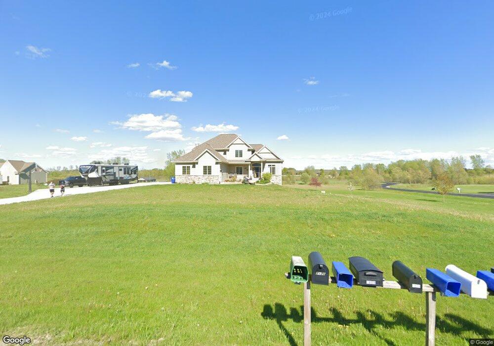
7838 Noah Ln West Bend, WI 53090
Estimated Value: $788,655 - $970,000
--
Bed
--
Bath
--
Sq Ft
6.35
Acres
About This Home
This home is located at 7838 Noah Ln, West Bend, WI 53090 and is currently estimated at $849,218. 7838 Noah Ln is a home with nearby schools including Kewaskum High School.
Ownership History
Date
Name
Owned For
Owner Type
Purchase Details
Closed on
Jun 13, 2013
Sold by
Zurn Jeffrey J and Zurn Jennifer N
Bought by
Herbert Michael D and Herbert Shannon N
Current Estimated Value
Home Financials for this Owner
Home Financials are based on the most recent Mortgage that was taken out on this home.
Original Mortgage
$69,400
Outstanding Balance
$33,163
Interest Rate
3.75%
Mortgage Type
Adjustable Rate Mortgage/ARM
Estimated Equity
$816,055
Purchase Details
Closed on
Mar 3, 2006
Sold by
Lache Steven R and Lache Tamara A
Bought by
Zurn Jeffery J and Zurn Jennifer N
Home Financials for this Owner
Home Financials are based on the most recent Mortgage that was taken out on this home.
Original Mortgage
$85,950
Interest Rate
5.73%
Mortgage Type
Assumption
Create a Home Valuation Report for This Property
The Home Valuation Report is an in-depth analysis detailing your home's value as well as a comparison with similar homes in the area
Home Values in the Area
Average Home Value in this Area
Purchase History
| Date | Buyer | Sale Price | Title Company |
|---|---|---|---|
| Herbert Michael D | $86,800 | None Available | |
| Zurn Jeffery J | $95,500 | None Available |
Source: Public Records
Mortgage History
| Date | Status | Borrower | Loan Amount |
|---|---|---|---|
| Open | Herbert Michael D | $69,400 | |
| Previous Owner | Zurn Jeffery J | $85,950 |
Source: Public Records
Tax History Compared to Growth
Tax History
| Year | Tax Paid | Tax Assessment Tax Assessment Total Assessment is a certain percentage of the fair market value that is determined by local assessors to be the total taxable value of land and additions on the property. | Land | Improvement |
|---|---|---|---|---|
| 2024 | $5,574 | $488,200 | $102,200 | $386,000 |
| 2023 | $5,056 | $488,200 | $102,200 | $386,000 |
| 2022 | $4,524 | $480,000 | $102,200 | $377,800 |
| 2021 | $4,661 | $480,000 | $102,200 | $377,800 |
| 2020 | $4,744 | $480,000 | $102,200 | $377,800 |
| 2019 | $4,550 | $369,200 | $64,000 | $305,200 |
| 2018 | $4,513 | $369,200 | $64,000 | $305,200 |
| 2017 | $4,598 | $369,200 | $64,000 | $305,200 |
| 2016 | $4,520 | $369,200 | $64,000 | $305,200 |
| 2015 | $4,399 | $369,200 | $64,000 | $305,200 |
| 2014 | $806 | $64,000 | $64,000 | $0 |
| 2013 | $889 | $64,000 | $64,000 | $0 |
Source: Public Records
Map
Nearby Homes
- 5036 County Highway D
- 7721 Aurora Rd
- 7165 Town Line Rd
- Lt0 County Hwy W
- 8480 Fairview Dr
- 6837 Reuter Ln
- 744 Ojibwe Path
- Lt3-5 Schuster Dr
- Lt3 Schuster Dr
- Lt5 Schuster Dr
- Lt4 Schuster Dr
- 800 Chief Kewaskum Place
- Lt2 Beaver Dam Rd
- 7360 Rustic Rd
- 6386 Alpine Dr
- 7526 Northpoint Ct
- 5954 Mohawk Rd
- 708 Pleasantwood Dr
- 4932 County H
- 3462 Town Hall Rd