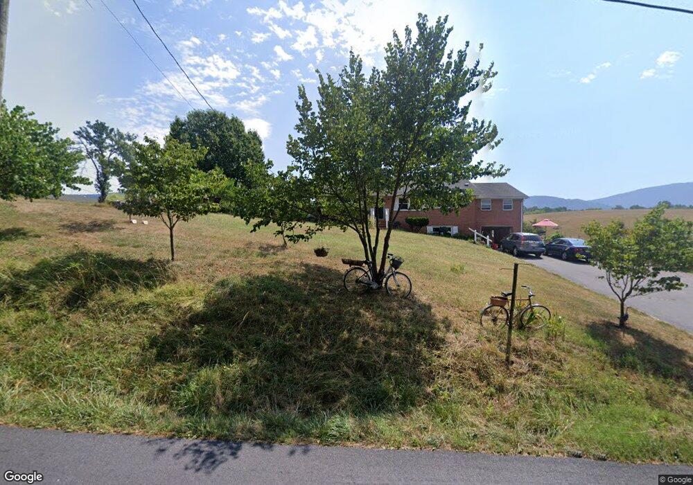
784 Browntown Rd Bentonville, VA 22610
Bentonville NeighborhoodEstimated Value: $390,130 - $470,000
3
Beds
1
Bath
1,672
Sq Ft
$258/Sq Ft
Est. Value
About This Home
This home is located at 784 Browntown Rd, Bentonville, VA 22610 and is currently estimated at $431,283, approximately $257 per square foot. 784 Browntown Rd is a home located in Warren County with nearby schools including Ressie Jeffries Elementary School and Warren County High School.
Ownership History
Date
Name
Owned For
Owner Type
Purchase Details
Closed on
Jun 18, 2019
Sold by
Frame Sandra J
Bought by
Frame Sandra J and Sandra J Frame Rev Tr
Current Estimated Value
Purchase Details
Closed on
May 16, 2016
Sold by
Frame Milton W and Frame Sandra J
Bought by
Frame Sandra J and Frame Milton W
Purchase Details
Closed on
Mar 3, 2009
Sold by
Frame Milton W and Frame Sandra J
Bought by
Frame Milton W and Revoca Sandra
Create a Home Valuation Report for This Property
The Home Valuation Report is an in-depth analysis detailing your home's value as well as a comparison with similar homes in the area
Home Values in the Area
Average Home Value in this Area
Purchase History
| Date | Buyer | Sale Price | Title Company |
|---|---|---|---|
| Frame Sandra J | -- | None Available | |
| Frame Sandra J | -- | None Available | |
| Frame Milton W | -- | -- |
Source: Public Records
Tax History Compared to Growth
Tax History
| Year | Tax Paid | Tax Assessment Tax Assessment Total Assessment is a certain percentage of the fair market value that is determined by local assessors to be the total taxable value of land and additions on the property. | Land | Improvement |
|---|---|---|---|---|
| 2025 | $1,802 | $376,060 | $72,000 | $304,060 |
| 2024 | $1,580 | $298,200 | $79,000 | $219,200 |
| 2023 | $1,461 | $298,200 | $79,000 | $219,200 |
| 2022 | $1,414 | $215,900 | $70,000 | $145,900 |
| 2021 | $1,414 | $215,900 | $70,000 | $145,900 |
| 2020 | $1,414 | $215,900 | $70,000 | $145,900 |
| 2019 | $1,414 | $215,900 | $70,000 | $145,900 |
| 2018 | $1,333 | $202,000 | $65,000 | $137,000 |
| 2017 | $1,313 | $202,000 | $65,000 | $137,000 |
| 2016 | $626 | $202,000 | $65,000 | $137,000 |
| 2015 | -- | $202,000 | $65,000 | $137,000 |
| 2014 | -- | $171,300 | $55,000 | $116,300 |
Source: Public Records
Map
Nearby Homes
- 40 Meadowbrook Ct
- Lot 7 Holiday Ct
- 5865 Gooney Manor Loop
- 0 Gooney Manor Loop Unit VAWR2012426
- 0 Gooney Manor Loop Unit VAWR2011970
- 51 Gooney Manor Loop
- 472 Wesley Ln
- 93 Smedley Ln
- 95 Smedley Ln
- 97 Smedley Ln
- 96 Smedley Ln
- Lot 63B Buck Mountain Rd
- Lot 63C Buck Mountain Rd
- Lot 63 Buck Mountain Rd
- 3.7 ac Buck Mountain Rd
- Lot 9 Buck Mountain Rd
- 1996 Buck Mountain Rd
- 1903 Buck Mountain Rd
- Gooney manor loop Gooney Manor Loop
- 51A Gooney Manor Loop
- 808 Browntown Rd
- 758 Browntown Rd
- 830 Browntown Rd
- 7 Meadowbrook Ct
- 729 Browntown Rd
- 852 Browntown Rd
- 690 Browntown Rd
- 890 Browntown Rd
- 79 Meadowbrook Ct
- 79 Meadowbrook Ct
- 582 Browntown Rd
- 89 Meadowbrook Ct
- 89 Meadowbrook Ct
- 945 Browntown Rd
- 88 Meadowbrook Ct
- 90 Rolling Mountain Rd
- 206 Rolling Mountain Rd
- 987 Browntown Rd
- 482 Browntown Rd
- 277 Rolling Mountain Rd
