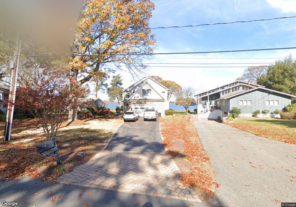
784 Locust Cir Arnold, MD 21012
Estimated Value: $1,903,000 - $2,504,000
6
Beds
4
Baths
3,640
Sq Ft
$597/Sq Ft
Est. Value
About This Home
This home is located at 784 Locust Cir, Arnold, MD 21012 and is currently estimated at $2,172,553, approximately $596 per square foot. 784 Locust Cir is a home located in Anne Arundel County with nearby schools including Broadneck Elementary School, Magothy River Middle School, and Broadneck High School.
Ownership History
Date
Name
Owned For
Owner Type
Purchase Details
Closed on
Apr 1, 2021
Sold by
Maxwell Mark T and Maxwell Nicole F
Bought by
Hull Jason R and Hull Alexandra J
Current Estimated Value
Home Financials for this Owner
Home Financials are based on the most recent Mortgage that was taken out on this home.
Original Mortgage
$1,458,250
Outstanding Balance
$1,316,623
Interest Rate
3%
Mortgage Type
VA
Estimated Equity
$855,930
Purchase Details
Closed on
Apr 23, 1999
Sold by
Klein John M
Bought by
Maxwell Mark T and Maxwell Nicole F
Purchase Details
Closed on
Dec 4, 1995
Sold by
Cumming William R
Bought by
Klein John M
Create a Home Valuation Report for This Property
The Home Valuation Report is an in-depth analysis detailing your home's value as well as a comparison with similar homes in the area
Home Values in the Area
Average Home Value in this Area
Purchase History
| Date | Buyer | Sale Price | Title Company |
|---|---|---|---|
| Hull Jason R | $1,535,625 | Freestate Ttl Svcs Of Annapo | |
| Maxwell Mark T | $470,000 | -- | |
| Klein John M | $305,600 | -- |
Source: Public Records
Mortgage History
| Date | Status | Borrower | Loan Amount |
|---|---|---|---|
| Open | Hull Jason R | $1,458,250 | |
| Closed | Klein John M | -- |
Source: Public Records
Tax History Compared to Growth
Tax History
| Year | Tax Paid | Tax Assessment Tax Assessment Total Assessment is a certain percentage of the fair market value that is determined by local assessors to be the total taxable value of land and additions on the property. | Land | Improvement |
|---|---|---|---|---|
| 2025 | $18,817 | $2,016,067 | -- | -- |
| 2024 | $18,817 | $1,962,300 | $1,394,100 | $568,200 |
| 2023 | $18,268 | $1,823,200 | $0 | $0 |
| 2022 | $17,020 | $1,684,100 | $0 | $0 |
| 2020 | $13,255 | $1,929,533 | $0 | $0 |
| 2019 | $25,017 | $1,923,867 | $0 | $0 |
| 2018 | $19,451 | $1,918,200 | $1,394,100 | $524,100 |
| 2017 | $11,555 | $1,673,067 | $0 | $0 |
| 2016 | -- | $1,427,933 | $0 | $0 |
| 2015 | -- | $1,182,800 | $0 | $0 |
| 2014 | -- | $1,182,800 | $0 | $0 |
Source: Public Records
Map
Nearby Homes
- 920 Burnett Ave
- 1171 Stiarna Ct
- 1182 Palmwood Ct
- 1194 Palmwood Ct
- 539 Greenblades Ct
- 636 Oakland Hills Dr Unit 2A
- 975 Phillips Dr
- 1019 Landon Ln
- 817 Riverside Dr
- 959 Morgan Dr
- 817 Barrett Ave
- 276 Overleaf Dr
- 434 Century Vista Dr
- 1138 Ramblewood Dr
- 509A Edgewater Rd
- 249 Overleaf Dr
- 303 Ternwing Dr
- 923 Whitstable Blvd
- 1165 Green Holly Ct
- 1167 Green Holly Dr