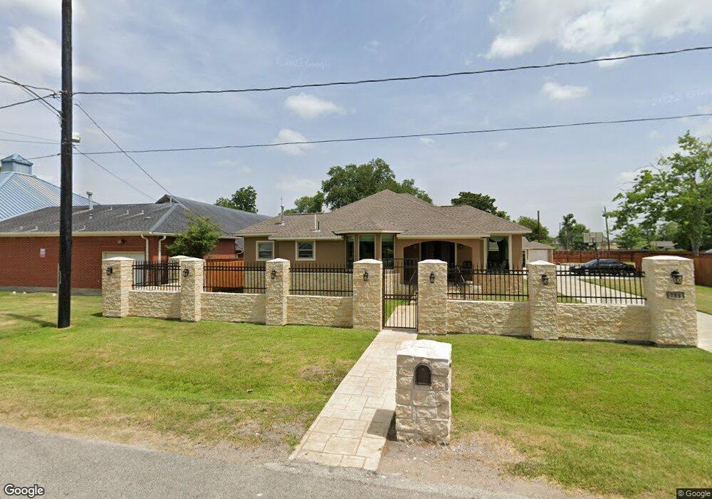
784 Millville Dr Houston, TX 77091
Acres Homes NeighborhoodEstimated Value: $257,000 - $338,000
4
Beds
2
Baths
2,642
Sq Ft
$116/Sq Ft
Est. Value
About This Home
This home is located at 784 Millville Dr, Houston, TX 77091 and is currently estimated at $307,060, approximately $116 per square foot. 784 Millville Dr is a home located in Harris County with nearby schools including Wesley Elementary School, Williams Middle, and Booker T Washington Sr High.
Ownership History
Date
Name
Owned For
Owner Type
Purchase Details
Closed on
Feb 27, 2002
Sold by
Wilson Rosie Brown and Brown James
Bought by
Wilson Calvin W
Current Estimated Value
Home Financials for this Owner
Home Financials are based on the most recent Mortgage that was taken out on this home.
Original Mortgage
$35,700
Interest Rate
6.93%
Mortgage Type
VA
Create a Home Valuation Report for This Property
The Home Valuation Report is an in-depth analysis detailing your home's value as well as a comparison with similar homes in the area
Home Values in the Area
Average Home Value in this Area
Purchase History
| Date | Buyer | Sale Price | Title Company |
|---|---|---|---|
| Wilson Calvin W | -- | Texas American Title Company |
Source: Public Records
Mortgage History
| Date | Status | Borrower | Loan Amount |
|---|---|---|---|
| Closed | Wilson Calvin W | $35,700 |
Source: Public Records
Tax History Compared to Growth
Tax History
| Year | Tax Paid | Tax Assessment Tax Assessment Total Assessment is a certain percentage of the fair market value that is determined by local assessors to be the total taxable value of land and additions on the property. | Land | Improvement |
|---|---|---|---|---|
| 2025 | $1,911 | $378,121 | $73,593 | $304,528 |
| 2024 | $1,911 | $294,219 | $73,593 | $220,626 |
| 2023 | $1,911 | $259,204 | $52,091 | $207,113 |
| 2022 | $2,625 | $269,112 | $40,656 | $228,456 |
| 2021 | $1,687 | $124,651 | $26,681 | $97,970 |
| 2020 | $1,593 | $119,128 | $22,869 | $96,259 |
| 2019 | $1,166 | $102,825 | $20,328 | $82,497 |
| 2018 | $550 | $56,926 | $7,623 | $49,303 |
| 2017 | $963 | $56,926 | $7,623 | $49,303 |
| 2016 | $876 | $56,926 | $7,623 | $49,303 |
| 2015 | $469 | $31,487 | $5,082 | $26,405 |
| 2014 | $469 | $31,487 | $5,082 | $26,405 |
Source: Public Records
Map
Nearby Homes
- 748 Millville Dr
- 855 W Little York Rd
- 740 Millville Dr
- 775 Rittenhouse St
- 7014 De Priest St
- 834 Green Meadow Ln
- 814 Granville Dr
- 741 Granville Dr
- 6220 De Priest St
- 862 Granville Dr
- 747 W Rittenhouse Rd
- 859 W Rittenhouse St
- 899 W Little York Rd
- 872 Granville Dr
- 715 W Rittenhouse Rd
- 893 Wall St
- 924 W Little York Rd
- 824 W Rittenhouse St
- 922 W Little York Rd
- 786 Lucky St
- 775 Green Meadow Ln
- 776 Millville Dr
- 783 Millville Dr
- 767 Green Meadow Ln
- 793 Millville Dr
- 779 Millville Dr
- 787 Millville Dr
- 791 Millville Dr
- 775 Millville Dr
- 782 Green Meadow Ln
- 764 Green Meadow Ln
- 790 Green Meadow
- 790 Green Meadow Ln
- 7312 Andy Dr
- 794 Green Meadow Ln
- 7210 Depriest
- 771 Millville Dr Unit 1
- 813 Millville St
- 7318 Andy Dr
- 7116 De Priest St