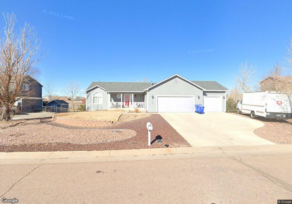
7842 Fort Smith Rd Peyton, CO 80831
Falcon NeighborhoodEstimated Value: $497,064 - $542,000
6
Beds
3
Baths
1,592
Sq Ft
$329/Sq Ft
Est. Value
About This Home
This home is located at 7842 Fort Smith Rd, Peyton, CO 80831 and is currently estimated at $524,016, approximately $329 per square foot. 7842 Fort Smith Rd is a home located in El Paso County with nearby schools including Woodmen Hills Elementary School, Falcon Middle School, and Falcon High School.
Ownership History
Date
Name
Owned For
Owner Type
Purchase Details
Closed on
Nov 2, 2001
Sold by
Trail Ridge Homes Inc
Bought by
Ozick Robert C and Ozick Nancy E
Current Estimated Value
Home Financials for this Owner
Home Financials are based on the most recent Mortgage that was taken out on this home.
Original Mortgage
$161,535
Outstanding Balance
$63,089
Interest Rate
6.71%
Estimated Equity
$460,927
Create a Home Valuation Report for This Property
The Home Valuation Report is an in-depth analysis detailing your home's value as well as a comparison with similar homes in the area
Home Values in the Area
Average Home Value in this Area
Purchase History
| Date | Buyer | Sale Price | Title Company |
|---|---|---|---|
| Ozick Robert C | $201,922 | Land Title |
Source: Public Records
Mortgage History
| Date | Status | Borrower | Loan Amount |
|---|---|---|---|
| Open | Ozick Robert C | $161,535 |
Source: Public Records
Tax History Compared to Growth
Tax History
| Year | Tax Paid | Tax Assessment Tax Assessment Total Assessment is a certain percentage of the fair market value that is determined by local assessors to be the total taxable value of land and additions on the property. | Land | Improvement |
|---|---|---|---|---|
| 2025 | $2,308 | $35,670 | -- | -- |
| 2024 | $1,718 | $36,230 | $7,200 | $29,030 |
| 2023 | $1,718 | $36,230 | $7,200 | $29,030 |
| 2022 | $1,271 | $25,250 | $5,910 | $19,340 |
| 2021 | $1,321 | $25,970 | $6,080 | $19,890 |
| 2020 | $1,099 | $22,740 | $5,510 | $17,230 |
| 2019 | $1,089 | $22,740 | $5,510 | $17,230 |
| 2018 | $1,301 | $18,310 | $5,040 | $13,270 |
| 2017 | $1,192 | $18,310 | $5,040 | $13,270 |
| 2016 | $1,170 | $17,730 | $5,570 | $12,160 |
| 2015 | $1,171 | $17,730 | $5,570 | $12,160 |
| 2014 | $1,085 | $16,120 | $4,780 | $11,340 |
Source: Public Records
Map
Nearby Homes
- 7524 Stephenville Rd
- 7715 Old Spec Rd
- 8072 Oliver Rd
- 8119 Oliver Rd
- 7679 Bierstadt Heights
- 7682 Capel Point
- The Plum Creek Plan at Rolling Hills Ranch - Designer Series
- The Kirkland Plan at Rolling Hills Ranch - Signature Series
- The Raintree Plan at Rolling Hills Ranch - Designer Series
- The Whitman Plan at Rolling Hills Ranch - Signature Series
- The Thoreau Plan at Rolling Hills Ranch - Signature Series
- The Newton Plan at Rolling Hills Ranch - Signature Series
- The Edison Plan at Rolling Hills Ranch - Signature Series
- The Montarbor Plan at Rolling Hills Ranch - Designer Series
- The Monarch Plan at Rolling Hills Ranch - Designer Series
- The Hemingway Plan at Rolling Hills Ranch - Signature Series
- The Emerson Plan at Rolling Hills Ranch - Signature Series
- The Carnegie Plan at Rolling Hills Ranch - Signature Series
- The Pebble Beach Plan at Rolling Hills Ranch - Designer Series
- The Ridgewood Plan at Rolling Hills Ranch - Designer Series
- 7856 Fort Smith Rd
- 7828 Fort Smith Rd
- 7831 Buschborn Rd
- 7884 Fort Smith Rd
- 7847 Buschborn Rd
- 7814 Fort Smith Rd
- 7855 Fort Smith Rd
- 7813 Fort Smith Rd
- 7869 Fort Smith Rd
- 7815 Buschborn Rd
- 7898 Fort Smith Rd
- 7827 Fort Smith Rd
- 7883 Fort Smith Rd
- 7879 Buschborn Rd
- 7816 Buschborn Rd
- 7912 Fort Smith Rd
- 7897 Fort Smith Rd
- 7895 Buschborn Rd
- 7848 Buschborn Rd
- 7864 Buschborn Rd