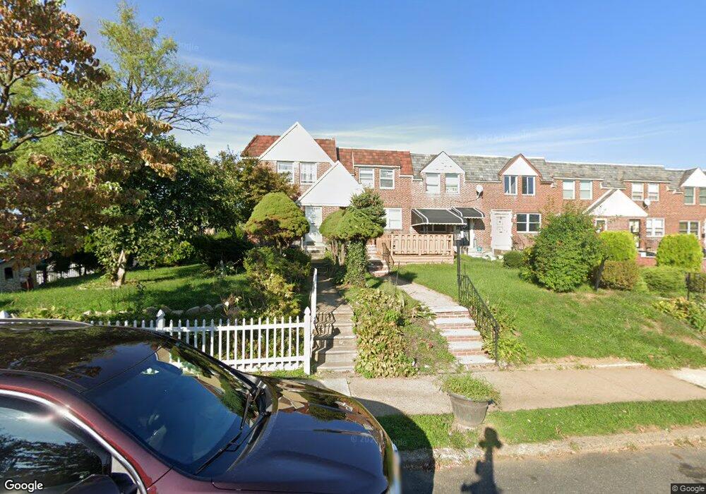
7845 Forrest Ave Philadelphia, PA 19150
West Oak Lane NeighborhoodEstimated Value: $221,000 - $276,000
3
Beds
1
Bath
1,088
Sq Ft
$221/Sq Ft
Est. Value
About This Home
This home is located at 7845 Forrest Ave, Philadelphia, PA 19150 and is currently estimated at $240,195, approximately $220 per square foot. 7845 Forrest Ave is a home located in Philadelphia County with nearby schools including Franklin S Edmonds School, Martin Luther King High School, and St. Raymond Of Penafort Catholic School.
Ownership History
Date
Name
Owned For
Owner Type
Purchase Details
Closed on
Dec 2, 2005
Sold by
Lamb Ronald E
Bought by
Lamb Ronald E and Lamb Stephanie
Current Estimated Value
Home Financials for this Owner
Home Financials are based on the most recent Mortgage that was taken out on this home.
Original Mortgage
$110,500
Interest Rate
6.33%
Mortgage Type
Fannie Mae Freddie Mac
Purchase Details
Closed on
Nov 7, 1997
Sold by
Lamb Ronald E and Lamb Robin A
Bought by
Lamb Ronald E
Create a Home Valuation Report for This Property
The Home Valuation Report is an in-depth analysis detailing your home's value as well as a comparison with similar homes in the area
Home Values in the Area
Average Home Value in this Area
Purchase History
| Date | Buyer | Sale Price | Title Company |
|---|---|---|---|
| Lamb Ronald E | -- | None Available | |
| Lamb Ronald E | -- | -- |
Source: Public Records
Mortgage History
| Date | Status | Borrower | Loan Amount |
|---|---|---|---|
| Closed | Lamb Ronald E | $110,500 |
Source: Public Records
Tax History Compared to Growth
Tax History
| Year | Tax Paid | Tax Assessment Tax Assessment Total Assessment is a certain percentage of the fair market value that is determined by local assessors to be the total taxable value of land and additions on the property. | Land | Improvement |
|---|---|---|---|---|
| 2025 | $2,618 | $232,100 | $46,420 | $185,680 |
| 2024 | $2,618 | $232,100 | $46,420 | $185,680 |
| 2023 | $2,618 | $187,000 | $37,400 | $149,600 |
| 2022 | $1,988 | $142,000 | $37,400 | $104,600 |
| 2021 | $1,886 | $0 | $0 | $0 |
| 2020 | $1,886 | $0 | $0 | $0 |
| 2019 | $1,968 | $0 | $0 | $0 |
| 2018 | $1,978 | $0 | $0 | $0 |
| 2017 | $1,978 | $0 | $0 | $0 |
| 2016 | $1,558 | $0 | $0 | $0 |
| 2015 | $1,491 | $0 | $0 | $0 |
| 2014 | -- | $141,300 | $16,814 | $124,486 |
| 2012 | -- | $16,352 | $2,506 | $13,846 |
Source: Public Records
Map
Nearby Homes
- 7837 Williams Ave
- 7824 Fayette St
- 7724 Fayette St
- 7968 Fayette St
- 7734 Temple Rd
- 7732 Temple Rd
- 7703 Gilbert St
- 7729 Temple Rd
- 7723 Temple Rd
- 7640 Williams Ave
- 7919 Michener Ave
- 7638 Thouron Ave
- 7643 Gilbert St
- 7638 Fayette St
- 1300 E Gorgas Ln
- 1167 E Dorset St
- 8042 Fayette St
- 8016 Michener Ave
- 1148 E Slocum St
- 7617 Woolston Ave
- 7843 Forrest Ave
- 7847 Forrest Ave
- 7841 Forrest Ave
- 7839 Forrest Ave
- 7837 Forrest Ave
- 7835 Forrest Ave
- 7833 Forrest Ave
- 7831 Forrest Ave
- 7844 Williams Ave
- 7842 Williams Ave
- 7846 Williams Ave
- 7840 Williams Ave
- 7829 Forrest Ave
- 7838 Williams Ave
- 7836 Williams Ave
- 7834 Williams Ave
- 7827 Forrest Ave
- 7832 Williams Ave
- 7825 Forrest Ave
- 7830 Williams Ave