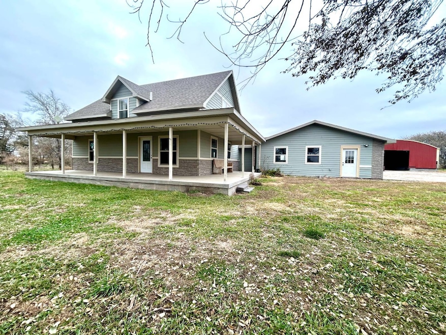
7845 S Pawnee Ave Glenvil, NE 68941
Estimated payment $2,440/month
Highlights
- Views of a Farm
- Main Floor Primary Bedroom
- Covered Patio or Porch
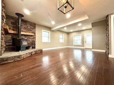
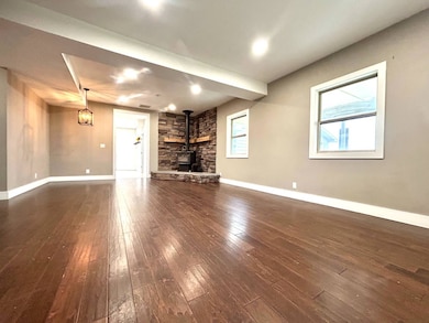
- Wood Flooring
- Farmhouse Style Home
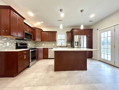
- Stainless Steel Appliances
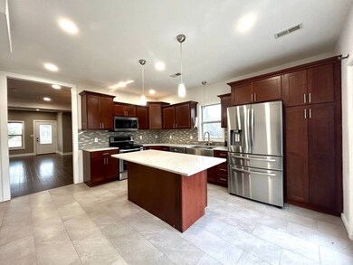
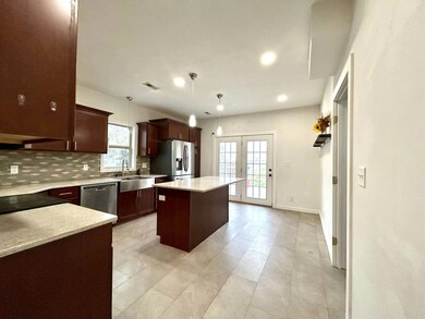
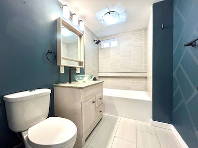
About This Home
Here's your opportunity to live on an acreage in the Adams Central School District! This 3.5+ acre property is situated within 10 minutes of Hastings and just 1.5 miles off the Assumption blacktop creating incredible ease of access coupled with desirable seclusion. The property features a beautifully updated 3 bed, 3 bath home with a spacious kitchen and attached 3 car garage, and the ever-coveted wrap-around porch. Each of the bathrooms have been fully remodeled with high-end finishes, and there can be an allowance given for new carpeting. This property also features a 40'x100' unfinished quonset, and the sellers are willing to negotiate an allowance to assist with its finish. Properties like this are very hard to come by, so call today to schedule your private walkthrough.
Open House Schedule
-
Sunday, November 23, 20252:00 to 3:30 pm11/23/2025 2:00:00 PM +00:0011/23/2025 3:30:00 PM +00:00Add to Calendar
Home Details
Home Type
- Single Family
Est. Annual Taxes
- $2,710
Lot Details
- 3.53 Acre Lot
Parking
- 3 Car Attached Garage
Home Design
- Farmhouse Style Home
- Frame Construction
- Asphalt Roof
- Vinyl Siding
Interior Spaces
- 2,140 Sq Ft Home
- 2-Story Property
- Entrance Foyer
- Living Room
- Views of a Farm
- Crawl Space
Kitchen
- Eat-In Kitchen
- Oven
- Stainless Steel Appliances
- Disposal
Flooring
- Wood
- Carpet
Bedrooms and Bathrooms
- 3 Bedrooms
- Primary Bedroom on Main
- En-Suite Primary Bedroom
- Walk-In Closet
- 3 Full Bathrooms
Laundry
- Laundry Room
- Dryer
Outdoor Features
- Covered Patio or Porch
- Outbuilding
Utilities
- Forced Air Zoned Heating and Cooling System
- Water Heater
- Septic Tank
Map
Home Values in the Area
Average Home Value in this Area
Tax History
| Year | Tax Paid | Tax Assessment Tax Assessment Total Assessment is a certain percentage of the fair market value that is determined by local assessors to be the total taxable value of land and additions on the property. | Land | Improvement |
|---|---|---|---|---|
| 2024 | $2,710 | $324,807 | $42,560 | $282,247 |
| 2023 | $3,291 | $281,420 | $42,560 | $238,860 |
| 2022 | $3,009 | $238,223 | $42,560 | $195,663 |
| 2021 | $1,420 | $120,094 | $42,560 | $77,534 |
| 2020 | $1,327 | $116,143 | $42,560 | $73,583 |
| 2019 | $1,263 | $114,000 | $42,560 | $71,440 |
| 2018 | $1,132 | $100,000 | $28,560 | $71,440 |
| 2017 | $931 | $168,220 | $0 | $0 |
| 2016 | $889 | $84,030 | $28,560 | $55,470 |
| 2010 | $1,015 | $67,385 | $20,770 | $46,615 |
Property History
| Date | Event | Price | List to Sale | Price per Sq Ft |
|---|---|---|---|---|
| 11/18/2025 11/18/25 | For Sale | $420,000 | -- | $196 / Sq Ft |
Purchase History
| Date | Type | Sale Price | Title Company |
|---|---|---|---|
| Warranty Deed | $300,000 | Prairie Title | |
| Warranty Deed | $100,000 | -- |
Mortgage History
| Date | Status | Loan Amount | Loan Type |
|---|---|---|---|
| Open | $285,000 | Purchase Money Mortgage | |
| Previous Owner | $100,000 | Reverse Mortgage Home Equity Conversion Mortgage |
Source: My State MLS
MLS Number: 11608262
APN: 152-00702.00
- 608 1st St
- 12235 S Antioch Ave
- 1820 S Wabash Ave
- 1312 S Wabash Ave
- 6165 E South St
- Lot S California
- 1410 E South St
- 1002 S Lincoln Ave
- Fairfield Unit Nebraska
- 402 S Delaware Ave
- 719 S Kansas Ave
- 1142 W H St
- 1140 Renae Ln
- 200 E A St
- 747 E 2nd St
- 12 Avalon Ln
- 115 E A St
- 907 E 3rd St
- 720 W D St
- 418 E 2nd St
