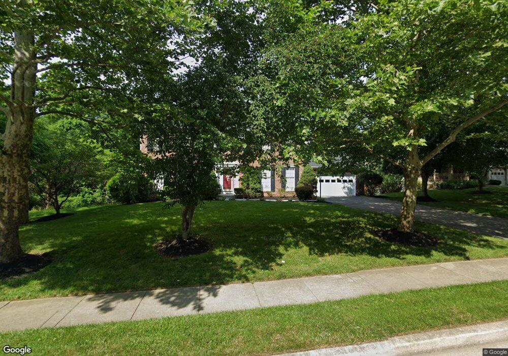
7846 Rockburn Dr Ellicott City, MD 21043
Estimated Value: $724,553 - $890,000
--
Bed
3
Baths
2,420
Sq Ft
$338/Sq Ft
Est. Value
About This Home
This home is located at 7846 Rockburn Dr, Ellicott City, MD 21043 and is currently estimated at $817,388, approximately $337 per square foot. 7846 Rockburn Dr is a home located in Howard County with nearby schools including Rockburn Elementary School, Long Reach High School, and Trinity School.
Ownership History
Date
Name
Owned For
Owner Type
Purchase Details
Closed on
Jul 17, 1990
Sold by
Ryland Group Inc The
Bought by
Davis Garland Kevin and Davis Catherine Twahanna
Current Estimated Value
Home Financials for this Owner
Home Financials are based on the most recent Mortgage that was taken out on this home.
Original Mortgage
$214,950
Interest Rate
10.11%
Purchase Details
Closed on
Oct 18, 1989
Sold by
Rockburn Township
Bought by
Ryland Group Inc The
Purchase Details
Closed on
Sep 7, 1988
Sold by
Danville I Associates
Bought by
Rockburn Township
Home Financials for this Owner
Home Financials are based on the most recent Mortgage that was taken out on this home.
Original Mortgage
$5,700,000
Interest Rate
10.65%
Create a Home Valuation Report for This Property
The Home Valuation Report is an in-depth analysis detailing your home's value as well as a comparison with similar homes in the area
Home Values in the Area
Average Home Value in this Area
Purchase History
| Date | Buyer | Sale Price | Title Company |
|---|---|---|---|
| Davis Garland Kevin | $238,900 | -- | |
| Ryland Group Inc The | $849,800 | -- | |
| Rockburn Township | $1,960,000 | -- |
Source: Public Records
Mortgage History
| Date | Status | Borrower | Loan Amount |
|---|---|---|---|
| Closed | Davis Garland Kevin | $214,950 | |
| Previous Owner | Rockburn Township | $5,700,000 |
Source: Public Records
Tax History Compared to Growth
Tax History
| Year | Tax Paid | Tax Assessment Tax Assessment Total Assessment is a certain percentage of the fair market value that is determined by local assessors to be the total taxable value of land and additions on the property. | Land | Improvement |
|---|---|---|---|---|
| 2025 | $8,606 | $608,733 | $0 | $0 |
| 2024 | $8,606 | $568,267 | $0 | $0 |
| 2023 | $8,039 | $527,800 | $202,500 | $325,300 |
| 2022 | $7,731 | $509,167 | $0 | $0 |
| 2021 | $7,346 | $490,533 | $0 | $0 |
| 2020 | $7,346 | $471,900 | $202,000 | $269,900 |
| 2019 | $7,458 | $469,233 | $0 | $0 |
| 2018 | $7,063 | $466,567 | $0 | $0 |
| 2017 | $7,003 | $463,900 | $0 | $0 |
| 2016 | -- | $452,067 | $0 | $0 |
| 2015 | -- | $440,233 | $0 | $0 |
| 2014 | -- | $428,400 | $0 | $0 |
Source: Public Records
Map
Nearby Homes
- 7718 Briarstone Ct
- 7712 Sandstone Ct
- 5908 Clear Ridge Rd
- 5317 Tims Ct
- 5816 Rockburn Woods Way
- 5983 Glen Willow Way
- 6021 Charles Crossing
- 5905-2 Logans Way Unit 2
- 6022 Maple Hill Rd
- 5948 Logans Way
- 5812 Lois Ln
- 5810 Lois Ln
- 6641 Cambria Terrace
- 5803 Lois Ln
- 5213 Talbots Landing
- 6210 Hunters Hollow Rd
- 8301 Elko Dr
- 6051 Talbot Dr
- 8106 Wooded Glen Ct
- 8378 Montgomery Run Rd Unit D
- 7842 Rockburn Dr
- 7838 Rockburn Dr
- 7803 Fieldstone Ct
- 7854 Rockburn Dr
- 7849 Rockburn Dr
- 7834 Rockburn Dr
- 7858 Rockburn Dr
- 7807 Fieldstone Ct
- 7806 Fieldstone Ct
- 7830 Rockburn Dr
- 7839 Rockburn Dr
- 7800 Flagstone Ct
- 7811 Fieldstone Ct
- 7810 Fieldstone Ct
- 7862 Rockburn Dr
- 7826 Rockburn Dr
- 7814 Fieldstone Ct
- 5466 Autumn Field Ct
- 7804 Flagstone Ct
- 5470 Autumn Field Ct