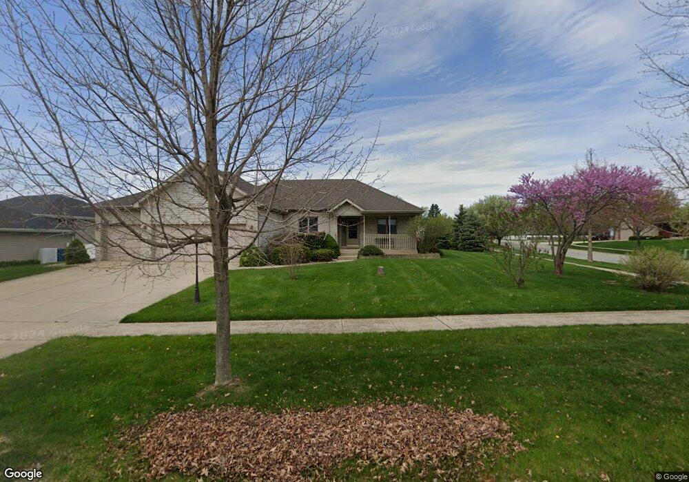
7848 W 92nd Ct Crown Point, IN 46307
Saint John NeighborhoodEstimated Value: $357,000 - $459,000
3
Beds
3
Baths
2,150
Sq Ft
$194/Sq Ft
Est. Value
About This Home
This home is located at 7848 W 92nd Ct, Crown Point, IN 46307 and is currently estimated at $417,383, approximately $194 per square foot. 7848 W 92nd Ct is a home located in Lake County with nearby schools including Kolling Elementary School, Hal E Clark Middle School, and Lake Central High School.
Ownership History
Date
Name
Owned For
Owner Type
Purchase Details
Closed on
Nov 12, 2009
Sold by
Pluard David J and Pluard Vicki L
Bought by
Bennett Andrew M and Bennett Sarah R
Current Estimated Value
Home Financials for this Owner
Home Financials are based on the most recent Mortgage that was taken out on this home.
Original Mortgage
$192,500
Outstanding Balance
$125,051
Interest Rate
4.9%
Mortgage Type
New Conventional
Estimated Equity
$292,332
Create a Home Valuation Report for This Property
The Home Valuation Report is an in-depth analysis detailing your home's value as well as a comparison with similar homes in the area
Home Values in the Area
Average Home Value in this Area
Purchase History
| Date | Buyer | Sale Price | Title Company |
|---|---|---|---|
| Bennett Andrew M | -- | Ticor Title Insurance |
Source: Public Records
Mortgage History
| Date | Status | Borrower | Loan Amount |
|---|---|---|---|
| Open | Bennett Andrew M | $192,500 |
Source: Public Records
Tax History Compared to Growth
Tax History
| Year | Tax Paid | Tax Assessment Tax Assessment Total Assessment is a certain percentage of the fair market value that is determined by local assessors to be the total taxable value of land and additions on the property. | Land | Improvement |
|---|---|---|---|---|
| 2024 | $7,138 | $369,200 | $91,000 | $278,200 |
| 2023 | $3,207 | $353,000 | $91,000 | $262,000 |
| 2022 | $3,337 | $328,800 | $91,000 | $237,800 |
| 2021 | $3,104 | $314,100 | $91,000 | $223,100 |
| 2020 | $3,024 | $300,900 | $62,300 | $238,600 |
| 2019 | $2,874 | $268,800 | $62,300 | $206,500 |
| 2018 | $2,959 | $268,000 | $62,300 | $205,700 |
| 2017 | $2,695 | $255,800 | $62,300 | $193,500 |
| 2016 | $2,396 | $234,200 | $62,300 | $171,900 |
| 2014 | $2,284 | $234,400 | $62,300 | $172,100 |
| 2013 | $2,390 | $239,300 | $62,300 | $177,000 |
Source: Public Records
Map
Nearby Homes
- The Torbet Plan at Walden Clearing - Manors at Walden Clearing
- Dune Plan at Walden Clearing - Manors at Walden Clearing
- The Harper Plan at Walden Clearing - Manors at Walden Clearing
- The Princeton Plan at Walden Clearing - Manors at Walden Clearing
- Harrison Plan at Walden Clearing - Manors at Walden Clearing
- The Powell II Plan at Walden Clearing - Manors at Walden Clearing
- The Augusta Plan at Walden Clearing - Manors at Walden Clearing
- Clifty Plan at Walden Clearing - Manors at Walden Clearing
- Martin Plan at Walden Clearing - Manors at Walden Clearing
- The Bennett Plan at Walden Clearing - Manors at Walden Clearing
- The Elbert Plan at Walden Clearing - Manors at Walden Clearing
- The Rainier Plan at Walden Clearing - Manors at Walden Clearing
- The Huxley Plan at Walden Clearing - Manors at Walden Clearing
- 8312 Wyman Dr
- 6640 W 89th Ave
- 6915 W 93rd Ave
- 8950 Marquette St
- 8903 Edison St
- 7605 W 86th Ave
- 9270 W 93rd Ave
- 7910 W 92nd Ct
- 9216 Lee Place
- 7859 W 92nd Ave
- 7839 W 92nd Ave
- 7926 W 92nd Ct
- 7919 W 92nd Ave
- 7829 W 92nd Ct
- 7817 W 92nd Ct
- 7940 W 92nd Ct
- 7953 W 92nd Ave
- 9215 Lee Place
- 9203 Lee Place
- 7943 W 92nd Ct
- 9149 Lee Place
- 9149 Lee Place
- 7850 W 92nd Ave
- 7730 W 92nd Ln
- 7910 W 92nd Ave
- 7715 W 92nd Ln
- 9141 Lee Place