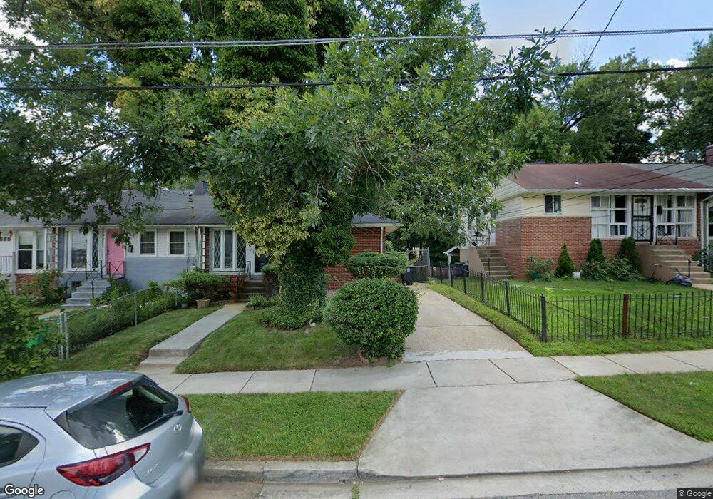
7849 Burnside Rd Hyattsville, MD 20785
Greater Landover NeighborhoodEstimated Value: $232,000 - $301,000
Studio
2
Baths
884
Sq Ft
$298/Sq Ft
Est. Value
About This Home
This home is located at 7849 Burnside Rd, Hyattsville, MD 20785 and is currently estimated at $263,584, approximately $298 per square foot. 7849 Burnside Rd is a home located in Prince George's County with nearby schools including William Paca Elementary School, Kenmoor Middle School, and Charles Herbert Flowers High School.
Ownership History
Date
Name
Owned For
Owner Type
Purchase Details
Closed on
Dec 21, 2007
Sold by
Brooks&Bey Living Trust
Bought by
Brooks,Michell Brook and Brooks,Michell D
Current Estimated Value
Home Financials for this Owner
Home Financials are based on the most recent Mortgage that was taken out on this home.
Original Mortgage
$155,000
Outstanding Balance
$98,109
Interest Rate
6.3%
Mortgage Type
Stand Alone Refi Refinance Of Original Loan
Estimated Equity
$165,475
Purchase Details
Closed on
Nov 30, 2007
Sold by
Brooks&Bey Living Trust
Bought by
Brooks,Michell Brook and Brooks,Michell D
Home Financials for this Owner
Home Financials are based on the most recent Mortgage that was taken out on this home.
Original Mortgage
$155,000
Outstanding Balance
$98,109
Interest Rate
6.3%
Mortgage Type
Stand Alone Refi Refinance Of Original Loan
Estimated Equity
$165,475
Create a Home Valuation Report for This Property
The Home Valuation Report is an in-depth analysis detailing your home's value as well as a comparison with similar homes in the area
Home Values in the Area
Average Home Value in this Area
Purchase History
| Date | Buyer | Sale Price | Title Company |
|---|---|---|---|
| Brooks,Michell Brook | -- | -- | |
| Brooks,Michell Brook | -- | -- |
Source: Public Records
Mortgage History
| Date | Status | Borrower | Loan Amount |
|---|---|---|---|
| Open | Brooks,Michell Brook | $155,000 | |
| Closed | Brooks,Michell Brook | $155,000 |
Source: Public Records
Tax History
| Year | Tax Paid | Tax Assessment Tax Assessment Total Assessment is a certain percentage of the fair market value that is determined by local assessors to be the total taxable value of land and additions on the property. | Land | Improvement |
|---|---|---|---|---|
| 2025 | $3,579 | $223,233 | -- | -- |
| 2024 | $3,579 | $214,567 | -- | -- |
| 2023 | $3,449 | $205,900 | $45,000 | $160,900 |
| 2022 | $3,228 | $191,033 | $0 | $0 |
| 2021 | $3,007 | $176,167 | $0 | $0 |
| 2020 | $2,786 | $161,300 | $45,000 | $116,300 |
| 2019 | $2,689 | $154,733 | $0 | $0 |
| 2018 | $2,591 | $148,167 | $0 | $0 |
| 2017 | $2,494 | $141,600 | $0 | $0 |
| 2016 | -- | $134,233 | $0 | $0 |
| 2015 | $1,978 | $126,867 | $0 | $0 |
| 2014 | $1,978 | $119,500 | $0 | $0 |
Source: Public Records
Map
Nearby Homes
- 7818 Allendale Dr
- 8001 Barlowe Rd
- 8120 Allendale Dr
- 7708 Bender Rd
- 8110 Sheriff Rd
- 7905 Greenleaf Rd
- 7630 Allendale Dr
- 7617 Allendale Cir
- 7700 Greenleaf Rd
- 7513 Allendale Dr
- 7509 Allendale Dr
- 2308 Tuemmler Ave
- 7721 Penbrook Place
- 1827 Dutch Village Dr Unit K-350
- 1765 Dutch Village Dr Unit L-326
- 7717 Oxman Rd
- 7624 Oxman Rd
- 1909 Dutch Village Dr Unit I-234
- 1931 Dutch Village Dr Unit I-245
- 1925 Dutch Village Dr Unit I-242
- 7851 Burnside Rd
- 7847 Burnside Rd
- 7853 Burnside Rd
- 7845 Burnside Rd
- 7843 Burnside Rd
- 7855 Burnside Rd
- 7841 Burnside Rd
- 7839 Burnside Rd
- 7859 Burnside Rd
- 7837 Burnside Rd
- 7848 Burnside Rd
- 7852 Burnside Rd
- 7846 Burnside Rd
- 7854 Burnside Rd
- 7844 Burnside Rd
- 7861 Burnside Rd
- 7858 Burnside Rd
- 7835 Burnside Rd
- 7863 Burnside Rd
- 7840 Burnside Rd
Your Personal Tour Guide
Ask me questions while you tour the home.