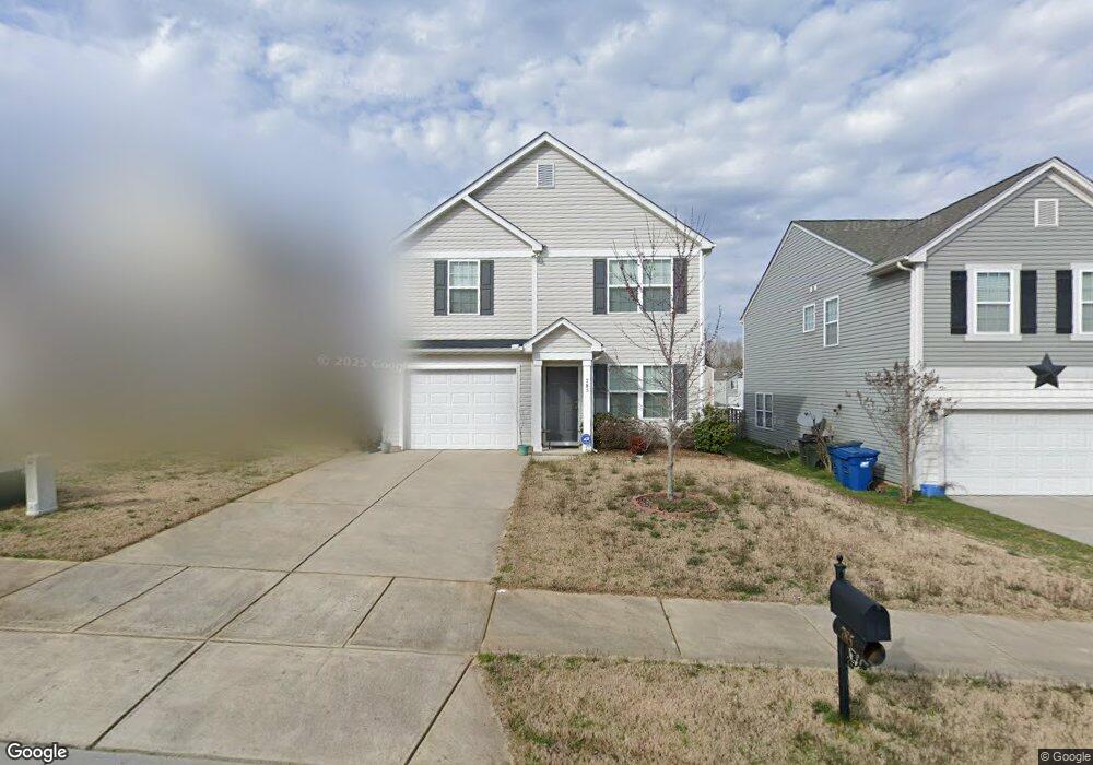
785 Bartram Ave Concord, NC 28025
Estimated Value: $260,000 - $317,000
3
Beds
3
Baths
1,564
Sq Ft
$187/Sq Ft
Est. Value
About This Home
This home is located at 785 Bartram Ave, Concord, NC 28025 and is currently estimated at $291,783, approximately $186 per square foot. 785 Bartram Ave is a home located in Cabarrus County with nearby schools including Rocky River Elementary School, C.C. Griffin Middle School, and Central Cabarrus High School.
Ownership History
Date
Name
Owned For
Owner Type
Purchase Details
Closed on
May 29, 2013
Sold by
Regent Homes Inc
Bought by
Clarke Beverly
Current Estimated Value
Home Financials for this Owner
Home Financials are based on the most recent Mortgage that was taken out on this home.
Original Mortgage
$113,773
Outstanding Balance
$80,060
Interest Rate
3.25%
Mortgage Type
FHA
Estimated Equity
$211,723
Purchase Details
Closed on
Dec 29, 2011
Sold by
Morrison Creek Llc
Bought by
Nw Southeast Holdings Llc
Create a Home Valuation Report for This Property
The Home Valuation Report is an in-depth analysis detailing your home's value as well as a comparison with similar homes in the area
Home Values in the Area
Average Home Value in this Area
Purchase History
| Date | Buyer | Sale Price | Title Company |
|---|---|---|---|
| Clarke Beverly | $118,000 | None Available | |
| Nw Southeast Holdings Llc | $480,000 | None Available |
Source: Public Records
Mortgage History
| Date | Status | Borrower | Loan Amount |
|---|---|---|---|
| Open | Clarke Beverly | $113,773 |
Source: Public Records
Tax History
| Year | Tax Paid | Tax Assessment Tax Assessment Total Assessment is a certain percentage of the fair market value that is determined by local assessors to be the total taxable value of land and additions on the property. | Land | Improvement |
|---|---|---|---|---|
| 2025 | $2,837 | $284,800 | $70,000 | $214,800 |
| 2024 | $2,837 | $284,800 | $70,000 | $214,800 |
| 2023 | $2,317 | $189,890 | $45,000 | $144,890 |
| 2022 | $2,317 | $189,890 | $45,000 | $144,890 |
| 2021 | $2,317 | $189,890 | $45,000 | $144,890 |
| 2020 | $2,317 | $189,890 | $45,000 | $144,890 |
| 2019 | $1,567 | $128,440 | $20,000 | $108,440 |
| 2018 | $1,541 | $128,440 | $20,000 | $108,440 |
| 2017 | $1,516 | $128,440 | $20,000 | $108,440 |
| 2016 | $899 | $113,020 | $20,000 | $93,020 |
| 2015 | $236 | $113,020 | $20,000 | $93,020 |
| 2014 | $236 | $113,020 | $20,000 | $93,020 |
Source: Public Records
Map
Nearby Homes
- 741 Nannyberry Ln
- 4003 Long Arrow Dr Unit 366
- 4018 Bethesda Place
- 608 Nannyberry Ln
- 1039 Manston Place SW
- 303 Olde North Church Dr Unit 38
- 1308 Roseberry Place SW
- 4194 Clifftonville Ave SW
- 685 Continental Dr
- 836 Chastain Ave
- 3560 Us Highway 601 S
- 3044 Parade Ln SW
- 1009 Braxton Dr
- 847 Kathryn Dr SE
- 3168 Sossamon Place
- 3560-C U S 601
- 1234 Piney Church Rd
- 4227 Kiser Woods Dr SW
- 3043 Talledaga Ln SW
- 518 Viking Place SW
- 789 Bartram Ave
- 781 Bartram Ave
- 793 Bartram Ave
- 777 Bartram Ave
- 776 Nannyberry Ln
- 780 Nannyberry Ln
- 773 Bartram Ave
- 772 Nannyberry Ln
- 784 Nannyberry Ln
- 780 Bartram Ave
- 768 Nannyberry Ln
- 776 Bartram Ave
- 784 Bartram Ave
- 772 Bartram Ave
- 769 Bartram Ave
- 764 Nannyberry Ln
- 788 Nannyberry Ln
- 786 Bartram Ave
- 768 Bartram Ave
- 760 Nannyberry Ln
Your Personal Tour Guide
Ask me questions while you tour the home.