Estimated Value: $182,000 - $195,396
3
Beds
1
Bath
1,191
Sq Ft
$160/Sq Ft
Est. Value
About This Home
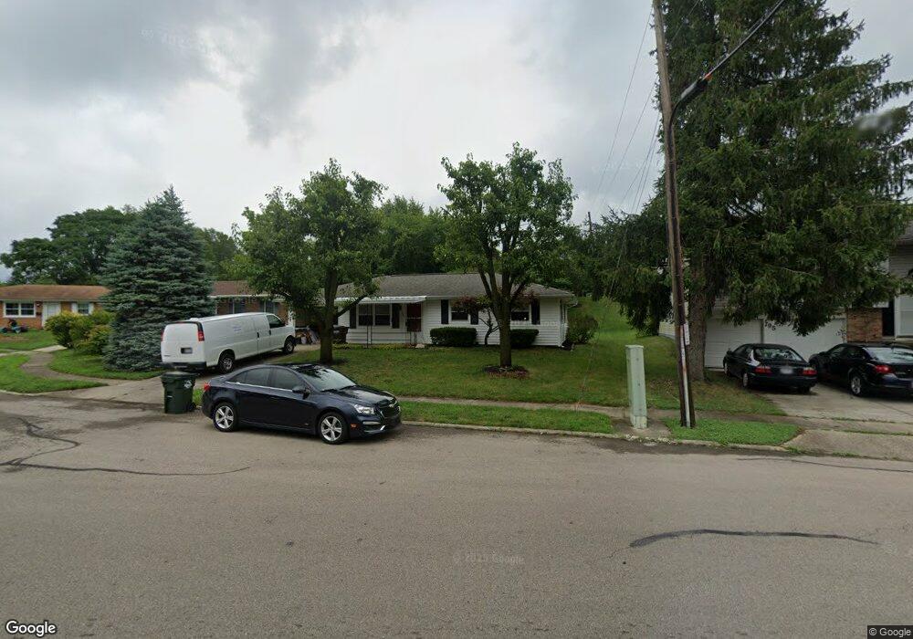
This home is located at 785 Buckskin Trail, Xenia, OH 45385 and is currently estimated at $190,599, approximately $160 per square foot. 785 Buckskin Trail is a home located in Greene County with nearby schools including Xenia High School, Summit Academy Community School for Alternative Learners - Xenia, and Legacy Christian Academy.
Ownership History
Date
Name
Owned For
Owner Type
Purchase Details
Closed on
Jun 26, 2023
Sold by
Griffith Thomas D
Bought by
Mcinerney Kenton and Mcinerney Sophie
Current Estimated Value
Home Financials for this Owner
Home Financials are based on the most recent Mortgage that was taken out on this home.
Original Mortgage
$156,750
Outstanding Balance
$152,725
Interest Rate
6.39%
Mortgage Type
New Conventional
Estimated Equity
$37,874
Purchase Details
Closed on
Aug 2, 2021
Sold by
Luckenbill Joshua D and Sink Holly Taylor
Bought by
Griffith Thomas D
Home Financials for this Owner
Home Financials are based on the most recent Mortgage that was taken out on this home.
Original Mortgage
$104,000
Interest Rate
2.9%
Mortgage Type
New Conventional
Purchase Details
Closed on
Jan 25, 2013
Sold by
Cox Lewis H
Bought by
Luckenbill Joshua D
Home Financials for this Owner
Home Financials are based on the most recent Mortgage that was taken out on this home.
Original Mortgage
$77,000
Interest Rate
3.34%
Mortgage Type
Unknown
Purchase Details
Closed on
Jan 17, 2012
Sold by
Cox Lewis H
Bought by
Cox Lewis H and Lewis H Cox Revocable Trust
Create a Home Valuation Report for This Property
The Home Valuation Report is an in-depth analysis detailing your home's value as well as a comparison with similar homes in the area
Home Values in the Area
Average Home Value in this Area
Purchase History
| Date | Buyer | Sale Price | Title Company |
|---|---|---|---|
| Mcinerney Kenton | $165,000 | None Listed On Document | |
| Griffith Thomas D | $130,000 | Servicelink | |
| Luckenbill Joshua D | -- | None Available | |
| Cox Lewis H | -- | Attorney |
Source: Public Records
Mortgage History
| Date | Status | Borrower | Loan Amount |
|---|---|---|---|
| Open | Mcinerney Kenton | $156,750 | |
| Previous Owner | Griffith Thomas D | $104,000 | |
| Previous Owner | Luckenbill Joshua D | $77,000 |
Source: Public Records
Tax History Compared to Growth
Tax History
| Year | Tax Paid | Tax Assessment Tax Assessment Total Assessment is a certain percentage of the fair market value that is determined by local assessors to be the total taxable value of land and additions on the property. | Land | Improvement |
|---|---|---|---|---|
| 2024 | $1,997 | $46,670 | $11,550 | $35,120 |
| 2023 | $1,997 | $46,670 | $11,550 | $35,120 |
| 2022 | $1,656 | $33,000 | $6,790 | $26,210 |
| 2021 | $1,636 | $33,000 | $6,790 | $26,210 |
| 2020 | $1,565 | $33,000 | $6,790 | $26,210 |
| 2019 | $1,366 | $27,110 | $6,090 | $21,020 |
| 2018 | $1,372 | $27,110 | $6,090 | $21,020 |
| 2017 | $1,331 | $27,110 | $6,090 | $21,020 |
| 2016 | $1,250 | $24,260 | $6,090 | $18,170 |
| 2015 | $627 | $24,260 | $6,090 | $18,170 |
| 2014 | $600 | $24,260 | $6,090 | $18,170 |
Source: Public Records
Map
Nearby Homes
- 1208 Bellbrook Ave
- 1144 Rockwell Dr
- 1272 Bellbrook Ave
- 1342 Kylemore Dr
- 1618 Navajo Dr
- 1223 June Dr
- 1233 June Dr
- 1778 Arapaho Dr
- 1283 June Dr
- 1568 Cheyenne Dr
- 1391 June Dr
- 1653 Seneca Dr
- 1403 Texas Dr
- 305-325 Bellbrook Ave
- 453 Walnut St
- 1769 Gayhart Dr
- 523 Newport Rd
- 1866 Roxbury Dr
- 121 S Progress Dr
- 1829 Gayhart Dr
- 779 Buckskin Trail
- 807 Buckskin Trail
- 773 Buckskin Trail
- 819 Buckskin Trail
- 766 Buckskin Trail
- 796 Buckskin Trail
- 767 Buckskin Trail
- 761 Buckskin Trail
- 808 Buckskin Trail
- 833 Buckskin Trail
- 753 Buckskin Trail
- 820 Buckskin Trail
- 738 Buckskin Trail
- 745 Buckskin Trail
- 834 Buckskin Trail
- 801 Moccasin Trail
- 1416 Peacepipe Trail
- 1404 Peacepipe Trail
- 813 Moccasin Trail
- 726 Buckskin Trail