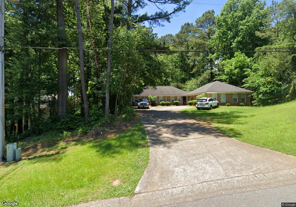
785 Farm Creek Rd NE Unit 787 Woodstock, GA 30188
Sandy Plains NeighborhoodEstimated Value: $322,000 - $425,000
5
Beds
4
Baths
2,076
Sq Ft
$180/Sq Ft
Est. Value
About This Home
This home is located at 785 Farm Creek Rd NE Unit 787, Woodstock, GA 30188 and is currently estimated at $372,774, approximately $179 per square foot. 785 Farm Creek Rd NE Unit 787 is a home located in Cobb County with nearby schools including Nicholson Elementary School, McCleskey Middle School, and Kell High School.
Ownership History
Date
Name
Owned For
Owner Type
Purchase Details
Closed on
Jan 6, 1998
Sold by
Mccleskey Fred P
Bought by
Mervar Thomas M and Mervar Carole S
Current Estimated Value
Home Financials for this Owner
Home Financials are based on the most recent Mortgage that was taken out on this home.
Original Mortgage
$81,800
Outstanding Balance
$14,259
Interest Rate
7.19%
Mortgage Type
New Conventional
Estimated Equity
$358,515
Create a Home Valuation Report for This Property
The Home Valuation Report is an in-depth analysis detailing your home's value as well as a comparison with similar homes in the area
Home Values in the Area
Average Home Value in this Area
Purchase History
| Date | Buyer | Sale Price | Title Company |
|---|---|---|---|
| Mervar Thomas M | $104,000 | -- |
Source: Public Records
Mortgage History
| Date | Status | Borrower | Loan Amount |
|---|---|---|---|
| Open | Mervar Thomas M | $81,800 |
Source: Public Records
Tax History Compared to Growth
Tax History
| Year | Tax Paid | Tax Assessment Tax Assessment Total Assessment is a certain percentage of the fair market value that is determined by local assessors to be the total taxable value of land and additions on the property. | Land | Improvement |
|---|---|---|---|---|
| 2024 | $3,666 | $121,592 | $30,000 | $91,592 |
| 2023 | $2,239 | $74,264 | $16,000 | $58,264 |
| 2022 | $2,254 | $74,264 | $16,000 | $58,264 |
| 2021 | $2,254 | $74,264 | $16,000 | $58,264 |
| 2020 | $1,758 | $57,940 | $10,800 | $47,140 |
| 2019 | $1,758 | $57,940 | $10,800 | $47,140 |
| 2018 | $1,758 | $57,940 | $10,800 | $47,140 |
| 2017 | $1,410 | $49,028 | $10,800 | $38,228 |
| 2016 | $1,410 | $49,028 | $10,800 | $38,228 |
| 2015 | $1,009 | $34,248 | $7,200 | $27,048 |
| 2014 | $1,018 | $34,248 | $0 | $0 |
Source: Public Records
Map
Nearby Homes
- 5142 Farm Place Dr NE
- 4793 Moonstone Trace
- 639 Tigers Eye Terrace
- 4785 Moonstone Trace
- 4778 Moonstone Trace
- 4669 Blue Topaz Trail
- The Gavin E Plan at The Village at Shallowford - Signature Series
- The Marion A Plan at The Village at Shallowford - Classic Series
- The Cary A Plan at The Village at Shallowford - Classic Series
- 4778 Moonstone NE
- 707 Smokey Quartz Way
- 710 Smokey Quartz Way
- 694 Smokey Quartz Way
- 4785 Moonstone NE
- 703 Smokey Quartz Way
- 706 Smokey Quartz Way
- 702 Smokey Quartz Way
- 791 Farm Creek Rd NE
- 791 Farm Creek Rd NE Unit 791, 793
- 781 Farm Creek Rd NE Unit 783
- 777 Farm Creek Rd NE Unit 779
- 4862 Old Farm Ct NE
- 4916 Farmstead Ct NE
- 795 Farm Creek Rd NE Unit 797
- 4918 Farmstead Ct NE
- 826 Farm Creek Rd NE
- 4863 Old Farm Ct NE
- 824 Farm Creek Rd NE Unit 824
- 824 Farm Creek Rd NE Unit 826
- 824 Farm Creek Rd NE
- 4920 Farmstead Ct NE
- 773 Farm Creek Rd NE Unit 775
- 0 Farm Creek Rd NE Unit 3179079
- 0 Farm Creek Rd NE Unit 3250561
- 0 Farm Creek Rd NE Unit 3250557
- 0 Farm Creek Rd NE Unit 8589494
- 0 Farm Creek Rd NE Unit 8160162