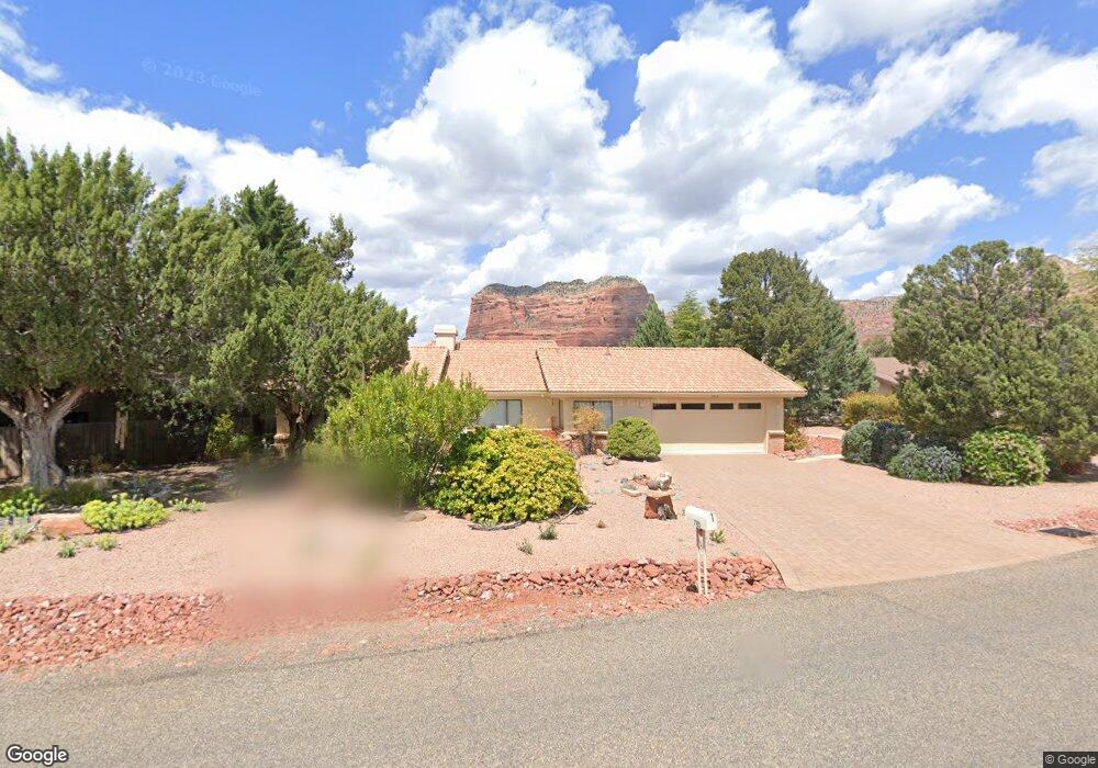
785 Lee Mountain Rd Sedona, AZ 86351
Village of Oak Creek (Big Park) NeighborhoodEstimated Value: $608,585 - $860,000
--
Bed
--
Bath
1,618
Sq Ft
$459/Sq Ft
Est. Value
About This Home
This home is located at 785 Lee Mountain Rd, Sedona, AZ 86351 and is currently estimated at $742,396, approximately $458 per square foot. 785 Lee Mountain Rd is a home located in Yavapai County with nearby schools including Sedona Red Rock Junior/Senior High School.
Ownership History
Date
Name
Owned For
Owner Type
Purchase Details
Closed on
Nov 26, 2014
Sold by
Wood Deanne Rawlins
Bought by
Wood Deanne Rawlins
Current Estimated Value
Purchase Details
Closed on
Sep 15, 2009
Sold by
Wood Robert Snyder and Wood Deanne Rawlins
Bought by
Banner Group
Purchase Details
Closed on
Dec 28, 1999
Sold by
The Wood Family Trust and Thomis Timothy
Bought by
Wood Robert S and Wood Deanne R
Purchase Details
Closed on
May 15, 1995
Sold by
Rose Elliott H
Bought by
Wood Robert S and Wood Deanne R
Home Financials for this Owner
Home Financials are based on the most recent Mortgage that was taken out on this home.
Original Mortgage
$100,000
Interest Rate
7.67%
Create a Home Valuation Report for This Property
The Home Valuation Report is an in-depth analysis detailing your home's value as well as a comparison with similar homes in the area
Home Values in the Area
Average Home Value in this Area
Purchase History
| Date | Buyer | Sale Price | Title Company |
|---|---|---|---|
| Wood Deanne Rawlins | -- | None Available | |
| Banner Group | -- | None Available | |
| Wood Robert S | -- | -- | |
| Thomis Timothy | -- | -- | |
| Wood Robert S | $152,000 | Transamerica Title Ins Co |
Source: Public Records
Mortgage History
| Date | Status | Borrower | Loan Amount |
|---|---|---|---|
| Previous Owner | Wood Robert S | $100,000 |
Source: Public Records
Tax History Compared to Growth
Tax History
| Year | Tax Paid | Tax Assessment Tax Assessment Total Assessment is a certain percentage of the fair market value that is determined by local assessors to be the total taxable value of land and additions on the property. | Land | Improvement |
|---|---|---|---|---|
| 2026 | $2,446 | $51,182 | -- | -- |
| 2024 | $2,433 | $56,746 | -- | -- |
| 2023 | $2,433 | $43,264 | $15,924 | $27,340 |
| 2022 | $2,327 | $30,693 | $10,127 | $20,566 |
| 2021 | $2,384 | $30,952 | $10,074 | $20,878 |
| 2020 | $2,383 | $0 | $0 | $0 |
| 2019 | $2,364 | $0 | $0 | $0 |
| 2018 | $2,248 | $0 | $0 | $0 |
| 2017 | $2,195 | $0 | $0 | $0 |
| 2016 | $2,153 | $0 | $0 | $0 |
| 2015 | $2,059 | $0 | $0 | $0 |
| 2014 | $2,059 | $0 | $0 | $0 |
Source: Public Records
Map
Nearby Homes
- 40 Broken Arrow Dr
- 5 Clearwater Cir Unit 14
- 85 Overlook Way Unit 19
- 150 Pebble Dr Unit 220
- 465 Concho Dr
- 1050 Lee Mountain Rd
- 280 Concho Dr Unit 55
- 195 Alta Vista Dr
- 1110 Lee Mountain Rd
- 36 Aspen Ct
- 200 Bell Creek Way
- 80 Bell Wash Ct Unit 1
- 20 Rose Mountain Ct
- 95 Bell Wash Ct
- 4 Running Springs Dr Unit 90
- 25 Estates Cir
- 327 Suncliffe Dr
- 59 Vistella Dr Unit 4
- 10 Ho Hum Cir
- 104 Vistella Dr Unit 6