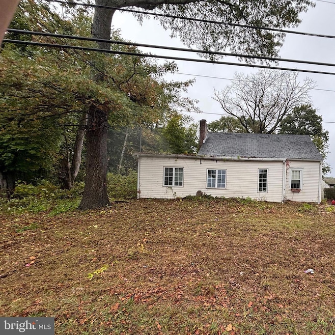
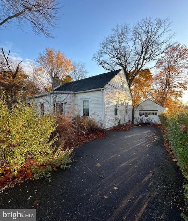
785 Old York Rd Hightstown, NJ 08520
Estimated payment $2,170/month
Highlights
- Rambler Architecture
- 1 Car Detached Garage
- Dining Room
- No HOA
- Living Room
- Hot Water Baseboard Heater
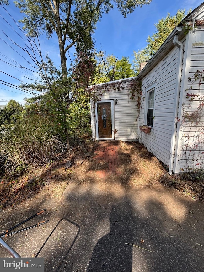
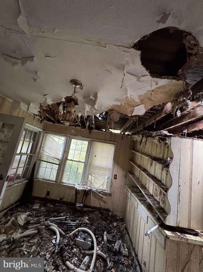
About This Home
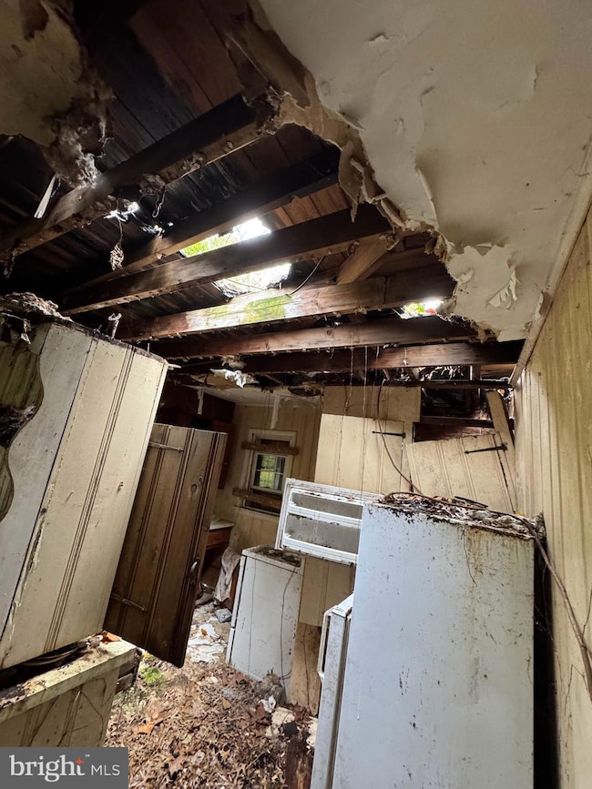
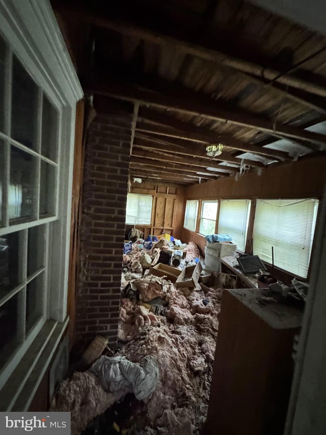
Investors.....Your Next Profitable Project Awaits! Prime location with endless potential! This 3-bedroom, 1-bath home with a detached garage is ready for a full renovation or rebuild. Surrounded by beautiful homes and newer developments, this property offers incredible upside in a highly desirable area. Convenient to major highways, shopping, and transit. Being sold strictly as-is. Buyer responsible for all inspections, certifications, and repairs. Agents please see agent notes! **Seller has called for Highest & Best Offers by Sunday October 26th, 2025"
Listing Agent
(609) 346-8649 shonda.mccallum@exprealty.com EXP Realty, LLC License #2184780 Listed on: 10/13/2025

Home Details
Home Type
- Single Family
Est. Annual Taxes
- $6,429
Year Built
- Built in 1950
Lot Details
- 0.26 Acre Lot
- Property is zoned R2
Parking
- 1 Car Detached Garage
Home Design
- Rambler Architecture
- Block Foundation
- Vinyl Siding
Interior Spaces
- 1,145 Sq Ft Home
- Property has 1 Level
- Living Room
- Dining Room
- Finished Basement
- Basement Fills Entire Space Under The House
Bedrooms and Bathrooms
- 3 Main Level Bedrooms
- 1 Full Bathroom
Schools
- Hightstown School
Utilities
- Heating System Uses Oil
- Hot Water Baseboard Heater
- Oil Water Heater
Community Details
- No Home Owners Association
Listing and Financial Details
- Tax Lot 00007
- Assessor Parcel Number 01-00029-00007
Map
Home Values in the Area
Average Home Value in this Area
Tax History
| Year | Tax Paid | Tax Assessment Tax Assessment Total Assessment is a certain percentage of the fair market value that is determined by local assessors to be the total taxable value of land and additions on the property. | Land | Improvement |
|---|---|---|---|---|
| 2025 | $9,661 | $259,700 | $172,100 | $87,600 |
| 2024 | $9,147 | $259,700 | $172,100 | $87,600 |
| 2023 | $9,147 | $259,700 | $172,100 | $87,600 |
| 2022 | $8,910 | $259,700 | $172,100 | $87,600 |
| 2021 | $8,845 | $259,700 | $172,100 | $87,600 |
| 2020 | $8,856 | $259,700 | $172,100 | $87,600 |
| 2019 | $8,775 | $259,700 | $172,100 | $87,600 |
| 2018 | $8,661 | $259,700 | $172,100 | $87,600 |
| 2017 | $8,653 | $259,700 | $172,100 | $87,600 |
| 2016 | $8,531 | $259,700 | $172,100 | $87,600 |
| 2015 | $8,365 | $259,700 | $172,100 | $87,600 |
| 2014 | $8,266 | $259,700 | $172,100 | $87,600 |
Property History
| Date | Event | Price | List to Sale | Price per Sq Ft |
|---|---|---|---|---|
| 10/13/2025 10/13/25 | For Sale | $310,000 | -- | $271 / Sq Ft |
Purchase History
| Date | Type | Sale Price | Title Company |
|---|---|---|---|
| Deed | $325,000 | -- | |
| Deed | $239,900 | -- | |
| Deed | $123,700 | -- |
Mortgage History
| Date | Status | Loan Amount | Loan Type |
|---|---|---|---|
| Open | $260,000 | Purchase Money Mortgage | |
| Previous Owner | $126,174 | VA |
Source: Bright MLS
MLS Number: NJME2067176
APN: 01-00029-0000-00007
Disclaimer: Certain information contained herein is derived from information provided by parties other than Homes.com. All information provided is deemed reliable, but is not guaranteed to be accurate and should be independently verified.
![]() The data relating to real estate for sale on this website appears in part through the BRIGHT Internet Data Exchange program, a voluntary cooperative exchange of property listing data between licensed real estate brokerage firms, and is provided by BRIGHT through a licensing agreement.
The data relating to real estate for sale on this website appears in part through the BRIGHT Internet Data Exchange program, a voluntary cooperative exchange of property listing data between licensed real estate brokerage firms, and is provided by BRIGHT through a licensing agreement.
Listing information is from various brokers who participate in the Bright MLS IDX program and not all listings may be visible on the site.
The property information being provided on or through the website is for the personal, non-commercial use of consumers and such information may not be used for any purpose other than to identify prospective properties consumers may be interested in purchasing.
Some properties which appear for sale on the website may no longer be available because they are for instance, under contract, sold or are no longer being offered for sale.
Property information displayed is deemed reliable but is not guaranteed.
Copyright 2025 Bright MLS, Inc.
- 4 Wendover Rd
- 24 Stonehedge Dr
- 59 Moorsgate Cir
- 20 Stonehedge Dr
- 23 Fulham Way
- 2 Carriage Ct
- 648 Old York Rd
- 28 Columbia Ave
- 740 Windsor Perrineville
- 108 Orchard Ave
- 865 Windsor Perrineville Rd
- 89 Hickory Corner Rd
- 302 S Main St
- 102 Teal Ct
- 58 Teal Ct
- 17 Winchester Dr
- 107 Hausser Ave
- 201 Morrison Ave
- 569 Route 130
- 104 1st Ave
- 73 Winchester Dr
- 94 Teal Ct
- 222 Stockton St
- 220 Stockton St Unit 222 B
- 400 Stockton St
- 152 Hickory Corner Rd
- 3 D 3d Twin River Dr
- 23 Powell Ct
- 1 Schindler Dr
- 400 Dutch Neck Rd
- B23 Garden View Terrace
- 43-19 Garden View Terrace
- 100 Wyndmoor Dr
- 51 Garden View Terrace Unit 2
- 661 Abbington Dr
- 3 Keats Ct
- 11 Tennyson Rd
- 20 Spyglass Ct
- 226 Dorchester Dr
- 342 Sharon Rd