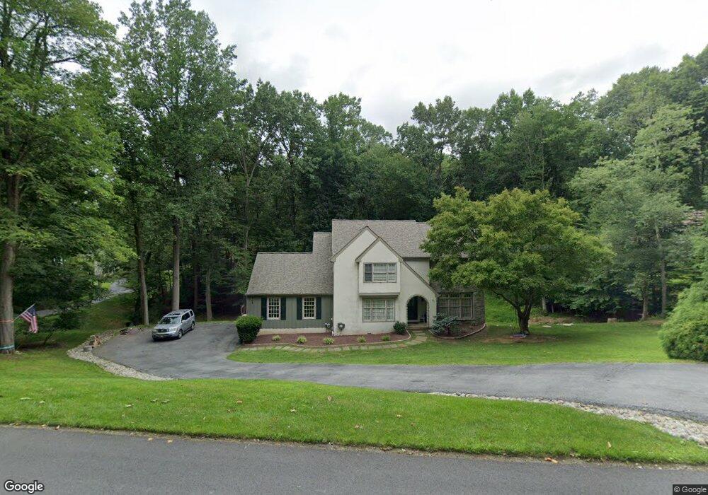
785 Tree Ln West Chester, PA 19380
Estimated Value: $662,000 - $935,000
3
Beds
3
Baths
3,020
Sq Ft
$272/Sq Ft
Est. Value
About This Home
This home is located at 785 Tree Ln, West Chester, PA 19380 and is currently estimated at $820,821, approximately $271 per square foot. 785 Tree Ln is a home located in Chester County with nearby schools including East Bradford Elementary School, E.N. Peirce Middle School, and Henderson High School.
Ownership History
Date
Name
Owned For
Owner Type
Purchase Details
Closed on
Apr 29, 2021
Sold by
Kutchins Loring A and Kutchins Rosalyn G
Bought by
Yancey Kenneth R and Yancey Thuy D
Current Estimated Value
Home Financials for this Owner
Home Financials are based on the most recent Mortgage that was taken out on this home.
Original Mortgage
$200,000
Outstanding Balance
$151,417
Interest Rate
3.1%
Mortgage Type
New Conventional
Estimated Equity
$669,404
Purchase Details
Closed on
Jan 1, 1993
Bought by
Kutchins Loring A and Kutchins Rosalyn G
Create a Home Valuation Report for This Property
The Home Valuation Report is an in-depth analysis detailing your home's value as well as a comparison with similar homes in the area
Home Values in the Area
Average Home Value in this Area
Purchase History
| Date | Buyer | Sale Price | Title Company |
|---|---|---|---|
| Yancey Kenneth R | $450,000 | Manito Abstract Company Inc | |
| Kutchins Loring A | $285,000 | -- |
Source: Public Records
Mortgage History
| Date | Status | Borrower | Loan Amount |
|---|---|---|---|
| Open | Yancey Kenneth R | $200,000 |
Source: Public Records
Tax History Compared to Growth
Tax History
| Year | Tax Paid | Tax Assessment Tax Assessment Total Assessment is a certain percentage of the fair market value that is determined by local assessors to be the total taxable value of land and additions on the property. | Land | Improvement |
|---|---|---|---|---|
| 2025 | $7,882 | $285,890 | $65,010 | $220,880 |
| 2024 | $7,882 | $271,920 | $65,010 | $206,910 |
| 2023 | $7,765 | $270,220 | $65,010 | $205,210 |
| 2022 | $7,664 | $270,220 | $65,010 | $205,210 |
| 2021 | $7,489 | $270,220 | $65,010 | $205,210 |
| 2020 | $7,439 | $270,220 | $65,010 | $205,210 |
| 2019 | $3,462 | $270,220 | $65,010 | $205,210 |
| 2018 | $7,040 | $270,220 | $65,010 | $205,210 |
| 2017 | $6,882 | $270,220 | $65,010 | $205,210 |
| 2016 | $5,913 | $270,220 | $65,010 | $205,210 |
| 2015 | $5,913 | $270,220 | $65,010 | $205,210 |
| 2014 | $5,913 | $270,220 | $65,010 | $205,210 |
Source: Public Records
Map
Nearby Homes
- 530 Legion Dr
- Lot 1 Susan Dr
- 4 Amanda Ln
- 806 Downingtown Pike
- 112 Crosspointe Dr
- 1280 Cardinal Ave
- 1252 Memory Ln
- 370 Highland Rd
- 479 Douglas Dr
- 303 Star Tavern Ln
- 734 Marshall Dr
- 735 Hillside Dr
- 723 Hillside Dr
- 702 Scotch Way Unit 20
- 418 Hannum Ave
- 306 Greenhill Rd
- 48 Sheffield Ln
- 325 W Chestnut St
- 331 Hannum Ave
- 331 W Gay St