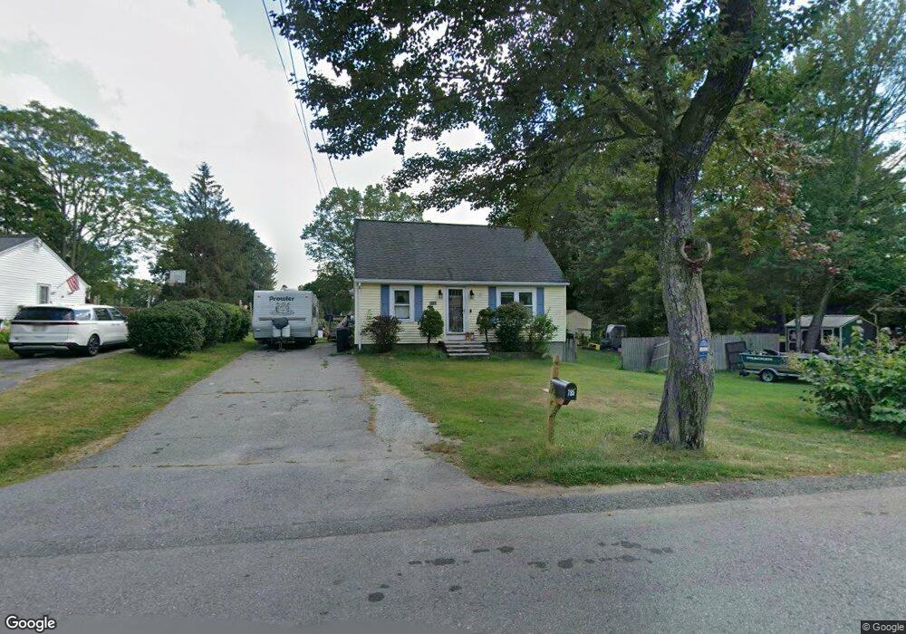
785 West St Lunenburg, MA 01462
Estimated Value: $422,388 - $474,000
4
Beds
1
Bath
1,512
Sq Ft
$299/Sq Ft
Est. Value
About This Home
This home is located at 785 West St, Lunenburg, MA 01462 and is currently estimated at $451,597, approximately $298 per square foot. 785 West St is a home located in Worcester County with nearby schools including Lunenburg Primary School, Lunenburg High School, and St Bernards Elementary School.
Ownership History
Date
Name
Owned For
Owner Type
Purchase Details
Closed on
Oct 24, 2001
Sold by
Gaetz Barry J and Gaetz Larissa A
Bought by
Ferguson Michael E and Manning Heather L
Current Estimated Value
Home Financials for this Owner
Home Financials are based on the most recent Mortgage that was taken out on this home.
Original Mortgage
$161,500
Interest Rate
6.86%
Mortgage Type
Purchase Money Mortgage
Purchase Details
Closed on
Dec 21, 1998
Sold by
Workers Cu
Bought by
Gaetz Barry J and Gaetz Larissa A
Home Financials for this Owner
Home Financials are based on the most recent Mortgage that was taken out on this home.
Original Mortgage
$98,800
Interest Rate
6.85%
Mortgage Type
Purchase Money Mortgage
Purchase Details
Closed on
Jul 9, 1998
Sold by
Cormier Denis P
Bought by
Workers Cu
Create a Home Valuation Report for This Property
The Home Valuation Report is an in-depth analysis detailing your home's value as well as a comparison with similar homes in the area
Home Values in the Area
Average Home Value in this Area
Purchase History
| Date | Buyer | Sale Price | Title Company |
|---|---|---|---|
| Ferguson Michael E | $170,000 | -- | |
| Gaetz Barry J | $104,000 | -- | |
| Workers Cu | $85,000 | -- |
Source: Public Records
Mortgage History
| Date | Status | Borrower | Loan Amount |
|---|---|---|---|
| Open | Workers Cu | $163,350 | |
| Closed | Workers Cu | $161,500 | |
| Previous Owner | Workers Cu | $98,800 | |
| Previous Owner | Workers Cu | $95,000 |
Source: Public Records
Tax History Compared to Growth
Tax History
| Year | Tax Paid | Tax Assessment Tax Assessment Total Assessment is a certain percentage of the fair market value that is determined by local assessors to be the total taxable value of land and additions on the property. | Land | Improvement |
|---|---|---|---|---|
| 2025 | $5,069 | $353,000 | $124,500 | $228,500 |
| 2024 | $4,824 | $342,100 | $117,400 | $224,700 |
| 2023 | $4,744 | $324,500 | $106,800 | $217,700 |
| 2022 | $4,325 | $251,600 | $88,800 | $162,800 |
| 2020 | $4,202 | $231,900 | $88,600 | $143,300 |
| 2019 | $4,097 | $219,300 | $83,500 | $135,800 |
| 2018 | $3,918 | $198,900 | $83,500 | $115,400 |
| 2017 | $3,662 | $183,300 | $76,300 | $107,000 |
| 2016 | $3,473 | $177,100 | $72,500 | $104,600 |
| 2015 | $3,109 | $169,700 | $68,800 | $100,900 |
Source: Public Records
Map
Nearby Homes
- 819 West St
- 3 Rennie St
- 5 Ramgren Rd
- 0 Summer St
- 9 Pleasant St
- 363 Lunenburg St
- 332-336 Lunenburg St
- 69 Jackson Ave
- 1479 Main St
- 23 Tilton Ave
- 276 Lunenburg St Unit 50
- 20 Clyde St
- 23-25 Kimball St
- 36 Jackson Ave
- 58 Goodrich St
- 452 Hollis Rd
- 183-185 Boutelle St
- 77 Electric Ave
- 112 Boutelle St
- 2 Arden Mills Way Unit 2210
- 779 West St
- 795 West St
- 790 West St
- 125 Pratt St
- 798 West St Unit 802
- 111 Pratt St
- 780 West St
- 798-802 West St
- 15 Pratt St
- 14 W Street Terrace
- 9 W Street Terrace
- 768 West St
- 768 West St Unit 4
- 128 Pratt St
- 120 Pratt St
- 120 Pratt St Unit rear
- 120 Rear Pratt St Unit 1
- 101 Pratt St
- 806 West St
- 114 Pratt St