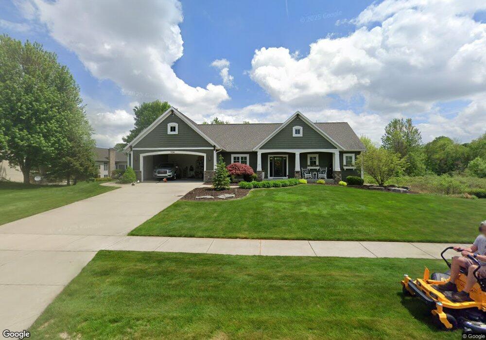
7850 Byron Depot Dr SW Byron Center, MI 49315
Estimated Value: $617,538 - $874,000
--
Bed
1
Bath
1,900
Sq Ft
$390/Sq Ft
Est. Value
About This Home
This home is located at 7850 Byron Depot Dr SW, Byron Center, MI 49315 and is currently estimated at $740,135, approximately $389 per square foot. 7850 Byron Depot Dr SW is a home located in Kent County with nearby schools including Brown Elementary School, Robert L. Nickels Intermediate School, and Byron Center West Middle School.
Ownership History
Date
Name
Owned For
Owner Type
Purchase Details
Closed on
Jan 17, 2023
Sold by
Wiltrakis Joseph and Wiltrakis Anne
Bought by
Wiltrakis Family Trust
Current Estimated Value
Purchase Details
Closed on
Jul 27, 2010
Sold by
Still Kevin A and Still Tara L
Bought by
Wiltrakis Joseph and Wiltrakis Anne
Purchase Details
Closed on
May 12, 2004
Sold by
Railside Development Corp
Bought by
Still Kevin A and Still Tara L
Create a Home Valuation Report for This Property
The Home Valuation Report is an in-depth analysis detailing your home's value as well as a comparison with similar homes in the area
Home Values in the Area
Average Home Value in this Area
Purchase History
| Date | Buyer | Sale Price | Title Company |
|---|---|---|---|
| Wiltrakis Family Trust | -- | -- | |
| Wiltrakis Joseph | $65,000 | River Valley Title | |
| Still Kevin A | $78,900 | None Available |
Source: Public Records
Tax History Compared to Growth
Tax History
| Year | Tax Paid | Tax Assessment Tax Assessment Total Assessment is a certain percentage of the fair market value that is determined by local assessors to be the total taxable value of land and additions on the property. | Land | Improvement |
|---|---|---|---|---|
| 2025 | $4,559 | $301,800 | $0 | $0 |
| 2024 | $4,559 | $285,700 | $0 | $0 |
| 2023 | $4,340 | $251,900 | $0 | $0 |
| 2022 | $6,049 | $244,500 | $0 | $0 |
| 2021 | $5,887 | $233,200 | $0 | $0 |
| 2020 | $3,994 | $217,100 | $0 | $0 |
| 2019 | $5,745 | $211,600 | $0 | $0 |
| 2018 | $5,626 | $208,700 | $42,000 | $166,700 |
| 2017 | $5,488 | $198,700 | $0 | $0 |
| 2016 | $5,278 | $188,000 | $0 | $0 |
| 2015 | $5,187 | $188,000 | $0 | $0 |
| 2013 | -- | $166,700 | $0 | $0 |
Source: Public Records
Map
Nearby Homes
- 3183 Railway Dr SW
- 7998 Byron Depot Dr SW
- 8030 Lionel Dr
- 8115 Byron Depot Dr SW
- Redwood Plan at Railside - Woodland Series
- Sycamore Plan at Railside - Woodland Series
- Bay Harbor Plan at Railside - Landmark Series
- Northport Plan at Railside - Landmark Series
- Pentwater Plan at Railside - Landmark Series
- Oakwood Plan at Railside - Woodland Series
- 3563 Conrail Dr
- 8047 Erie Dr
- 8090 Country Rail Ct SW
- 8138 Boardwalk Dr SW
- 8393 Woodhaven Dr SW Unit 1
- 2740 Woodhaven Ct SW Unit 2
- 3152 84th St SW
- 8330 Rockledge Way SW Unit 92
- 8549 Eldora Dr SW
- 8564 Elkwood Dr SW
- 7841 Lionel Dr SW
- 7864 Byron Depot Dr SW
- 7853 Lionel Dr SW
- 7845 Byron Depot Dr SW
- 7859 Byron Depot Dr SW
- 7878 Byron Depot Dr SW
- 7831 Byron Depot Dr SW
- 7822 Byron Depot Dr SW
- 7822 Byron Depot Dr
- 7840 Byron Depot Dr SW
- 7877 Byron Depot Dr SW
- 7869 Lionel Dr SW
- 7835 Railyard Dr SW
- 7825 Byron Depot Dr SW
- 7877 Lionel Dr SW
- 7892 Byron Depot Dr SW
- 7889 Byron Depot Dr
- 7808 Byron Depot Dr SW
- 7889 Byron Depot Dr SW
- 7817 Byron Depot Dr SW