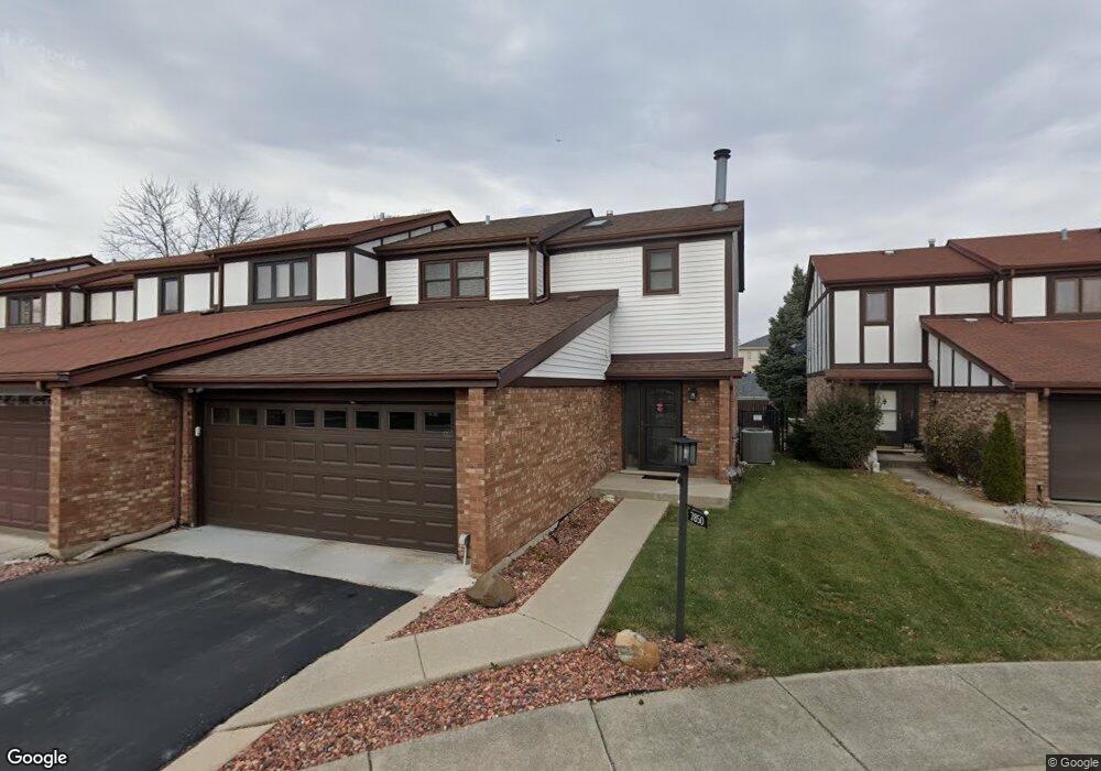
7850 Sheffield Dr Palos Hills, IL 60465
Estimated Value: $283,332 - $339,000
3
Beds
2
Baths
1,557
Sq Ft
$200/Sq Ft
Est. Value
About This Home
This home is located at 7850 Sheffield Dr, Palos Hills, IL 60465 and is currently estimated at $311,083, approximately $199 per square foot. 7850 Sheffield Dr is a home located in Cook County with nearby schools including Sorrick Elementary School, Oak Ridge Elementary School, and H H Conrady Jr High School.
Ownership History
Date
Name
Owned For
Owner Type
Purchase Details
Closed on
Jun 22, 1999
Sold by
Batory Catherine A and Wasik Denise M
Bought by
Wasik Denise M
Current Estimated Value
Home Financials for this Owner
Home Financials are based on the most recent Mortgage that was taken out on this home.
Original Mortgage
$100,000
Outstanding Balance
$26,895
Interest Rate
7.29%
Estimated Equity
$284,188
Create a Home Valuation Report for This Property
The Home Valuation Report is an in-depth analysis detailing your home's value as well as a comparison with similar homes in the area
Home Values in the Area
Average Home Value in this Area
Purchase History
| Date | Buyer | Sale Price | Title Company |
|---|---|---|---|
| Wasik Denise M | -- | -- |
Source: Public Records
Mortgage History
| Date | Status | Borrower | Loan Amount |
|---|---|---|---|
| Open | Wasik Denise M | $100,000 |
Source: Public Records
Tax History Compared to Growth
Tax History
| Year | Tax Paid | Tax Assessment Tax Assessment Total Assessment is a certain percentage of the fair market value that is determined by local assessors to be the total taxable value of land and additions on the property. | Land | Improvement |
|---|---|---|---|---|
| 2024 | $5,210 | $24,000 | $3,067 | $20,933 |
| 2023 | $3,862 | $24,000 | $3,067 | $20,933 |
| 2022 | $3,862 | $17,424 | $2,671 | $14,753 |
| 2021 | $4,983 | $17,423 | $2,670 | $14,753 |
| 2020 | $4,957 | $17,423 | $2,670 | $14,753 |
| 2019 | $5,300 | $18,802 | $2,473 | $16,329 |
| 2018 | $5,100 | $18,802 | $2,473 | $16,329 |
| 2017 | $4,938 | $18,802 | $2,473 | $16,329 |
| 2016 | $6,337 | $20,842 | $2,176 | $18,666 |
| 2015 | $6,205 | $20,842 | $2,176 | $18,666 |
| 2014 | $6,113 | $20,842 | $2,176 | $18,666 |
| 2013 | $6,130 | $22,190 | $2,176 | $20,014 |
Source: Public Records
Map
Nearby Homes
- 10409 Sheffield Dr Unit 13
- 7810 W 102nd St
- 10324 S 81st Ave
- 10226 S 81st Ave
- 10300 S Kathy Ct
- 10125 S 81st Ct
- 10440 S 75th Ct
- 10441 S 83rd Ave
- 10221 S Eleanor Ave
- 7822 W 99th Place
- 10230 S 83rd Ct
- 10233 Concord Ln Unit C
- 10820 Kathleen Ct Unit D
- 10225 Camden Ln Unit K
- 7826 W 98th Place
- 10408 S Alta Dr
- 10562 S 84th Ave
- 8360 W 100th Place
- 9940 S Wood Ln
- 9841 S 82nd Ave
- 7860 Sheffield Dr
- 7840 Sheffield Dr
- 7870 Sheffield Dr
- 7880 Sheffield Dr
- 7830 Sheffield Dr
- 7890 Sheffield Dr
- 7820 Sheffield Dr
- 7900 Sheffield Dr
- 7810 Sheffield Dr
- 7861 Sheffield Dr
- 7851 Sheffield Dr
- 7871 Sheffield Dr
- 7811 Sheffield Dr
- 7841 Sheffield Dr
- 7881 Sheffield Dr
- 7831 Sheffield Dr
- 7921 W 103rd St Unit 2A
- 7921 W 103rd St Unit G3
- 7921 W 103rd St Unit G5
- 7921 W 103rd St Unit G1