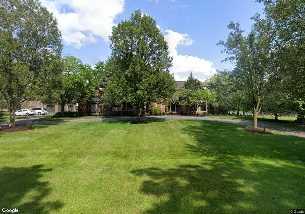
7851 Brint Rd Sylvania, OH 43560
Estimated Value: $966,000 - $1,450,000
5
Beds
4
Baths
5,729
Sq Ft
$201/Sq Ft
Est. Value
About This Home
This home is located at 7851 Brint Rd, Sylvania, OH 43560 and is currently estimated at $1,151,699, approximately $201 per square foot. 7851 Brint Rd is a home located in Lucas County with nearby schools including Central Trail Elementary School, Sylvania Timberstone Junior High School, and Sylvania Southview High School.
Ownership History
Date
Name
Owned For
Owner Type
Purchase Details
Closed on
Jul 23, 2021
Sold by
Wagoner William T
Bought by
William T Wagoner and Barbara C Wagoner
Current Estimated Value
Home Financials for this Owner
Home Financials are based on the most recent Mortgage that was taken out on this home.
Interest Rate
2.78%
Purchase Details
Closed on
Aug 16, 2000
Sold by
Nachtrab Deborah K Trustee
Bought by
Wagoner William T and Wagoner Barbara C
Home Financials for this Owner
Home Financials are based on the most recent Mortgage that was taken out on this home.
Original Mortgage
$100,000
Interest Rate
8%
Mortgage Type
Stand Alone Second
Purchase Details
Closed on
Aug 13, 1998
Sold by
Nachtrab Deborah K
Bought by
Nachtrab Deborah K
Create a Home Valuation Report for This Property
The Home Valuation Report is an in-depth analysis detailing your home's value as well as a comparison with similar homes in the area
Home Values in the Area
Average Home Value in this Area
Purchase History
| Date | Buyer | Sale Price | Title Company |
|---|---|---|---|
| William T Wagoner | $10,000 | -- | |
| Wagoner William T | $950,000 | Louisville Title Agency For | |
| Nachtrab Deborah K | -- | -- |
Source: Public Records
Mortgage History
| Date | Status | Borrower | Loan Amount |
|---|---|---|---|
| Previous Owner | William T Wagoner | -- | |
| Previous Owner | Wagoner William T | $100,000 | |
| Previous Owner | Wagoner William T | $650,000 |
Source: Public Records
Tax History Compared to Growth
Tax History
| Year | Tax Paid | Tax Assessment Tax Assessment Total Assessment is a certain percentage of the fair market value that is determined by local assessors to be the total taxable value of land and additions on the property. | Land | Improvement |
|---|---|---|---|---|
| 2024 | $11,959 | $373,765 | $40,775 | $332,990 |
| 2023 | $22,458 | $301,070 | $37,205 | $263,865 |
| 2022 | $22,484 | $301,070 | $37,205 | $263,865 |
| 2021 | $23,032 | $301,070 | $37,205 | $263,865 |
| 2020 | $21,624 | $250,250 | $31,115 | $219,135 |
| 2019 | $20,824 | $250,250 | $31,115 | $219,135 |
| 2018 | $19,791 | $250,250 | $31,115 | $219,135 |
| 2017 | $20,320 | $221,690 | $43,680 | $178,010 |
| 2016 | $19,931 | $633,400 | $124,800 | $508,600 |
| 2015 | $18,794 | $633,400 | $124,800 | $508,600 |
| 2014 | $18,021 | $213,150 | $42,000 | $171,150 |
| 2013 | $18,021 | $213,150 | $42,000 | $171,150 |
Source: Public Records
Map
Nearby Homes
- 7639 Cobblestone Dr
- 5060 Olde Mill Ct
- 4902 Marble Cliff Blvd
- 5235 Brookfield Ln
- 5046 King Rd
- 7430 Country Commons Ln
- 7428 Kings Walk Ln
- 4504 Promenade Ln
- 5255 Fairmeadow Dr
- 8826 Flint Ct
- 8729 Harlow Ct
- 8816 Harlow Ct
- 8801 Harlow Ct
- 8753 Harlow Ct
- 9516 Paradise Ln
- 9532 Paradise Ln
- 9017 Driftwood Ct
- 5308 Radcliffe Rd
- 7345 Country Commons Ln
- 5310 Turnberry Ln
- 7839 Brint Rd
- 7751 Denali Ct
- 7758 Denali Ct
- 7853 Brint Rd
- 7907 Brint Rd
- 4809 Parklands Dr
- 7750 Denali Ct
- 7743 Denali Ct
- 7757 Sandia Ct
- 4801 Parklands Dr
- 7749 Sandia Ct
- 7742 Denali Ct
- 0 Kuenzler Dr Unit 6061759
- 4755 Parklands Dr
- 7905 Brint Rd
- 7915 Brint Rd
- 7760 Sandia Ct
- 7825 Brint Rd
- 4851 Parklands Dr
- 7861 Brint Rd