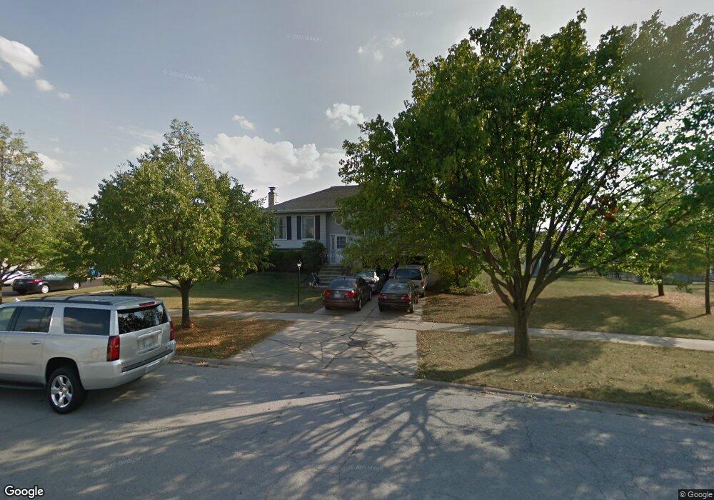
7851 W Frankfort Square Rd Frankfort, IL 60423
Frankfort Square NeighborhoodEstimated Value: $272,000 - $342,000
3
Beds
3
Baths
1,140
Sq Ft
$277/Sq Ft
Est. Value
About This Home
This home is located at 7851 W Frankfort Square Rd, Frankfort, IL 60423 and is currently estimated at $316,297, approximately $277 per square foot. 7851 W Frankfort Square Rd is a home located in Will County with nearby schools including Frankfort Square Elementary School, Summit Hill Junior High School, and Lincoln-Way East High School.
Ownership History
Date
Name
Owned For
Owner Type
Purchase Details
Closed on
Aug 14, 2020
Sold by
Marquette Bank
Bought by
Donlan James and Donlan Elizabeth
Current Estimated Value
Home Financials for this Owner
Home Financials are based on the most recent Mortgage that was taken out on this home.
Original Mortgage
$126,800
Outstanding Balance
$112,481
Interest Rate
3%
Estimated Equity
$203,816
Purchase Details
Closed on
Mar 27, 1995
Sold by
Kindinger Stanley
Bought by
Marquette National Bank
Purchase Details
Closed on
Jan 13, 1995
Sold by
Langtim Daniel C and Langtim Colleen A
Bought by
Kindlinger Stanley
Create a Home Valuation Report for This Property
The Home Valuation Report is an in-depth analysis detailing your home's value as well as a comparison with similar homes in the area
Home Values in the Area
Average Home Value in this Area
Purchase History
| Date | Buyer | Sale Price | Title Company |
|---|---|---|---|
| Donlan James | $135,000 | None Available | |
| Marquette National Bank | -- | -- | |
| Kindlinger Stanley | -- | -- |
Source: Public Records
Mortgage History
| Date | Status | Borrower | Loan Amount |
|---|---|---|---|
| Open | Donlan James | $126,800 |
Source: Public Records
Tax History Compared to Growth
Tax History
| Year | Tax Paid | Tax Assessment Tax Assessment Total Assessment is a certain percentage of the fair market value that is determined by local assessors to be the total taxable value of land and additions on the property. | Land | Improvement |
|---|---|---|---|---|
| 2024 | $6,928 | $90,133 | $18,195 | $71,938 |
| 2023 | $6,928 | $80,498 | $16,250 | $64,248 |
| 2022 | $6,147 | $73,320 | $14,801 | $58,519 |
| 2021 | $5,750 | $68,594 | $13,847 | $54,747 |
| 2020 | $2,769 | $66,661 | $13,457 | $53,204 |
| 2019 | $2,755 | $64,877 | $13,097 | $51,780 |
| 2018 | $2,738 | $63,011 | $12,720 | $50,291 |
| 2017 | $2,749 | $61,540 | $12,423 | $49,117 |
| 2016 | $2,765 | $59,430 | $11,997 | $47,433 |
| 2015 | $2,673 | $57,338 | $11,575 | $45,763 |
| 2014 | $2,673 | $56,940 | $11,495 | $45,445 |
| 2013 | $2,673 | $57,678 | $11,644 | $46,034 |
Source: Public Records
Map
Nearby Homes
- 20027 S Jessica Ln
- 8025 Stonegate Dr
- 8131 W Evergreen Dr
- 7758 W Kingston Dr
- 7800 W Kingston Dr
- 7959 Brookside Glen Dr Unit VI
- 20137 S Hampton Ct Unit A
- 20130 S Frankfort Square Rd
- 19708 S Skye Dr
- 7752 W Almond Ct Unit 135
- 7905 Richardson Ln
- 8124 Glenbrook Place Unit 1
- 20206 S Frankfort Square Rd Unit A
- 20158 S Rosewood Dr
- 7928 Trinity Cir Unit 2SW
- 7928 Trinity Cir Unit 3NW
- 7407 Ridgefield Ln
- 20301 S Pine Hill Rd Unit 1D
- 20301 S Pine Hill Rd Unit 3A
- 19642 S Edinburgh Ln
- 7860 W Carrie Ct
- 7861 W Frankfort Square Rd
- 7847 W Carrie Ct
- 7848 W Frankfort Square Rd
- 7839 W Carrie Ct
- 7851 W Carrie Ct
- 7860 W Frankfort Square Rd
- 7909 W Frankfort Square Rd
- 7843 W Carrie Ct
- 7900 W Carrie Ct
- 7838 W Frankfort Square Rd
- 7859 W Carrie Ct
- 7863 W Carrie Ct Unit 1
- 7823 W Frankfort Square Rd
- 7855 W Carrie Ct
- 7830 W Frankfort Square Rd
- 7908 W Carrie Ct
- 7859 W Evan Terrace
- 7917 W Frankfort Square Rd
- 7849 W Evan Terrace